$98,000

0000 N Mineral Park Rd Kingman, AZ 86409

Estimated payment $618/month

Total Views 1,067
19 Acres
$5,036 Price per Acre
847,678 Sq Ft Lot

About This Lot

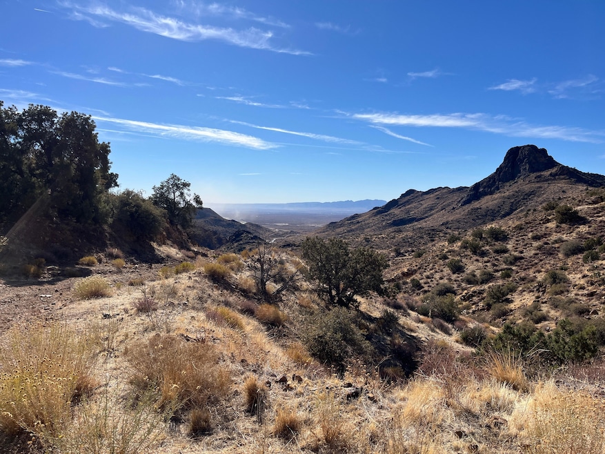
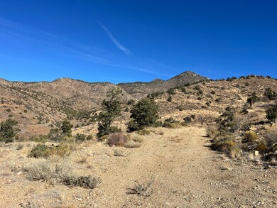
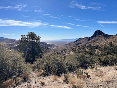
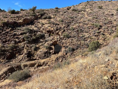
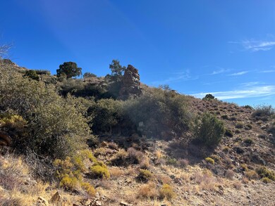
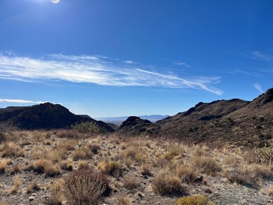
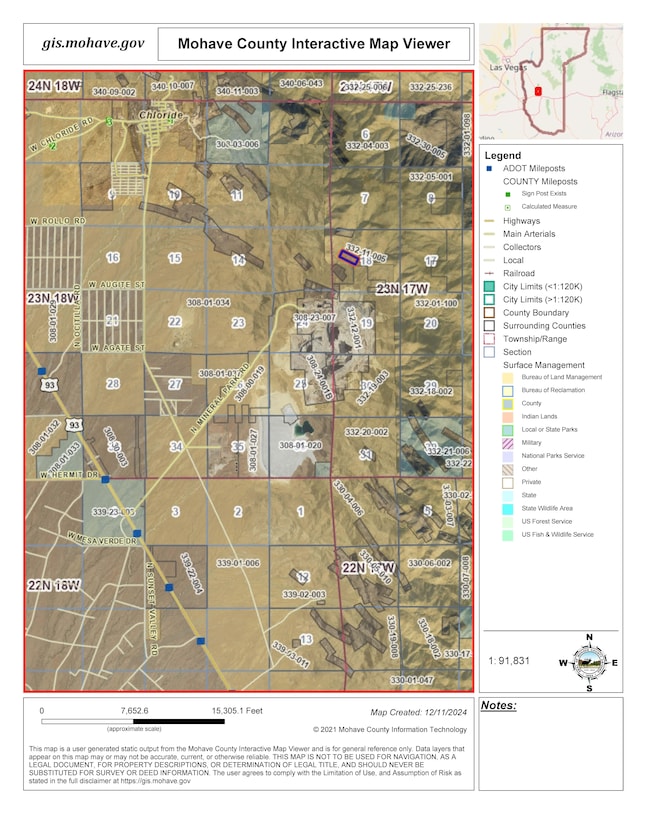
Gold Mine For Sale!! This Mining Claim conveys with its mineral rights. 19.46 acres of possibilities surrounded on all 4 sides by BLM land. This part of Mohave County is still full of active gold-and-mineral producing mines. Mineral Park, being actively mined today by Origin Mining Company, is less than a mile south of this Mining Claim of the Golden Star Mine, part of the Wallapai Mining District. Approximately 1.25 miles NW of the Origin Mining Staff Parking lot as the crow files. Note: Sellers have never been to the property, and Realtor was unable to navigate to the property. Adventurers welcome!! Photos on listing are from area nearby -- not of the property itself. If you go adventuring, be prepared with food, water, warm clothes, and satellite communications as cell signal drops out in the valley areas, and be aware you are traveling in an open mining-pit area. Do not approach any mine shafts edges closer than 20 yards. GPS Coordinates: 35.382912, -114.145162

Last Listed By

Elise Harron

Dirt Road Real Estate License #BR645447000 Listed on: 01/24/2025

Listing Provided By

Property Details

Property Type

  • Land

Lot Details

  • Dirt Road
  • Desert Landscape
  • Steep Slope
  • Hilly Lot
  • Mountainous Lot
  • Soil Types include Rocky/Shale

Outdoor Features

  • Wildlife includes mule deer, quails, doves

Location

  • Easements include none
  • Outside City Limits

Property Details

Property Type

Land

Lot Details

0

Listing Details

  • Office Phone: 928-508-2174
  • Listing Website: https://www.land.com/property/0000-n-mineral-park-road-kingman-arizona-86409/22469103/
  • Property Type: Lot / Land
  • Property Sub-Type: Other
  • Offered By: LandNetwork
  • Special Features: None
  • Property Sub Type: LotsLands

Interior Features

  • Has Attic: No
  • Disability Access: No
  • Sprinklers: No

Exterior Features

  • Road Description: Outside City Limits, Dirt
  • Fencing: None
  • Wildlife: Mule Deer, Quail, Dove

Lot Info

  • Lot Description: Acreage, Hilly, Steep, Varied, Desert, Mountain
  • Easements: None
  • Soil Type: Rocky/Shale

Map

Range of Values:

Collateral Analytics

Collateral Analytics Collateral Analytics AVMs (Automated Valuation Model) employ a number of statistical approaches combined with neighborhood-specific comparable selection guarantees the most up-to-date and precise valuations.

Not Available

Collateral Analytics does not have data for the current month. Please view the chart for historical values.

ICE

ICE Mortgage Technology ICE Mortgage Technology’s AVM (Automated Valuation Model) is a state-of-the-art online residential property valuation tool that provides a quick and accurate estimate of the value of almost any home in the U.S.

Not Available

ICE Mortgage Technology does not have data for the current month. Please view the chart for historical values.

First American

First American First American Data & Analytics’ next-generation AVM combines unrivaled data assets with a blended ensemble of valuation models to produce highly accurate, reliable valuations you can trust.

Not Available

First American does not have data for the current month. Please view the chart for historical values.

Quantarium

Quantarium Quantarium’s valuation service, repeatedly proven the industry’s most accurate and comprehensive, is supercharged with a self-learning and auto-tuning AI engine that continually becomes smarter and more accurate as it processes daily inputs from the industry’s leading RE data lake.

Not Available

Quantarium does not have data for the current month. Please view the chart for historical values.

Average Value
Not Available
List Price
Sold Price
Create a Home Valuation Report for This Property
The Home Valuation Report is an in-depth analysis detailing your home's value as well as a comparison with similar homes in the area

Home Values in the Area

Source: Public Records

Average Home Value in this Area


Source: Public Records

Property History

Date Event Price Change Sq Ft Price
01/24/2025 01/24/25 For Sale $98,000 -- --

Similar Properties in Kingman, AZ

  • 003 Walapai Mining District, Kingman, AZ 86409

    $100,000

    • Land
    • 21 Acres
    • $4,840 per Acre
    • 003 Walapai Mining District
    • Kingman, AZ

    Over 20 acres of Patented Mining Claim. De La Fountain, a lode mining claim in the Walapai Mining District shown on Mineral Survey NO 1456. Access to mine from Stockton Hill or Old Hwy 93.

    Kerri Pearce KG Keller Williams Arizona Living Realty

    Section Image
  • 310-03-092 Cherum Rd, Kingman, AZ 86409

    $90,000

    • Land
    • 19 Acres
    • $4,634 per Acre
    • 310-03-092 Cherum Rd
    • Kingman, AZ

    This 20 acre gem (19.42 acres) is tucked away on the North end of Cherum, North of Kingman. This property can be subdivided into 5 acre parcels and there are a couple gorgeous building sites that are possible to build your dream home. A portion of this parcel is a rocky bluff with amazing 360 views. Utilities need to be extended but power is close. Septic needs to be installed and you would

    Lynn Thompson Realty ONE Group Mountain Desert

    Section Image
  • 0 N Stockton Hill Rd Unit 29201, Kingman, AZ 86401

    $94,900

    • Land
    • 20 Acres
    • $4,854 per Acre
    • 0 N Stockton Hill Rd
    • Unit 29201
    • Kingman, AZ

    "TOP OF THE MOUNTAIN WITH 360 DEGREE VIEWS!" Breath taking desert foliage, blue skies, mountains and over abundance of "fresh air". This 19.55 acre parcel is waiting for you and your new home! Peace and quiet at your doorstep. Approximately 10 miles north on North Stockton Hill Road.

    Carol Gilje Barbara Ricca Realty

    Section Image