Estimated Value: $151,000 - $239,179
3
Beds
2
Baths
1,728
Sq Ft
$121/Sq Ft
Est. Value
About This Home
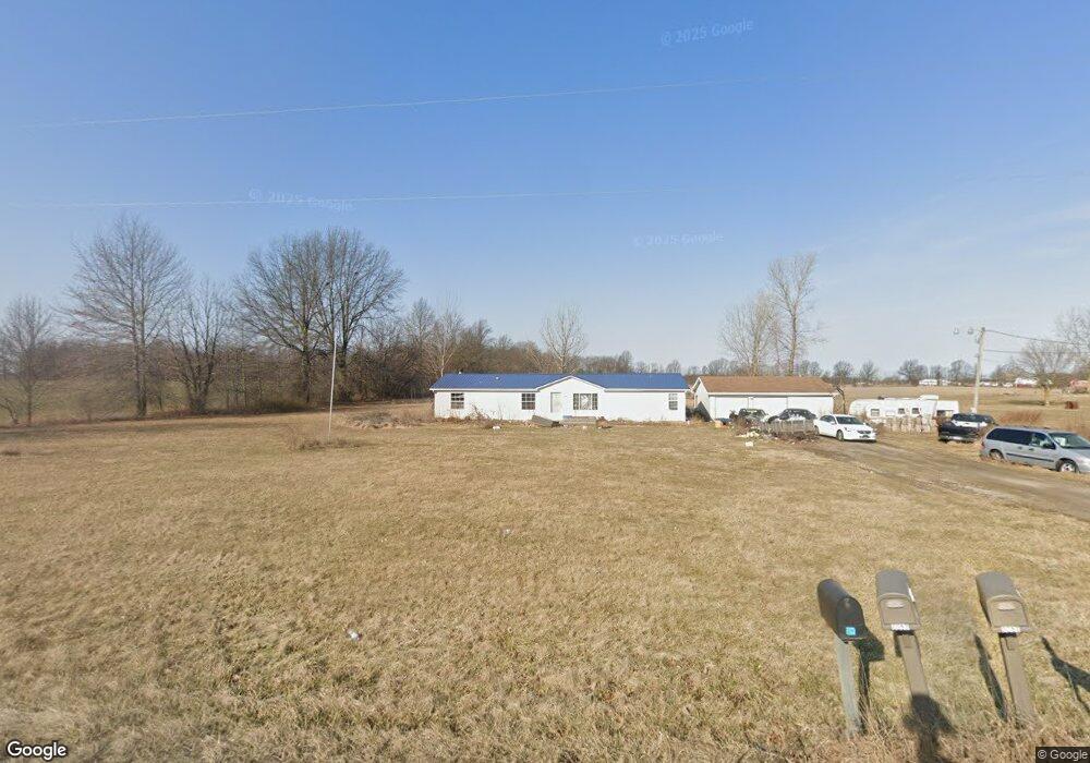
This home is located at 0257 State Route 235, Ada, OH 45810 and is currently estimated at $208,295, approximately $120 per square foot. 0257 State Route 235 is a home located in Hardin County with nearby schools including Ada Elementary School and Ada High School.
Ownership History
Date
Name
Owned For
Owner Type
Purchase Details
Closed on
Jun 8, 2016
Sold by
Beery John E
Bought by
May Heather N
Current Estimated Value
Home Financials for this Owner
Home Financials are based on the most recent Mortgage that was taken out on this home.
Original Mortgage
$105,061
Outstanding Balance
$83,861
Interest Rate
3.66%
Mortgage Type
FHA
Estimated Equity
$124,434
Purchase Details
Closed on
Nov 21, 2006
Sold by
Armbrecht Robert E and Armbrecht Alisa L
Bought by
Beery John E
Home Financials for this Owner
Home Financials are based on the most recent Mortgage that was taken out on this home.
Original Mortgage
$104,000
Interest Rate
6.36%
Mortgage Type
New Conventional
Purchase Details
Closed on
Jun 8, 1998
Bought by
Wells Alisa L
Purchase Details
Closed on
May 24, 1996
Bought by
Dysert Kevin and Dysert Debra
Create a Home Valuation Report for This Property
The Home Valuation Report is an in-depth analysis detailing your home's value as well as a comparison with similar homes in the area
Home Values in the Area
Average Home Value in this Area
Purchase History
| Date | Buyer | Sale Price | Title Company |
|---|---|---|---|
| May Heather N | $107,000 | First Lima Title Agency | |
| Beery John E | $104,000 | None Available | |
| Wells Alisa L | $89,900 | -- | |
| Dysert Kevin | $7,500 | -- |
Source: Public Records
Mortgage History
| Date | Status | Borrower | Loan Amount |
|---|---|---|---|
| Open | May Heather N | $105,061 | |
| Previous Owner | Beery John E | $104,000 |
Source: Public Records
Tax History Compared to Growth
Tax History
| Year | Tax Paid | Tax Assessment Tax Assessment Total Assessment is a certain percentage of the fair market value that is determined by local assessors to be the total taxable value of land and additions on the property. | Land | Improvement |
|---|---|---|---|---|
| 2024 | $1,586 | $41,820 | $10,180 | $31,640 |
| 2023 | $1,586 | $41,820 | $10,180 | $31,640 |
| 2022 | $1,357 | $31,110 | $5,270 | $25,840 |
| 2021 | $1,505 | $31,110 | $5,270 | $25,840 |
| 2020 | $1,517 | $31,110 | $5,270 | $25,840 |
| 2019 | $1,346 | $27,920 | $5,060 | $22,860 |
| 2018 | $1,317 | $27,920 | $5,060 | $22,860 |
| 2017 | $1,232 | $27,920 | $5,060 | $22,860 |
| 2016 | $1,179 | $27,720 | $4,540 | $23,180 |
| 2015 | $1,156 | $27,720 | $4,540 | $23,180 |
| 2014 | $1,149 | $27,720 | $4,540 | $23,180 |
| 2013 | $1,455 | $33,260 | $4,540 | $28,720 |
Source: Public Records
Map
Nearby Homes
- 3769 County Road 304
- 22694 County Road 12
- 3600 Township Road 27
- 629 N Main St
- 128 W North Ave
- 444 Edwards St Unit A, B
- 444 Edwards St Unit 2
- 442 Edwards St
- 210 N Gilbert St
- 211 S Main St
- 212 N Simon St
- 211 W Buckeye Ave Unit 211 1/2
- 301 S Main St
- 308-310 S Simon St
- 314 E University Ave
- 00 Lincoln Hwy
- 710 S Main St
- 4071 Township Road 35
- 20515 County Road 15
- 000 Lincoln Hwy