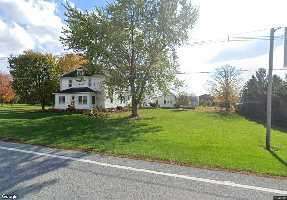
07618 State Route 219 New Knoxville, OH 45871
Estimated Value: $247,000 - $307,000
4
Beds
3
Baths
2,260
Sq Ft
$121/Sq Ft
Est. Value
About This Home
This home is located at 07618 State Route 219, New Knoxville, OH 45871 and is currently estimated at $274,201, approximately $121 per square foot. 07618 State Route 219 is a home located in Auglaize County with nearby schools including New Knoxville Elementary School.
Ownership History
Date
Name
Owned For
Owner Type
Purchase Details
Closed on
Aug 22, 2005
Sold by
Chalk Michael J and Siefring Melissa A
Bought by
Chalk Michael J and Chalk Melissa A
Current Estimated Value
Home Financials for this Owner
Home Financials are based on the most recent Mortgage that was taken out on this home.
Original Mortgage
$104,000
Outstanding Balance
$55,368
Interest Rate
5.87%
Mortgage Type
Adjustable Rate Mortgage/ARM
Estimated Equity
$218,833
Purchase Details
Closed on
Aug 19, 2002
Sold by
Henschen Elmer H
Bought by
Chalk Michael J
Create a Home Valuation Report for This Property
The Home Valuation Report is an in-depth analysis detailing your home's value as well as a comparison with similar homes in the area
Home Values in the Area
Average Home Value in this Area
Purchase History
| Date | Buyer | Sale Price | Title Company |
|---|---|---|---|
| Chalk Michael J | -- | None Available | |
| Chalk Michael J | $105,000 | -- |
Source: Public Records
Mortgage History
| Date | Status | Borrower | Loan Amount |
|---|---|---|---|
| Open | Chalk Michael J | $104,000 |
Source: Public Records
Tax History Compared to Growth
Tax History
| Year | Tax Paid | Tax Assessment Tax Assessment Total Assessment is a certain percentage of the fair market value that is determined by local assessors to be the total taxable value of land and additions on the property. | Land | Improvement |
|---|---|---|---|---|
| 2024 | $3,546 | $52,960 | $10,960 | $42,000 |
| 2023 | $1,539 | $52,960 | $10,960 | $42,000 |
| 2022 | $1,597 | $42,700 | $9,130 | $33,570 |
| 2021 | $1,578 | $42,700 | $9,130 | $33,570 |
| 2020 | $1,581 | $42,697 | $9,128 | $33,569 |
| 2019 | $1,359 | $36,338 | $7,739 | $28,599 |
| 2018 | $1,360 | $36,338 | $7,739 | $28,599 |
| 2017 | $1,362 | $36,338 | $7,739 | $28,599 |
| 2016 | $1,235 | $33,657 | $7,368 | $26,289 |
| 2015 | $1,204 | $33,657 | $7,368 | $26,289 |
| 2014 | $1,205 | $33,657 | $7,368 | $26,289 |
| 2013 | $1,421 | $33,657 | $7,368 | $26,289 |
Source: Public Records
Map
Nearby Homes
- 0 Saxony Unit 1032555
- 107 S Mill St
- 101 Saxony Dr
- 103 Saxony Dr
- 106 W Spring St
- 8937 Wiefenbach Rd
- 16785 Roettger Rd
- 116 Meadowbrook Ln
- 0 S Beech St
- 0 Schwieterman Unit 4 290334
- 0 Schwieterman Unit 8 290342
- 0 Schwieterman Unit 10 290345
- 0 Schwieterman Unit 11 290346
- 0 Schwieterman Unit 1 290329
- 0 Schwieterman Unit 9 290344
- 0 Schwieterman Unit 7 290341
- 0 Schwieterman Unit 12 290347
- 0 Schwieterman Unit 13 290348
- 200 N Knoxville Ave Unit 7
- 8304 Kruse Rd
- 05447 Henschen Rd
- 07759 State Route 219
- 07759 State Route 219
- 7807 State Route 219
- 323 E Spring St
- 6208 Cloverdale
- 324 E Spring St
- 321 E Spring St
- 322 E Spring St
- 317 E Spring St
- 7959 Ohio 219
- 316 E Spring St
- 316 E Spring St
- 316 E Spring St Unit 2
- 316 E Spring St Unit 316
- 07959 State Route 219
- 315 E Spring St
- 10255 Cook Rd
- 07985 State Route 219
- 312 E Spring St