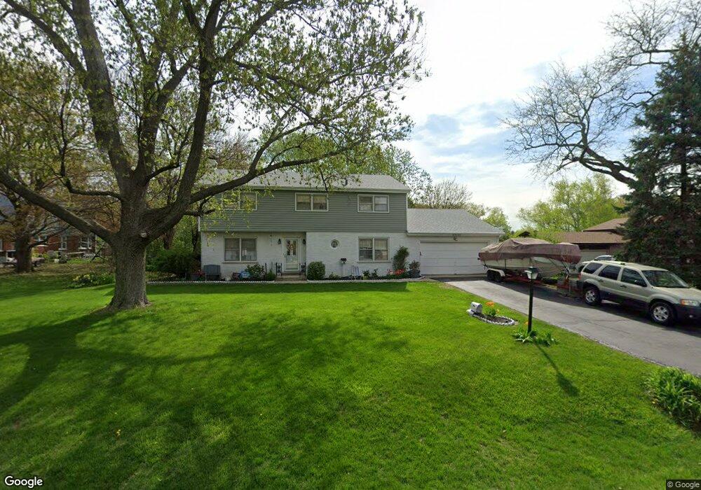
0N127 Jefferson St Winfield, IL 60190
Estimated Value: $534,839 - $771,000
--
Bed
--
Bath
2,524
Sq Ft
$241/Sq Ft
Est. Value
About This Home
This home is located at 0N127 Jefferson St, Winfield, IL 60190 and is currently estimated at $607,960, approximately $240 per square foot. 0N127 Jefferson St is a home located in DuPage County with nearby schools including Winfield Central School, Winfield Primary School, and West Chicago Community High School.
Ownership History
Date
Name
Owned For
Owner Type
Purchase Details
Closed on
Aug 24, 1998
Sold by
Marzotto John H and Marzotto Gail M
Bought by
Anderson Robert S and Stellmach Tracey
Current Estimated Value
Home Financials for this Owner
Home Financials are based on the most recent Mortgage that was taken out on this home.
Original Mortgage
$227,100
Outstanding Balance
$47,872
Interest Rate
7.04%
Mortgage Type
Purchase Money Mortgage
Estimated Equity
$560,088
Create a Home Valuation Report for This Property
The Home Valuation Report is an in-depth analysis detailing your home's value as well as a comparison with similar homes in the area
Home Values in the Area
Average Home Value in this Area
Purchase History
| Date | Buyer | Sale Price | Title Company |
|---|---|---|---|
| Anderson Robert S | $240,000 | -- |
Source: Public Records
Mortgage History
| Date | Status | Borrower | Loan Amount |
|---|---|---|---|
| Open | Anderson Robert S | $227,100 |
Source: Public Records
Tax History Compared to Growth
Tax History
| Year | Tax Paid | Tax Assessment Tax Assessment Total Assessment is a certain percentage of the fair market value that is determined by local assessors to be the total taxable value of land and additions on the property. | Land | Improvement |
|---|---|---|---|---|
| 2024 | $11,705 | $163,940 | $44,968 | $118,972 |
| 2023 | $11,200 | $149,730 | $41,070 | $108,660 |
| 2022 | $10,553 | $139,920 | $38,380 | $101,540 |
| 2021 | $9,933 | $134,120 | $36,790 | $97,330 |
| 2020 | $9,763 | $130,050 | $35,670 | $94,380 |
| 2019 | $9,696 | $123,850 | $33,970 | $89,880 |
| 2018 | $9,282 | $116,840 | $32,050 | $84,790 |
| 2017 | $9,049 | $111,020 | $30,450 | $80,570 |
| 2016 | $8,808 | $103,510 | $28,390 | $75,120 |
| 2015 | $8,654 | $95,820 | $26,280 | $69,540 |
| 2014 | $8,431 | $91,270 | $25,030 | $66,240 |
| 2013 | $8,298 | $94,610 | $25,950 | $68,660 |
Source: Public Records
Map
Nearby Homes
- 0S619 Forest Ave
- 0S044 Lee Ct
- 27W180 Cooley Ave
- 0S099 Lee Ct Unit 401
- 27W250 Birch St
- 26W537 Barnes Ave
- 27W705 Grasmere Dr Unit 1705
- 0N200 Windermere Rd Unit 2702
- 0N069 Windermere Rd Unit 2301
- 26W447 Harrison Ave
- 0S064 Calvin Ct
- S071 Leonard St
- 27W277 Waterford Dr
- 27W423 Sunnyside Ave
- 3 Sunnyside Ave
- 0N062 Forsythe Ct
- 0N082 Forsythe Ct
- 28W061 Woodland Dr
- 0N010 Stanley St
- 26W278 Harrison Ave
- 0N115 Jefferson St
- 27W251 Bolles Ave
- 0N120 Jefferson St
- 0N126 Robbins St
- 0N134 Jefferson St
- 0N093 Jefferson St
- 27W231 Bolles Ave
- 0N114 Robbins St
- 0N106 Jefferson St
- 0N092 Robbins St
- 27W273 Bolles Ave
- 27W244 Bolles Ave
- 0N079 Jefferson St
- 27W256 Bolles Ave
- 27W226 Bolles Ave
- 0N086 Jefferson St
- 0N078 Robbins St
- 0N160 Jefferson St
- 0N115 Robbins St
- 0N127 Robbins St