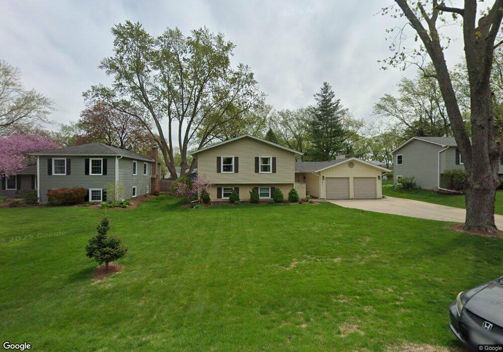
0N301 Peter Rd Winfield, IL 60190
Jewell Road NeighborhoodEstimated Value: $398,332 - $539,000
About This Home
This home is located at 0N301 Peter Rd, Winfield, IL 60190 and is currently estimated at $455,583, approximately $309 per square foot. 0N301 Peter Rd is a home located in DuPage County with nearby schools including Pleasant Hill Elementary School, Monroe Middle School, and Wheaton North High School.
Ownership History
We collect this data history from publicly available records. To have your information removed, we recommend requesting removal directly through your county’s website.
Purchase Details
Purchase Details
Home Financials for this Owner
Home Financials are based on the most recent Mortgage that was taken out on this home.Purchase Details
Home Financials for this Owner
Home Financials are based on the most recent Mortgage that was taken out on this home.Purchase Details
Home Financials for this Owner
Home Financials are based on the most recent Mortgage that was taken out on this home.Home Values in the Area
Average Home Value in this Area
Purchase History
We collect this data history from publicly available records. To have your information removed, we recommend requesting removal directly through your county’s website.
| Date | Buyer | Sale Price | Title Company |
|---|---|---|---|
| -- | None Available | ||
| -- | -- | ||
| $229,000 | -- | ||
| $214,000 | Chicago Title Insurance Co |
Mortgage History
We collect this data history from publicly available records. To have your information removed, we recommend requesting removal directly through your county’s website.
| Date | Status | Borrower | Loan Amount |
|---|---|---|---|
| Previous Owner | $224,000 | ||
| Previous Owner | $170,000 | ||
| Previous Owner | $164,000 |
Tax History
We collect this data history from publicly available records. To have your information removed, we recommend requesting removal directly through your county’s website.
| Year | Tax Paid | Tax Assessment Tax Assessment Total Assessment is a certain percentage of the fair market value that is determined by local assessors to be the total taxable value of land and additions on the property. | Land | Improvement |
|---|---|---|---|---|
| 2024 | $7,935 | $124,828 | $23,282 | $101,546 |
| 2023 | $7,568 | $114,900 | $21,430 | $93,470 |
| 2022 | $7,374 | $108,590 | $20,250 | $88,340 |
| 2021 | $6,985 | $106,010 | $19,770 | $86,240 |
| 2020 | $6,934 | $105,030 | $19,590 | $85,440 |
| 2019 | $6,792 | $102,260 | $19,070 | $83,190 |
| 2018 | $6,214 | $93,590 | $17,970 | $75,620 |
| 2017 | $6,105 | $90,140 | $17,310 | $72,830 |
| 2016 | $6,056 | $86,540 | $16,620 | $69,920 |
| 2015 | $6,022 | $82,560 | $15,860 | $66,700 |
| 2014 | $6,778 | $90,620 | $15,890 | $74,730 |
| 2013 | $6,552 | $90,890 | $15,940 | $74,950 |
Map
- 0N462 Arbor Ct
- 26W181 Grand Ave
- 26W447 Harrison Ave
- N385 Silverleaf Blvd
- 0S034 Calvin Ct
- s 075 Pleasant Hill Rd
- N350 County Farm Rd
- 0N741 Barry Ave
- 26W039 Marion Ave
- 1N003 Richard Ave
- 27W088 Evelyn Ave
- 27W231 Bolles Ave
- 27W119 Cooley Ave
- 1240 W Thomas Rd
- 1251 W Thomas Rd
- 27W306 Victoria Ln
- 0N682 Chelsea Cir
- 1150 Oakview Dr Unit D
- 1603 Beecher Ave
- 27W359 Aspen Ct
- 0N311 Peter Rd
- 0N281 Peter Rd
- 26W317 Blair St
- 26W304 Stanley St
- 0N273 Peter Rd
- 0N260 Stanley St
- 26W361 Blair St
- 0N304 Peter Rd
- 26W307 Blair St
- 0N252 Stanley St
- 26W350 Blair St
- 26W290 Stanley St
- 0N282 Peter Rd
- 0N265 Peter Rd
- 26W322 Blair St
- 0N274 Peter Rd
- 26W291 Blair St
- 0N246 Stanley St
- 0N348 Peter Rd
- 26W278 Stanley St
Ask me questions while you tour the home.