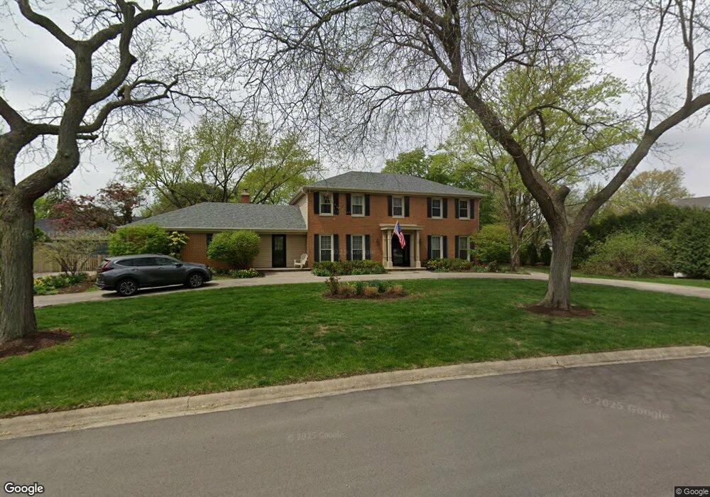
0N620 Herrick Dr Wheaton, IL 60187
Northside-Wheaton NeighborhoodEstimated Value: $619,000 - $846,000
4
Beds
4
Baths
2,564
Sq Ft
$291/Sq Ft
Est. Value
About This Home
This home is located at 0N620 Herrick Dr, Wheaton, IL 60187 and is currently estimated at $745,497, approximately $290 per square foot. 0N620 Herrick Dr is a home located in DuPage County with nearby schools including Carl Sandburg Elementary School, Monroe Middle School, and Wheaton North High School.
Ownership History
Date
Name
Owned For
Owner Type
Purchase Details
Closed on
Aug 28, 2013
Sold by
Bredfeldt Judith A and Judith A Bredfeldt Trust
Bought by
Lee Michael I and Lee Nam Mee G
Current Estimated Value
Home Financials for this Owner
Home Financials are based on the most recent Mortgage that was taken out on this home.
Original Mortgage
$384,000
Outstanding Balance
$289,029
Interest Rate
4.62%
Mortgage Type
New Conventional
Estimated Equity
$456,468
Purchase Details
Closed on
Dec 15, 2001
Sold by
Bredfeldt Glenn W and Bredfeldt Judith A
Bought by
Bredfeldt Judith A and Judith A Bredfeldt Trust Agreement
Create a Home Valuation Report for This Property
The Home Valuation Report is an in-depth analysis detailing your home's value as well as a comparison with similar homes in the area
Home Values in the Area
Average Home Value in this Area
Purchase History
| Date | Buyer | Sale Price | Title Company |
|---|---|---|---|
| Lee Michael I | $480,000 | Midwest Title Services Llc | |
| Bredfeldt Judith A | -- | -- |
Source: Public Records
Mortgage History
| Date | Status | Borrower | Loan Amount |
|---|---|---|---|
| Open | Lee Michael I | $384,000 |
Source: Public Records
Tax History
| Year | Tax Paid | Tax Assessment Tax Assessment Total Assessment is a certain percentage of the fair market value that is determined by local assessors to be the total taxable value of land and additions on the property. | Land | Improvement |
|---|---|---|---|---|
| 2024 | $13,070 | $225,168 | $42,772 | $182,396 |
| 2023 | $12,529 | $207,260 | $39,370 | $167,890 |
| 2022 | $12,134 | $195,870 | $37,200 | $158,670 |
| 2021 | $11,726 | $183,450 | $36,320 | $147,130 |
| 2020 | $11,667 | $181,740 | $35,980 | $145,760 |
| 2019 | $11,375 | $176,940 | $35,030 | $141,910 |
| 2018 | $11,411 | $175,910 | $33,010 | $142,900 |
| 2017 | $11,231 | $169,420 | $31,790 | $137,630 |
| 2016 | $11,080 | $162,650 | $30,520 | $132,130 |
| 2015 | $11,011 | $155,170 | $29,120 | $126,050 |
| 2014 | $9,457 | $131,740 | $18,100 | $113,640 |
| 2013 | $9,168 | $132,130 | $18,150 | $113,980 |
Source: Public Records
Map
Nearby Homes
- 26W181 Grand Ave
- 570 Amy Ln
- 0 Ellis Ave
- 2018 N West St
- Lot 11 Ellis Ave
- 25W275 Doris Ave
- 0N655 Courtney Ln
- 0N049 Page St
- 114 W Prairie Ave
- 26W548 Prairie Ave
- 27W130 W Street Charles Rd
- 27W214 Heather Ln
- 1115 N Main St
- 0N105 Lot 1 Nepil Ave
- 0N105 Lot 2 Nepil Ave
- 27W210 Providence Ln Unit 1
- 27W073 Jewell Rd
- 1902 N Washington St
- 340 Parkway Dr
- 107 N Pierce Ave
- 25W656 Jerome Ave
- 25W645 Coventry St
- 25W657 Coventry St
- 0N650 Herrick Dr
- 25W668 Jerome Ave
- 0N580 Herrick Dr
- 0N641 Herrick Dr
- 25W671 Coventry St
- 0N581 Herrick Dr
- 25W602 Jerome Ave
- 25W680 Jerome Ave
- 0N558 Herrick Dr
- 1 Jerome Ave
- 2 Jerome Ave
- ON651 Coventry St
- 0N651 Herrick Dr
- 25W630 Coventry St
- 0N567 Herrick Dr
- 25W706 Jerome Ave
- 25W644 Coventry St
Your Personal Tour Guide
Ask me questions while you tour the home.