0S172 Rowe Rd Elburn, IL 60119
Estimated Value: $494,000 - $598,000
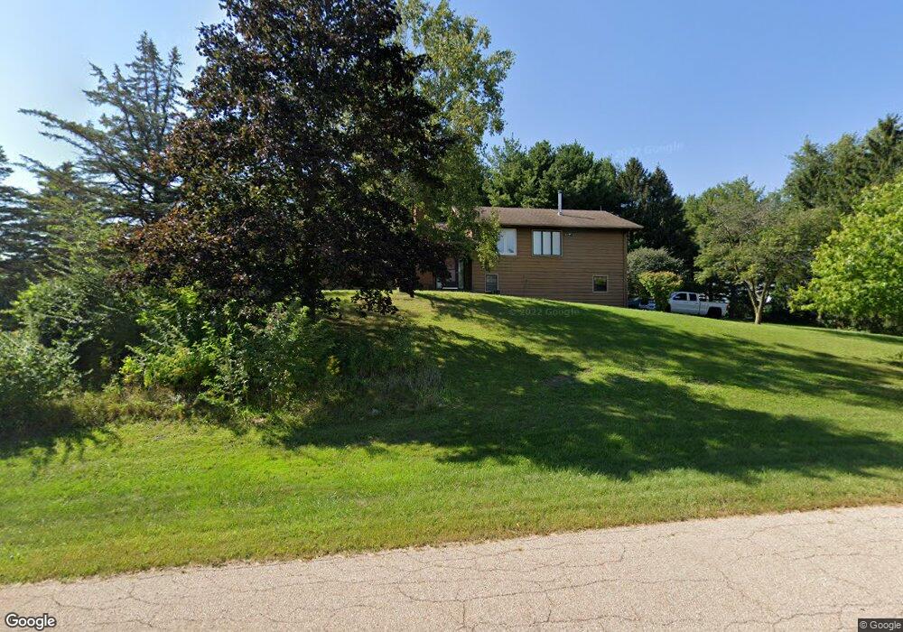
About This Home
This home is located at 0S172 Rowe Rd, Elburn, IL 60119 and is currently estimated at $570,992, approximately $237 per square foot. 0S172 Rowe Rd is a home with nearby schools including Kaneland Blackberry Creek Elementary School, Harter Middle School, and Kaneland High School.
Ownership History
We collect this data history from publicly available records. To have your information removed, we recommend requesting removal directly through your county’s website.
Purchase Details
Home Financials for this Owner
Home Financials are based on the most recent Mortgage that was taken out on this home.Purchase Details
Home Financials for this Owner
Home Financials are based on the most recent Mortgage that was taken out on this home.Home Values in the Area
Average Home Value in this Area
Purchase History
We collect this data history from publicly available records. To have your information removed, we recommend requesting removal directly through your county’s website.
| Date | Buyer | Sale Price | Title Company |
|---|---|---|---|
| $45,000 | -- | ||
| $45,000 | Standard Title |
Mortgage History
We collect this data history from publicly available records. To have your information removed, we recommend requesting removal directly through your county’s website.
| Date | Status | Borrower | Loan Amount |
|---|---|---|---|
| Closed | $33,500 | ||
| Previous Owner | $33,000 |
Tax History
We collect this data history from publicly available records. To have your information removed, we recommend requesting removal directly through your county’s website.
| Year | Tax Paid | Tax Assessment Tax Assessment Total Assessment is a certain percentage of the fair market value that is determined by local assessors to be the total taxable value of land and additions on the property. | Land | Improvement |
|---|---|---|---|---|
| 2024 | $9,793 | $130,070 | $21,880 | $108,190 |
| 2023 | $9,445 | $117,391 | $19,747 | $97,644 |
| 2022 | $8,135 | $97,307 | $18,123 | $79,184 |
| 2021 | $7,871 | $93,135 | $17,346 | $75,789 |
| 2020 | $7,738 | $90,952 | $16,939 | $74,013 |
| 2019 | $7,753 | $89,616 | $16,690 | $72,926 |
| 2018 | $7,429 | $84,487 | $16,690 | $67,797 |
| 2017 | $7,438 | $83,526 | $16,500 | $67,026 |
| 2016 | $8,008 | $87,009 | $19,171 | $67,838 |
| 2015 | -- | $80,803 | $18,423 | $62,380 |
| 2014 | -- | $84,472 | $20,500 | $63,972 |
| 2013 | -- | $84,472 | $20,500 | $63,972 |
Map
- 0S790 Rowe Rd
- Lot 9 Rowe Rd
- 635 Independence Ave
- 692 Independence Ave
- 00 Rt 38 Rd
- 16 Derek Dr
- #11 Derek Dr
- Lot #12 Derek Dr
- Lot #5 Derek Dr
- Lot #6 Derek Dr
- Lot #7 Derek Dr
- 1s Il Route 47
- 1140 Independence Ave
- 834 Citizen Ave
- 990 Citizen Ave
- 1200 Independence Ave
- Lot 4 Country View Ln
- 18.5 Acres Rt 47 - Hughes Rd
- 1303 Collins Dr
- 1010 Sears Cir
- 0S163 Surrey Dr
- 0S156 Rowe Rd
- 0S185 Rowe Rd
- 0S145 Surrey Dr
- 143 Rowe Rd
- 43W760 Rowe Rd Unit 3
- 0S190 Surrey Dr
- 43W747 Kenmar Dr
- 0S156 Surrey Dr
- 43W723 Kenmar Dr
- 43W771 Kenmar Dr
- 0S668 Derek Dr
- 0S810 Autumn Woods Ln
- 42 W Main Street Rd
- 0S129 Surrey Dr
- 43W770 Rowe Rd
- 0S219 Rowe Rd
- 0S123 Rowe Rd
- 0S131 Rowe Rd
- 43W693 Kenmar Dr
Ask me questions while you tour the home.