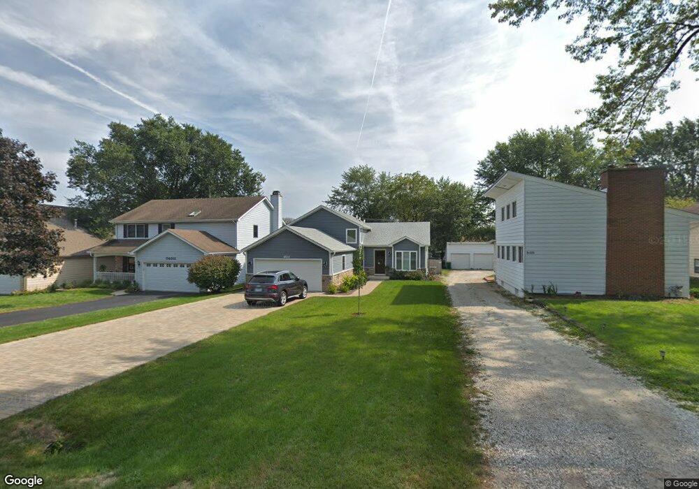
0S515 Robbins St Winfield, IL 60190
Estimated Value: $359,000 - $459,000
--
Bed
--
Bath
1,172
Sq Ft
$347/Sq Ft
Est. Value
About This Home
This home is located at 0S515 Robbins St, Winfield, IL 60190 and is currently estimated at $406,129, approximately $346 per square foot. 0S515 Robbins St is a home with nearby schools including Winfield Central School, Winfield Primary School, and West Chicago Community High School.
Ownership History
Date
Name
Owned For
Owner Type
Purchase Details
Closed on
Nov 23, 2016
Sold by
Dgr Investments Llc
Bought by
Herwaldt Mitch and Herwaldt Lindsay
Current Estimated Value
Home Financials for this Owner
Home Financials are based on the most recent Mortgage that was taken out on this home.
Original Mortgage
$274,114
Outstanding Balance
$220,620
Interest Rate
3.5%
Mortgage Type
FHA
Estimated Equity
$185,509
Purchase Details
Closed on
Dec 10, 2015
Sold by
Jaeger Joshua and Jaeger Lynnette
Bought by
Drg Investment Llc
Purchase Details
Closed on
Dec 30, 2013
Sold by
Brown Fred C
Bought by
Jaeger Joshua and Jaeger Lynnette
Create a Home Valuation Report for This Property
The Home Valuation Report is an in-depth analysis detailing your home's value as well as a comparison with similar homes in the area
Home Values in the Area
Average Home Value in this Area
Purchase History
| Date | Buyer | Sale Price | Title Company |
|---|---|---|---|
| Herwaldt Mitch | $279,500 | Git | |
| Drg Investment Llc | $48,000 | First American Title Company | |
| Jaeger Joshua | $30,000 | Ctic Dupage |
Source: Public Records
Mortgage History
| Date | Status | Borrower | Loan Amount |
|---|---|---|---|
| Open | Herwaldt Mitch | $274,114 |
Source: Public Records
Tax History Compared to Growth
Tax History
| Year | Tax Paid | Tax Assessment Tax Assessment Total Assessment is a certain percentage of the fair market value that is determined by local assessors to be the total taxable value of land and additions on the property. | Land | Improvement |
|---|---|---|---|---|
| 2024 | $8,124 | $116,235 | $22,435 | $93,800 |
| 2023 | $7,757 | $106,160 | $20,490 | $85,670 |
| 2022 | $7,346 | $99,220 | $19,150 | $80,070 |
| 2021 | $6,908 | $95,110 | $18,360 | $76,750 |
| 2020 | $6,786 | $92,220 | $17,800 | $74,420 |
| 2019 | $6,732 | $87,820 | $16,950 | $70,870 |
| 2018 | $6,436 | $82,850 | $16,000 | $66,850 |
| 2017 | $6,266 | $78,720 | $15,200 | $63,520 |
| 2016 | $1,887 | $14,170 | $14,170 | $0 |
| 2015 | $1,264 | $13,120 | $13,120 | $0 |
| 2014 | $1,235 | $12,490 | $12,490 | $0 |
| 2013 | $1,213 | $12,950 | $12,950 | $0 |
Source: Public Records
Map
Nearby Homes
- 27W120 Williams St
- 27W327 Williams St
- 0S732 Myrtle St
- 0S650 Forest St
- 27W423 Sunnyside Ave
- 1s050 Shaffner Rd
- 3 Sunnyside Ave
- 0S760 Cleveland St
- 27W0S Roosevelt Rd
- Lot 17,18,19 Roosevelt Rd
- 27W180 Cooley Ave
- 0S044 Lee Ct
- 0S619 Forest Ave
- 0S064 Calvin Ct
- 2059 W Roosevelt Rd
- 26W447 Harrison Ave
- 200 N Erie St
- 27W773 Beecher Ave
- 1310 Yorkshire Woods Ct
- 27W020 Walz Way
- 0S511 Robbins St
- 0S525 Robbins St
- 0S505 Robbins St
- 0S531 Robbins St
- 0S537 Robbins St
- 0S518 East St
- 0S512 East St
- 0S524 East St
- OS530 East St
- 0S504 East St
- 0S543 Robbins St
- 0S524 Robbins St
- S510 Robbins St
- 0S486 East St
- 27W179 Manchester Rd
- 0S512 Robbins St
- 0S536 Robbins St
- 0S480 East St
- 0S555 Robbins St
- 27W165 Manchester Rd