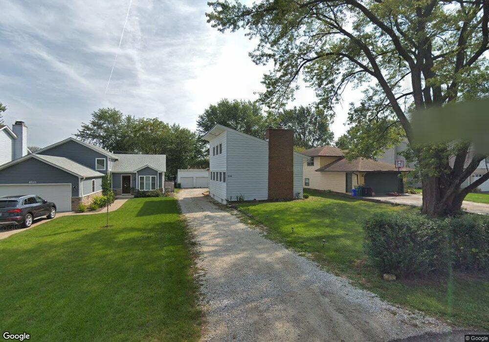
0S525 Robbins St Winfield, IL 60190
Estimated Value: $270,000 - $333,392
2
Beds
1
Bath
1,300
Sq Ft
$239/Sq Ft
Est. Value
About This Home
This home is located at 0S525 Robbins St, Winfield, IL 60190 and is currently estimated at $310,348, approximately $238 per square foot. 0S525 Robbins St is a home located in DuPage County with nearby schools including Winfield Central School, Winfield Primary School, and West Chicago Community High School.
Ownership History
Date
Name
Owned For
Owner Type
Purchase Details
Closed on
Sep 14, 2017
Sold by
Himmelfarb John and Day Molly
Bought by
Jouad Haba A and Radam Aead K
Current Estimated Value
Home Financials for this Owner
Home Financials are based on the most recent Mortgage that was taken out on this home.
Original Mortgage
$152,000
Outstanding Balance
$127,033
Interest Rate
3.93%
Mortgage Type
FHA
Estimated Equity
$183,315
Purchase Details
Closed on
Dec 23, 2009
Sold by
Himmelfarb Susan and Himmelfarb John
Bought by
Schneider Nell and Himmelfarb Susan
Create a Home Valuation Report for This Property
The Home Valuation Report is an in-depth analysis detailing your home's value as well as a comparison with similar homes in the area
Home Values in the Area
Average Home Value in this Area
Purchase History
| Date | Buyer | Sale Price | Title Company |
|---|---|---|---|
| Jouad Haba A | -- | Chicago Title Insurance Comp | |
| Schneider Nell | -- | None Available |
Source: Public Records
Mortgage History
| Date | Status | Borrower | Loan Amount |
|---|---|---|---|
| Open | Jouad Haba A | $152,000 |
Source: Public Records
Tax History Compared to Growth
Tax History
| Year | Tax Paid | Tax Assessment Tax Assessment Total Assessment is a certain percentage of the fair market value that is determined by local assessors to be the total taxable value of land and additions on the property. | Land | Improvement |
|---|---|---|---|---|
| 2024 | $5,414 | $80,136 | $22,435 | $57,701 |
| 2023 | $5,152 | $73,190 | $20,490 | $52,700 |
| 2022 | $4,917 | $68,390 | $19,150 | $49,240 |
| 2021 | $4,617 | $65,560 | $18,360 | $47,200 |
| 2020 | $4,531 | $63,570 | $17,800 | $45,770 |
| 2019 | $4,487 | $60,540 | $16,950 | $43,590 |
| 2018 | $4,282 | $57,130 | $16,000 | $41,130 |
| 2017 | $4,677 | $54,280 | $15,200 | $39,080 |
| 2016 | $4,572 | $50,610 | $14,170 | $36,440 |
| 2015 | $4,514 | $46,850 | $13,120 | $33,730 |
| 2014 | $4,411 | $44,610 | $12,490 | $32,120 |
| 2013 | $4,330 | $46,240 | $12,950 | $33,290 |
Source: Public Records
Map
Nearby Homes
- 27W120 Williams St
- 27W327 Williams St
- 0S732 Myrtle St
- 0S650 Forest St
- 27W423 Sunnyside Ave
- 1s050 Shaffner Rd
- 3 Sunnyside Ave
- 0S760 Cleveland St
- 27W0S Roosevelt Rd
- Lot 17,18,19 Roosevelt Rd
- 27W180 Cooley Ave
- 0S044 Lee Ct
- 0S619 Forest Ave
- 0S064 Calvin Ct
- 2059 W Roosevelt Rd
- 26W447 Harrison Ave
- 200 N Erie St
- 27W773 Beecher Ave
- 1310 Yorkshire Woods Ct
- 27W020 Walz Way
- 0S531 Robbins St
- 0S515 Robbins St
- 0S537 Robbins St
- 0S511 Robbins St
- 0S543 Robbins St
- 0S505 Robbins St
- 0S524 Robbins St
- OS530 East St
- 0S524 East St
- 0S536 Robbins St
- 0S518 East St
- 0S555 Robbins St
- 0S512 East St
- S510 Robbins St
- 0S512 Robbins St
- 0S504 East St
- s 544 Robbins St
- 0S550 Robbins St
- S550 Robbins St
- 27W179 Manchester Rd