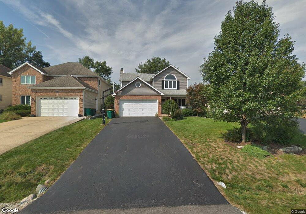
0S582 Robbins St Winfield, IL 60190
Estimated Value: $403,073 - $530,000
Studio
--
Bath
2,088
Sq Ft
$224/Sq Ft
Est. Value
About This Home
This home is located at 0S582 Robbins St, Winfield, IL 60190 and is currently estimated at $468,268, approximately $224 per square foot. 0S582 Robbins St is a home located in DuPage County with nearby schools including Winfield Central School, Winfield Primary School, and West Chicago Community High School.
Ownership History
Date
Name
Owned For
Owner Type
Purchase Details
Closed on
Nov 16, 2016
Sold by
Cassity Patrick A and Cassity Lisa
Bought by
Cassity Lisa
Current Estimated Value
Home Financials for this Owner
Home Financials are based on the most recent Mortgage that was taken out on this home.
Original Mortgage
$223,850
Outstanding Balance
$184,261
Interest Rate
4.25%
Mortgage Type
FHA
Estimated Equity
$284,007
Purchase Details
Closed on
Dec 20, 1996
Sold by
Cassity Everett A and Cassity Nancy M
Bought by
Cassity Patrick A and Cassity Lisa
Purchase Details
Closed on
Apr 19, 1996
Sold by
Hedrick C Mark and Hedrick Lisa Marie
Bought by
Cassity Patrick A and Cassity Nancy M
Home Financials for this Owner
Home Financials are based on the most recent Mortgage that was taken out on this home.
Original Mortgage
$181,800
Interest Rate
7.44%
Mortgage Type
Purchase Money Mortgage
Create a Home Valuation Report for This Property
The Home Valuation Report is an in-depth analysis detailing your home's value as well as a comparison with similar homes in the area
Home Values in the Area
Average Home Value in this Area
Purchase History
| Date | Buyer | Sale Price | Title Company |
|---|---|---|---|
| Cassity Lisa | -- | Carrington Title Partners Ll | |
| Cassity Patrick A | -- | -- | |
| Cassity Patrick A | $202,000 | -- |
Source: Public Records
Mortgage History
| Date | Status | Borrower | Loan Amount |
|---|---|---|---|
| Open | Cassity Lisa | $223,850 | |
| Closed | Cassity Patrick A | $181,800 |
Source: Public Records
Tax History
| Year | Tax Paid | Tax Assessment Tax Assessment Total Assessment is a certain percentage of the fair market value that is determined by local assessors to be the total taxable value of land and additions on the property. | Land | Improvement |
|---|---|---|---|---|
| 2024 | $10,156 | $143,312 | $22,435 | $120,877 |
| 2023 | $9,711 | $130,890 | $20,490 | $110,400 |
| 2022 | $9,167 | $122,320 | $19,150 | $103,170 |
| 2021 | $8,626 | $117,260 | $18,360 | $98,900 |
| 2020 | $8,476 | $113,700 | $17,800 | $95,900 |
| 2019 | $8,414 | $108,270 | $16,950 | $91,320 |
| 2018 | $8,052 | $102,150 | $16,000 | $86,150 |
| 2017 | $7,846 | $97,060 | $15,200 | $81,860 |
| 2016 | $7,990 | $94,450 | $14,170 | $80,280 |
| 2015 | $7,846 | $87,430 | $13,120 | $74,310 |
| 2014 | $7,611 | $83,260 | $12,490 | $70,770 |
| 2013 | $7,494 | $86,310 | $12,950 | $73,360 |
Source: Public Records
Map
Nearby Homes
- 0S579 Robbins St
- 0S644 East St
- S645 Forest St
- 27W347 Washington Ave
- 1s050 Shaffner Rd
- Lot 17,18,19 Roosevelt Rd
- 27W0S Roosevelt Rd
- 0S760 Cleveland St
- 27W119 Cooley Ave
- 27W180 Cooley Ave
- 0S053 Lee Ct
- 27W073 Jewell Rd
- 28W032 Roosevelt Rd
- 26W548 Prairie Ave
- 1S710 Shaffner Rd
- 1442 Stonebridge Cir Unit I8
- 1462 Stonebridge Cir Unit F10
- 1S728 Shaffner Rd
- 1533 S County Farm Rd Unit 1-4
- 0N112 Leonard St
- 27W211 Childs St
- 0S586 Robbins St
- 0S602 Robbins St
- 0S610 Robbins St
- 0S575 Jefferson St
- 0S579 Jefferson St
- 0S587 Jefferson St
- 0S587 Robbins St
- 0S587 Robbins St
- 27W161 Childs St Unit ST3
- S605 Jefferson St
- 0S550 Robbins St
- S550 Robbins St
- 0S611 Jefferson St
- 0S611 Robbins St
- 0S557 Jefferson St
- 0S626 Robbins St
- s 544 Robbins St
- 0S617 Jefferson St
- 0S619 Robbins St
Your Personal Tour Guide
Ask me questions while you tour the home.