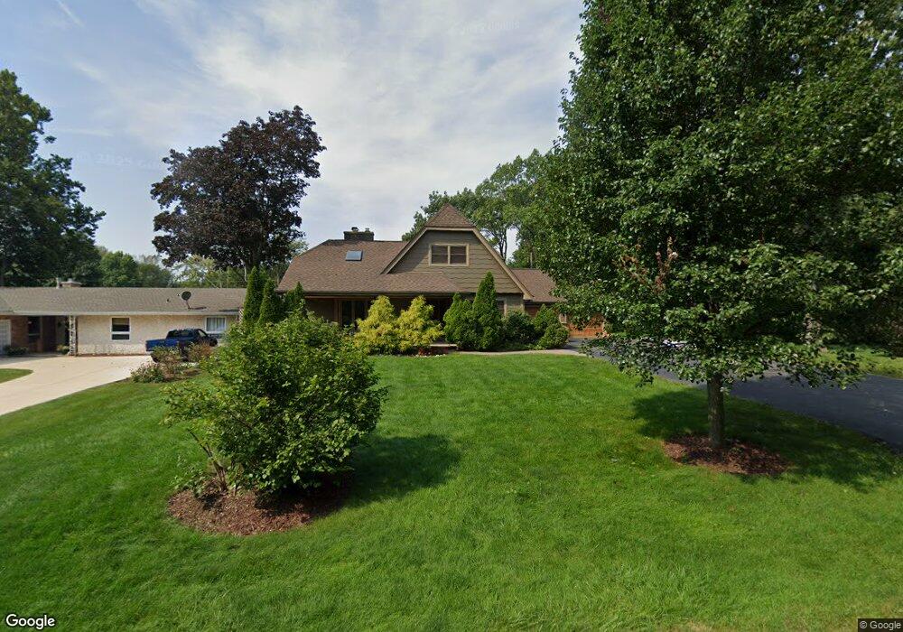
0S614 Grant St Winfield, IL 60190
Estimated Value: $425,000 - $551,000
--
Bed
--
Bath
1,875
Sq Ft
$257/Sq Ft
Est. Value
About This Home
This home is located at 0S614 Grant St, Winfield, IL 60190 and is currently estimated at $481,890, approximately $257 per square foot. 0S614 Grant St is a home with nearby schools including Winfield Central School, Winfield Primary School, and West Chicago Community High School.
Ownership History
Date
Name
Owned For
Owner Type
Purchase Details
Closed on
Aug 20, 2021
Sold by
Sullivan Elizabeth L
Bought by
Pokora Elizabeth L
Current Estimated Value
Purchase Details
Closed on
Nov 7, 2001
Sold by
Sullivan Michael C and Sullivan Elizabeth L
Bought by
Sullivan Elizabeth L
Purchase Details
Closed on
Dec 28, 1993
Sold by
Secker Peter T and Secker Mary A
Bought by
Sullivan Michael C and Sullivan Elizabeth L
Home Financials for this Owner
Home Financials are based on the most recent Mortgage that was taken out on this home.
Original Mortgage
$150,000
Interest Rate
7.16%
Mortgage Type
Purchase Money Mortgage
Create a Home Valuation Report for This Property
The Home Valuation Report is an in-depth analysis detailing your home's value as well as a comparison with similar homes in the area
Home Values in the Area
Average Home Value in this Area
Purchase History
| Date | Buyer | Sale Price | Title Company |
|---|---|---|---|
| Pokora Elizabeth L | -- | None Available | |
| Sullivan Elizabeth L | -- | -- | |
| Sullivan Michael C | $194,000 | -- |
Source: Public Records
Mortgage History
| Date | Status | Borrower | Loan Amount |
|---|---|---|---|
| Closed | Sullivan Michael C | $150,000 |
Source: Public Records
Tax History Compared to Growth
Tax History
| Year | Tax Paid | Tax Assessment Tax Assessment Total Assessment is a certain percentage of the fair market value that is determined by local assessors to be the total taxable value of land and additions on the property. | Land | Improvement |
|---|---|---|---|---|
| 2024 | $10,318 | $155,924 | $49,314 | $106,610 |
| 2023 | $9,812 | $142,410 | $45,040 | $97,370 |
| 2022 | $9,444 | $133,090 | $42,080 | $91,010 |
| 2021 | $8,871 | $127,580 | $40,340 | $87,240 |
| 2020 | $8,996 | $120,310 | $39,130 | $81,180 |
| 2019 | $8,933 | $114,570 | $37,260 | $77,310 |
| 2018 | $8,548 | $108,080 | $35,140 | $72,940 |
| 2017 | $8,332 | $102,700 | $33,390 | $69,310 |
| 2016 | $8,107 | $95,750 | $31,130 | $64,620 |
| 2015 | $7,963 | $88,640 | $28,820 | $59,820 |
| 2014 | $7,755 | $84,430 | $27,460 | $56,970 |
| 2013 | $7,633 | $87,510 | $28,460 | $59,050 |
Source: Public Records
Map
Nearby Homes
- 0S650 Forest St
- 0S760 Cleveland St
- 27W327 Williams St
- 27W0S Roosevelt Rd
- Lot 17,18,19 Roosevelt Rd
- 3 Sunnyside Ave
- 27W423 Sunnyside Ave
- 27W120 Williams St
- 0S732 Myrtle St
- 1s050 Shaffner Rd
- 1S150 Cantigny Dr
- Lot #69 Winfield Rd
- 27W773 Beecher Ave
- 0S044 Lee Ct
- 27W180 Cooley Ave
- 1S221 N Flanders Ln
- 0S619 Forest Ave
- 0N069 Windermere Rd Unit 2301
- 27W020 Walz Way
- 0N200 Windermere Rd Unit 2702
- 0S626 Grant St
- 0S634 Grant St
- 27W513 Manchester Rd
- 0S615 Grant St
- 0S625 Grant St
- 0S625 Cleveland St
- 0S644 Grant St
- 27W481 Manchester Rd
- 27W485 Manchester Rd
- 0S633 Grant St
- 0S633 Cleveland St
- S625 Cleveland St
- 0S641 Grant St
- 0S647 Cleveland St
- 27W570 Lincoln Ave
- 27W500 Williams St
- 27W500 Williams St
- 27W537 Manchester Rd
- 27W520 Williams St
- 27W460 Williams St