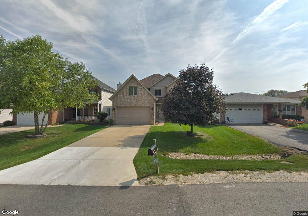
0S647 Robbins St Winfield, IL 60190
Estimated Value: $644,531 - $724,000
--
Bed
--
Bath
3,035
Sq Ft
$224/Sq Ft
Est. Value
About This Home
This home is located at 0S647 Robbins St, Winfield, IL 60190 and is currently estimated at $679,383, approximately $223 per square foot. 0S647 Robbins St is a home located in DuPage County with nearby schools including Winfield Central School, Winfield Primary School, and West Chicago Community High School.
Ownership History
Date
Name
Owned For
Owner Type
Purchase Details
Closed on
Sep 29, 2020
Sold by
Rigert Paul and Rigert Amy
Bought by
Rigert Paul J and Rigert Amy L
Current Estimated Value
Purchase Details
Closed on
Aug 21, 2003
Sold by
Century Grove Ltd
Bought by
Rigert Paul and Rigert Amy
Home Financials for this Owner
Home Financials are based on the most recent Mortgage that was taken out on this home.
Original Mortgage
$314,400
Outstanding Balance
$145,574
Interest Rate
6.33%
Mortgage Type
Purchase Money Mortgage
Estimated Equity
$533,809
Purchase Details
Closed on
Aug 30, 2002
Sold by
G Carey Construction Company
Bought by
Century Grove Ltd
Create a Home Valuation Report for This Property
The Home Valuation Report is an in-depth analysis detailing your home's value as well as a comparison with similar homes in the area
Home Values in the Area
Average Home Value in this Area
Purchase History
| Date | Buyer | Sale Price | Title Company |
|---|---|---|---|
| Rigert Paul J | -- | None Available | |
| Rigert Paul | $393,000 | Pntn | |
| Century Grove Ltd | -- | -- |
Source: Public Records
Mortgage History
| Date | Status | Borrower | Loan Amount |
|---|---|---|---|
| Open | Rigert Paul | $314,400 |
Source: Public Records
Tax History Compared to Growth
Tax History
| Year | Tax Paid | Tax Assessment Tax Assessment Total Assessment is a certain percentage of the fair market value that is determined by local assessors to be the total taxable value of land and additions on the property. | Land | Improvement |
|---|---|---|---|---|
| 2024 | $13,876 | $192,867 | $22,435 | $170,432 |
| 2023 | $13,288 | $176,150 | $20,490 | $155,660 |
| 2022 | $12,500 | $164,620 | $19,150 | $145,470 |
| 2021 | $11,769 | $157,810 | $18,360 | $139,450 |
| 2020 | $11,571 | $153,020 | $17,800 | $135,220 |
| 2019 | $11,495 | $145,720 | $16,950 | $128,770 |
| 2018 | $11,009 | $137,470 | $16,000 | $121,470 |
| 2017 | $10,738 | $130,620 | $15,200 | $115,420 |
| 2016 | $10,459 | $121,790 | $14,170 | $107,620 |
| 2015 | $10,285 | $112,740 | $13,120 | $99,620 |
| 2014 | $10,024 | $107,380 | $12,490 | $94,890 |
| 2013 | $9,862 | $111,310 | $12,950 | $98,360 |
Source: Public Records
Map
Nearby Homes
- 27W120 Williams St
- 0S732 Myrtle St
- 27W327 Williams St
- 0S650 Forest St
- 1s050 Shaffner Rd
- 27W0S Roosevelt Rd
- Lot 17,18,19 Roosevelt Rd
- 0S760 Cleveland St
- 27W423 Sunnyside Ave
- 3 Sunnyside Ave
- 27W180 Cooley Ave
- 2059 W Roosevelt Rd
- 2152 Belleau Woods Dr
- 0S044 Lee Ct
- 27W020 Walz Way
- 1310 Yorkshire Woods Ct
- 0S619 Forest Ave
- 0S064 Calvin Ct
- 1S710 Shaffner Rd
- 1S728 Shaffner Rd
- 0S643 Robbins St
- 0S651 Robbins St
- 0S635 Robbins St
- 27W180 Williams St
- 0S627 Robbins St
- 0S644 East St
- 0S644 East St
- 27W150 Williams St
- S630 East St
- 0S619 Robbins St
- 0S630 East St
- 0S624 East St
- 27W181 Williams St
- 634 Robbins St
- 0S611 Robbins St
- 0S626 Robbins St
- S678 Robbins St
- 0S616 East St
- 0S681 Robbins St
- 0S672 East St