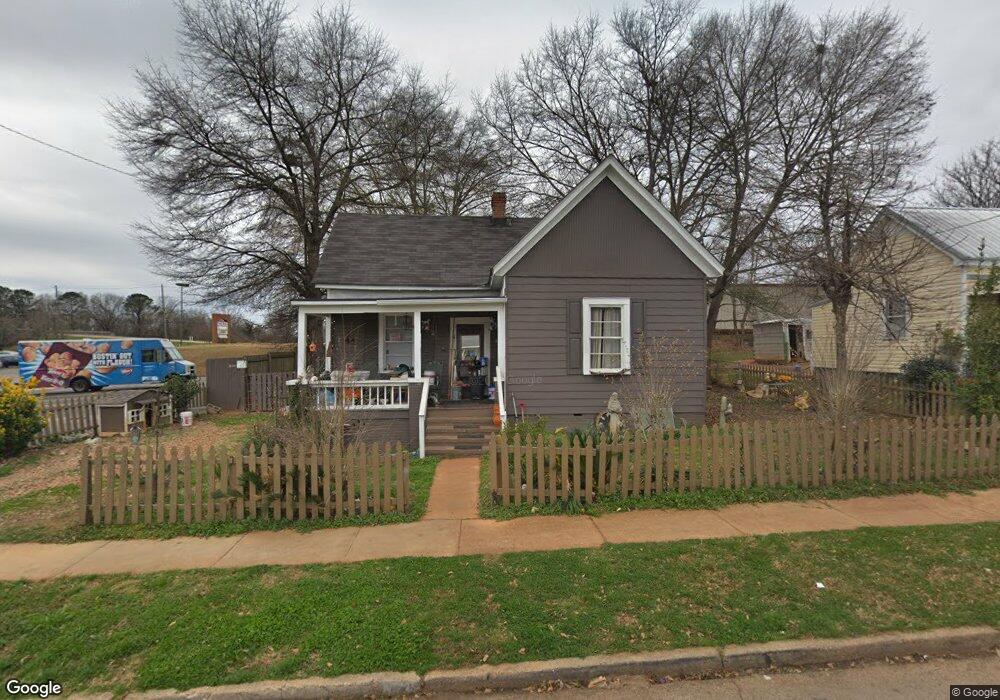
1 1/2 New St Lagrange, GA 30241
Estimated Value: $88,541 - $146,000
2
Beds
1
Bath
1,008
Sq Ft
$106/Sq Ft
Est. Value
About This Home
This home is located at 1 1/2 New St, Lagrange, GA 30241 and is currently estimated at $106,885, approximately $106 per square foot. 1 1/2 New St is a home with nearby schools including Franklin Forest Elementary School, Hollis Hand Elementary School, and Ethel W. Kight Elementary School.
Ownership History
Date
Name
Owned For
Owner Type
Purchase Details
Closed on
Dec 22, 2011
Bought by
Stone Sharon Jean
Current Estimated Value
Purchase Details
Closed on
Jan 18, 1996
Sold by
Spinks Etal
Bought by
Greenwood Properties Llc
Purchase Details
Closed on
Apr 1, 1986
Sold by
Eastside Prop
Bought by
Spinks Etal
Purchase Details
Closed on
Mar 1, 1986
Bought by
Eastside Prop
Purchase Details
Closed on
Dec 2, 1976
Sold by
Vlasti Dye Hall
Purchase Details
Closed on
Jan 1, 1965
Sold by
Clyde S Byrd
Bought by
Vlasti Dye Hall
Create a Home Valuation Report for This Property
The Home Valuation Report is an in-depth analysis detailing your home's value as well as a comparison with similar homes in the area
Home Values in the Area
Average Home Value in this Area
Purchase History
| Date | Buyer | Sale Price | Title Company |
|---|---|---|---|
| Stone Sharon Jean | $22,000 | -- | |
| Greenwood Properties Llc | -- | -- | |
| Spinks Etal | $18,000 | -- | |
| Eastside Prop | $142,000 | -- | |
| -- | $7,600 | -- | |
| Vlasti Dye Hall | -- | -- |
Source: Public Records
Tax History Compared to Growth
Tax History
| Year | Tax Paid | Tax Assessment Tax Assessment Total Assessment is a certain percentage of the fair market value that is determined by local assessors to be the total taxable value of land and additions on the property. | Land | Improvement |
|---|---|---|---|---|
| 2024 | $653 | $25,920 | $3,240 | $22,680 |
| 2023 | $50 | $1,448 | $0 | $1,448 |
| 2022 | $592 | $23,204 | $3,240 | $19,964 |
| 2021 | $499 | $18,544 | $2,680 | $15,864 |
| 2020 | $499 | $18,544 | $2,680 | $15,864 |
| 2019 | $458 | $17,188 | $2,680 | $14,508 |
| 2018 | $432 | $16,328 | $3,100 | $13,228 |
| 2017 | $433 | $16,328 | $3,100 | $13,228 |
| 2016 | $480 | $15,908 | $3,100 | $12,808 |
| 2015 | $294 | $9,719 | $2,716 | $7,003 |
| 2014 | $283 | $9,351 | $2,716 | $6,635 |
| 2013 | -- | $9,686 | $2,716 | $6,970 |
Source: Public Records
Map
Nearby Homes