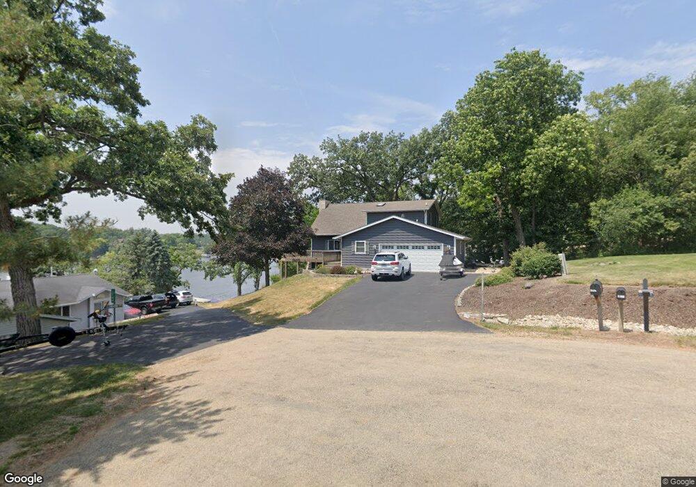
1-143 Perry Ct Lanark, IL 61046
Estimated Value: $410,000 - $883,000
3
Beds
4
Baths
2,552
Sq Ft
$272/Sq Ft
Est. Value
About This Home
This home is located at 1-143 Perry Ct, Lanark, IL 61046 and is currently estimated at $693,509, approximately $271 per square foot. 1-143 Perry Ct is a home located in Carroll County with nearby schools including Eastland Elementary School and Eastland Junior-Senior High School.
Ownership History
Date
Name
Owned For
Owner Type
Purchase Details
Closed on
Jul 26, 2024
Sold by
Hutchinson R & S L Joi Trust
Bought by
Jehl Joseph
Current Estimated Value
Home Financials for this Owner
Home Financials are based on the most recent Mortgage that was taken out on this home.
Original Mortgage
$480,600
Outstanding Balance
$464,920
Interest Rate
0.69%
Mortgage Type
New Conventional
Estimated Equity
$228,589
Purchase Details
Closed on
Jan 3, 2012
Sold by
Gabinski Christina A
Bought by
Hutchinson Randall L and Hutchinson Sandra L
Create a Home Valuation Report for This Property
The Home Valuation Report is an in-depth analysis detailing your home's value as well as a comparison with similar homes in the area
Purchase History
| Date | Buyer | Sale Price | Title Company |
|---|---|---|---|
| Jehl Joseph | $800,333 | Security First Title | |
| Hutchinson Randall L | $486,000 | -- |
Source: Public Records
Mortgage History
| Date | Status | Borrower | Loan Amount |
|---|---|---|---|
| Open | Jehl Joseph | $480,600 |
Source: Public Records
Tax History
| Year | Tax Paid | Tax Assessment Tax Assessment Total Assessment is a certain percentage of the fair market value that is determined by local assessors to be the total taxable value of land and additions on the property. | Land | Improvement |
|---|---|---|---|---|
| 2024 | $14,514 | $277,959 | $87,340 | $190,619 |
| 2023 | $14,514 | $220,307 | $77,456 | $142,851 |
| 2022 | $11,305 | $191,989 | $67,500 | $124,489 |
| 2021 | $10,604 | $169,902 | $59,735 | $110,167 |
| 2020 | $10,145 | $164,953 | $57,995 | $106,958 |
| 2019 | $10,606 | $167,726 | $66,470 | $101,256 |
| 2018 | $9,803 | $151,105 | $59,883 | $91,222 |
| 2017 | $9,827 | $151,104 | $59,882 | $91,222 |
| 2016 | $9,849 | $151,104 | $59,882 | $91,222 |
| 2015 | $10,322 | $159,062 | $63,036 | $96,026 |
| 2014 | $8,624 | $143,311 | $56,794 | $86,517 |
| 2013 | $8,624 | $127,956 | $50,709 | $77,247 |
Source: Public Records
Map
Nearby Homes
- 1-145 Perry Ct
- 1150 Perry Ct
- 4-1R Grandview Dr
- 1-228 Grandview Dr
- 21-51 Marina Ct
- 4-39 Grandview Dr
- 21-54 Old Wharf Rd
- 4-208 Beachcomber Ln
- 12-124R Briarwood Dr
- 5-53R Chadbourne Dr
- 21-59 Lake Carroll Blvd
- 22-6 Lakewood Ct
- 12-199 Willow Ct
- 23-7 Lake Carroll Blvd
- 31-5 Medinah Dr
- 22-2 Lakewood Ct
- 23-21 Broadview Dr
- 3-446 Deerfield
- 31-29 Cog Hill Ct
- 3-521 Shady Ln
Your Personal Tour Guide
Ask me questions while you tour the home.