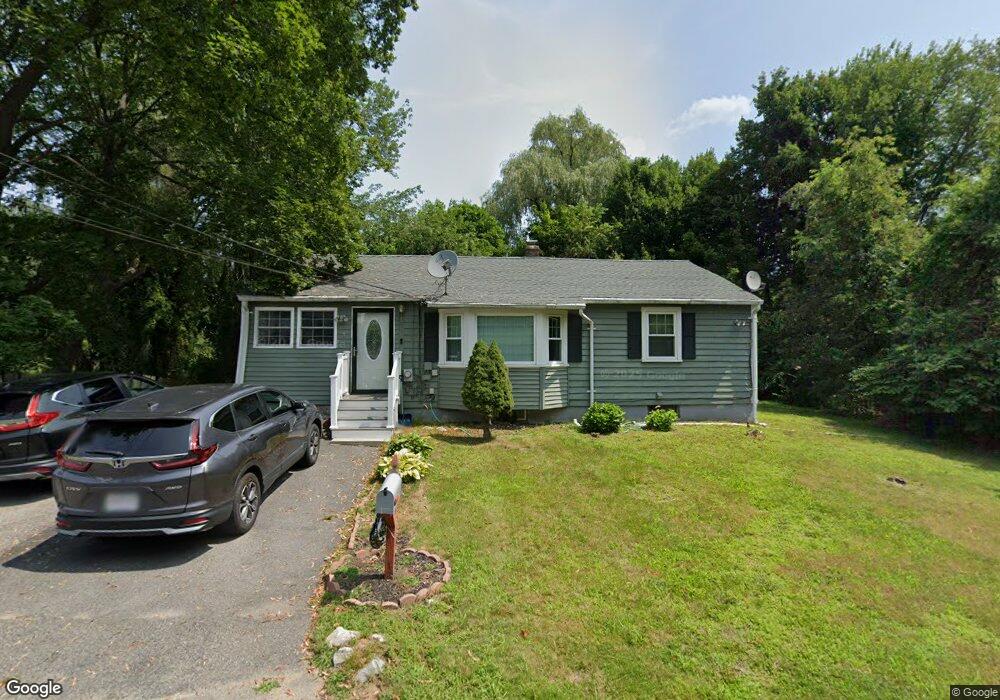
1 1st Rd Woburn, MA 01801
North Woburn NeighborhoodEstimated Value: $540,000 - $724,000
3
Beds
1
Bath
914
Sq Ft
$662/Sq Ft
Est. Value
About This Home
This home is located at 1 1st Rd, Woburn, MA 01801 and is currently estimated at $605,291, approximately $662 per square foot. 1 1st Rd is a home located in Middlesex County with nearby schools including Mary D. Altavesta Elementary School, John F. Kennedy Middle School, and Woburn High School.
Ownership History
Date
Name
Owned For
Owner Type
Purchase Details
Closed on
Dec 28, 2001
Sold by
Richardson Mark
Bought by
Shaikh Hanif and Shaikh Firdosanjum
Current Estimated Value
Home Financials for this Owner
Home Financials are based on the most recent Mortgage that was taken out on this home.
Original Mortgage
$189,000
Outstanding Balance
$73,271
Interest Rate
6.61%
Mortgage Type
Purchase Money Mortgage
Estimated Equity
$532,020
Create a Home Valuation Report for This Property
The Home Valuation Report is an in-depth analysis detailing your home's value as well as a comparison with similar homes in the area
Home Values in the Area
Average Home Value in this Area
Purchase History
| Date | Buyer | Sale Price | Title Company |
|---|---|---|---|
| Shaikh Hanif | $210,000 | -- |
Source: Public Records
Mortgage History
| Date | Status | Borrower | Loan Amount |
|---|---|---|---|
| Open | Shaikh Hanif | $189,000 |
Source: Public Records
Tax History
| Year | Tax Paid | Tax Assessment Tax Assessment Total Assessment is a certain percentage of the fair market value that is determined by local assessors to be the total taxable value of land and additions on the property. | Land | Improvement |
|---|---|---|---|---|
| 2025 | $4,460 | $522,300 | $334,800 | $187,500 |
| 2024 | $4,081 | $506,300 | $318,800 | $187,500 |
| 2023 | $4,096 | $470,800 | $289,900 | $180,900 |
| 2022 | $3,955 | $423,500 | $252,100 | $171,400 |
| 2021 | $5,412 | $400,100 | $240,100 | $160,000 |
| 2020 | $3,544 | $380,300 | $240,100 | $140,200 |
| 2019 | $38 | $362,400 | $228,700 | $133,700 |
| 2018 | $3,309 | $334,600 | $209,800 | $124,800 |
| 2017 | $4,610 | $320,700 | $199,900 | $120,800 |
| 2016 | $3,032 | $301,700 | $186,800 | $114,900 |
| 2015 | $2,905 | $285,600 | $174,600 | $111,000 |
| 2014 | $2,761 | $264,500 | $174,600 | $89,900 |
Source: Public Records
Map
Nearby Homes
- 7 E Dexter Ave Unit 33
- 9 Cottage St
- 22 Longwood Ave
- 1011 Main St Unit 5
- 14 Woodside Terrace
- 6 Callahan Dr
- 23 Ward St Unit A
- 13 West St
- 6 Kendal Dr
- 9 Winter St
- 18 Talbot Ln Unit 18
- 44 Pearl St
- 26 Lothrop Rd
- 106 Johnson Woods Dr Unit 106
- 2 Inwood Dr Unit 1005
- 30 Taylor Dr Unit 3011
- 1 Garvey Rd Unit 1
- 16 Munroe Ave
- 20 White Oaks Ln
- 141 Johnson Woods Dr
Your Personal Tour Guide
Ask me questions while you tour the home.