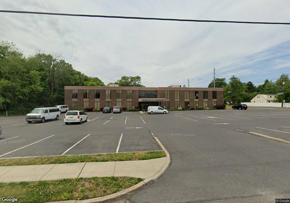
1 Alpha Ave Voorhees, NJ 08043
Estimated Value: $1,578,645
--
Bed
--
Bath
22,240
Sq Ft
$71/Sq Ft
Est. Value
About This Home
This home is located at 1 Alpha Ave, Voorhees, NJ 08043 and is currently estimated at $1,578,645, approximately $70 per square foot. 1 Alpha Ave is a home located in Camden County with nearby schools including Osage Elementary School, Voorhees Middle School, and Eastern Regional High School.
Ownership History
Date
Name
Owned For
Owner Type
Purchase Details
Closed on
Jul 14, 2017
Sold by
Garner And Jacoby A General Partnership
Bought by
Center For Family Services Inc
Current Estimated Value
Home Financials for this Owner
Home Financials are based on the most recent Mortgage that was taken out on this home.
Original Mortgage
$700,000
Interest Rate
3.92%
Mortgage Type
Commercial
Create a Home Valuation Report for This Property
The Home Valuation Report is an in-depth analysis detailing your home's value as well as a comparison with similar homes in the area
Home Values in the Area
Average Home Value in this Area
Purchase History
| Date | Buyer | Sale Price | Title Company |
|---|---|---|---|
| Center For Family Services Inc | $875,000 | Title America Agency Corp |
Source: Public Records
Mortgage History
| Date | Status | Borrower | Loan Amount |
|---|---|---|---|
| Previous Owner | Center For Family Services Inc | $700,000 |
Source: Public Records
Tax History Compared to Growth
Tax History
| Year | Tax Paid | Tax Assessment Tax Assessment Total Assessment is a certain percentage of the fair market value that is determined by local assessors to be the total taxable value of land and additions on the property. | Land | Improvement |
|---|---|---|---|---|
| 2025 | -- | $1,856,800 | $300,000 | $1,556,800 |
| 2024 | -- | $1,092,800 | $294,700 | $798,100 |
| 2023 | -- | $1,092,800 | $294,700 | $798,100 |
| 2022 | $0 | $1,092,800 | $294,700 | $798,100 |
| 2021 | $21,239 | $1,092,800 | $294,700 | $798,100 |
| 2020 | $21,239 | $1,092,800 | $294,700 | $798,100 |
| 2019 | $21,239 | $1,092,800 | $294,700 | $798,100 |
| 2018 | $21,239 | $1,092,800 | $294,700 | $798,100 |
| 2017 | $42,477 | $1,092,800 | $294,700 | $798,100 |
| 2016 | $40,171 | $1,092,800 | $294,700 | $798,100 |
| 2015 | $59,260 | $1,581,100 | $294,700 | $1,286,400 |
| 2014 | $58,517 | $1,581,100 | $294,700 | $1,286,400 |
Source: Public Records
Map
Nearby Homes
- 5 Perot Ave
- 101 Railroad Blvd
- 511 Ellis Ave
- 69 Franklin Cir
- 217 Ashland Ave
- 412 S Charleston Ave
- 158 E Evesham Rd
- 265 S Charleston Ave
- 208 Pelham Rd S
- 166 E Evesham Rd
- 348 Silk St
- 25 Country Ln
- 1401 Hillside Dr
- 208 Ashley Run
- 8 Echelon Rd
- 0 Orchard Ave
- 412 N White Horse Pike
- 178 E Charleston Ave
- 19 Sussex Ave
- 172 E Charleston Ave