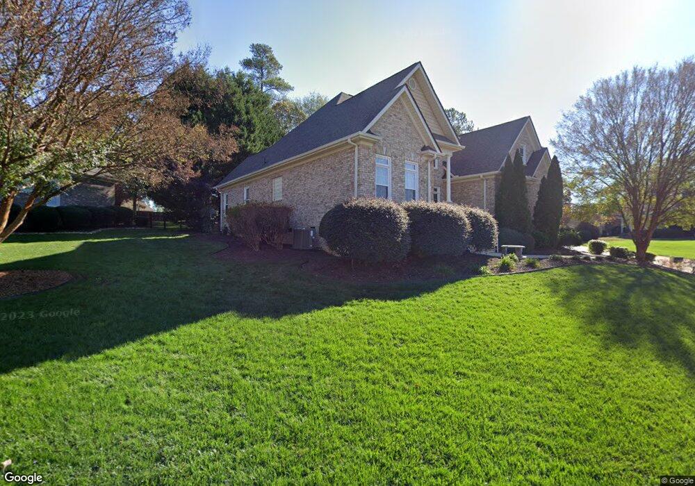
1 Amstar Ct Simpsonville, SC 29680
Estimated Value: $567,143 - $698,000
4
Beds
3
Baths
2,732
Sq Ft
$231/Sq Ft
Est. Value
About This Home
This home is located at 1 Amstar Ct, Simpsonville, SC 29680 and is currently estimated at $632,036, approximately $231 per square foot. 1 Amstar Ct is a home located in Greenville County with nearby schools including Fork Shoals School, Woodmont Middle School, and Woodmont High School.
Ownership History
Date
Name
Owned For
Owner Type
Purchase Details
Closed on
May 21, 2025
Sold by
Bolderson Brian J and Bolderson Julie L
Bought by
Bolderson Revocable Trust and Bolderson
Current Estimated Value
Purchase Details
Closed on
Jun 22, 2016
Sold by
Stone Ray E and Stone Susan A
Bought by
Bolderson Brian J and Bolderson Julie L
Home Financials for this Owner
Home Financials are based on the most recent Mortgage that was taken out on this home.
Original Mortgage
$81,000
Interest Rate
3.64%
Mortgage Type
New Conventional
Purchase Details
Closed on
Oct 10, 2006
Sold by
Allen Stanley B and Allen Mary E
Bought by
Stone Ray E and Stone Susan A
Home Financials for this Owner
Home Financials are based on the most recent Mortgage that was taken out on this home.
Original Mortgage
$344,000
Interest Rate
6.36%
Mortgage Type
Purchase Money Mortgage
Create a Home Valuation Report for This Property
The Home Valuation Report is an in-depth analysis detailing your home's value as well as a comparison with similar homes in the area
Home Values in the Area
Average Home Value in this Area
Purchase History
| Date | Buyer | Sale Price | Title Company |
|---|---|---|---|
| Bolderson Revocable Trust | -- | None Listed On Document | |
| Bolderson Brian J | $357,000 | None Available | |
| Stone Ray E | $430,000 | None Available |
Source: Public Records
Mortgage History
| Date | Status | Borrower | Loan Amount |
|---|---|---|---|
| Previous Owner | Bolderson Brian J | $81,000 | |
| Previous Owner | Stone Ray E | $344,000 |
Source: Public Records
Tax History Compared to Growth
Tax History
| Year | Tax Paid | Tax Assessment Tax Assessment Total Assessment is a certain percentage of the fair market value that is determined by local assessors to be the total taxable value of land and additions on the property. | Land | Improvement |
|---|---|---|---|---|
| 2024 | $2,545 | $15,560 | $2,400 | $13,160 |
| 2023 | $2,545 | $15,560 | $2,400 | $13,160 |
| 2022 | $2,481 | $15,560 | $2,400 | $13,160 |
| 2021 | $2,441 | $15,560 | $2,400 | $13,160 |
| 2020 | $2,529 | $15,250 | $2,210 | $13,040 |
| 2019 | $2,455 | $15,250 | $2,210 | $13,040 |
| 2018 | $2,598 | $15,250 | $2,210 | $13,040 |
| 2017 | $2,601 | $15,250 | $2,210 | $13,040 |
| 2016 | $2,517 | $381,180 | $55,250 | $325,930 |
| 2015 | $6,857 | $381,180 | $55,250 | $325,930 |
| 2014 | $6,474 | $364,750 | $58,000 | $306,750 |
Source: Public Records
Map
Nearby Homes
- 244 Brandau Ln
- 601 Sydney Ct
- 116 Eben Way Ln
- 109 Deer Spring Ln
- 316 Windy Meadow Way
- 104 Martele Ct
- 613 Whitemarsh Ave
- 4 Deer Spring Ln
- 406 Windwood St
- 303 Farming Creek Dr
- 14 Foxmoor Ct
- 305 Hayworth Dr
- 209 Bank Swallow Way
- 210 Bank Swallow Way
- 1 Indian Laurel Ct
- 633 Neely Farm Dr
- 8 Atchison Way
- 311 Lindstrom Ct
- 6 Woodbluff Place
- 214 Terrapin Cross Way
- 109 Weatherstone Ln
- 5 Amstar Ct
- 201 Weatherstone Ln
- 112 Weatherstone Ln
- 112 Weatherstone Ln
- 116 Weatherstone Ln
- 105 Weatherstone Ln
- 6 Amstar Ct
- 108 Weatherstone Ln
- 9 Amstar Ct
- 200 Weatherstone Ln
- 104 Brandau Ln
- 104 Weatherstone Ln
- 204 Weatherstone Ln
- 207 Weatherstone Ln
- 108 Brandau Ln
- 101 Weatherstone Ln
- 10 Amstar Ct
- 432 Meringer Place
- 15 Amstar Ct