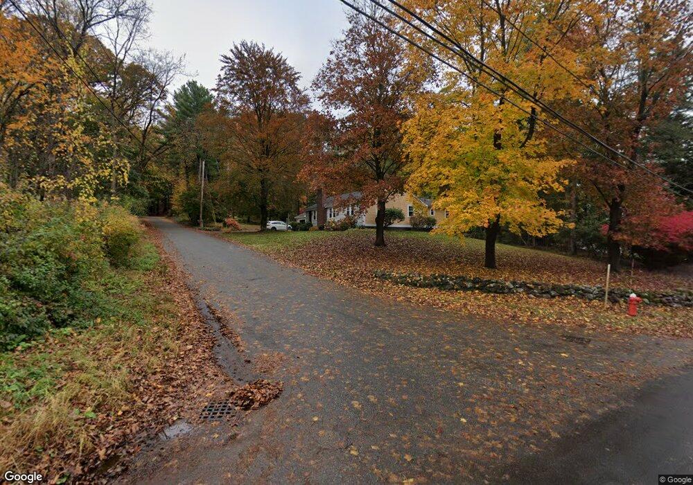
1 Andrews Rd Topsfield, MA 01983
Estimated Value: $767,355 - $973,000
4
Beds
2
Baths
1,970
Sq Ft
$437/Sq Ft
Est. Value
About This Home
This home is located at 1 Andrews Rd, Topsfield, MA 01983 and is currently estimated at $860,589, approximately $436 per square foot. 1 Andrews Rd is a home located in Essex County with nearby schools including Steward Elementary School, Proctor Elementary School, and Masconomet Regional Middle School.
Ownership History
Date
Name
Owned For
Owner Type
Purchase Details
Closed on
May 11, 2021
Sold by
Duval Karen A and Duval Michael J
Bought by
Duval Ft and Duval
Current Estimated Value
Purchase Details
Closed on
Mar 29, 2021
Sold by
Duval Ft and Duval
Bought by
Duval Karen A and Duval Michael J
Purchase Details
Closed on
Feb 13, 2020
Sold by
Duval Karen and Duval Michael
Bought by
Duval Ft and Duval
Purchase Details
Closed on
Mar 30, 1999
Sold by
Joseph Lawrence P and Joseph Gerdine E
Bought by
Duval Michael and Duval Karen
Create a Home Valuation Report for This Property
The Home Valuation Report is an in-depth analysis detailing your home's value as well as a comparison with similar homes in the area
Home Values in the Area
Average Home Value in this Area
Purchase History
| Date | Buyer | Sale Price | Title Company |
|---|---|---|---|
| Duval Ft | -- | None Available | |
| Duval Ft | -- | None Available | |
| Duval Ft | -- | None Available | |
| Duval Ft | -- | None Available | |
| Duval Karen A | -- | None Available | |
| Duval Karen A | -- | None Available | |
| Duval Karen A | -- | None Available | |
| Duval Karen A | -- | None Available | |
| Duval Ft | -- | None Available | |
| Duval Ft | -- | None Available | |
| Duval Ft | -- | None Available | |
| Duval Ft | -- | None Available | |
| Duval Michael | $290,000 | -- | |
| Duval Michael | $290,000 | -- |
Source: Public Records
Mortgage History
| Date | Status | Borrower | Loan Amount |
|---|---|---|---|
| Previous Owner | Duval Michael | $21,160 |
Source: Public Records
Tax History
| Year | Tax Paid | Tax Assessment Tax Assessment Total Assessment is a certain percentage of the fair market value that is determined by local assessors to be the total taxable value of land and additions on the property. | Land | Improvement |
|---|---|---|---|---|
| 2025 | $9,760 | $651,100 | $371,800 | $279,300 |
| 2024 | $9,277 | $631,500 | $352,200 | $279,300 |
| 2023 | $8,529 | $561,100 | $332,700 | $228,400 |
| 2022 | $8,951 | $537,600 | $332,700 | $204,900 |
| 2021 | $8,616 | $480,800 | $297,500 | $183,300 |
| 2020 | $8,173 | $469,200 | $297,500 | $171,700 |
| 2019 | $7,946 | $467,400 | $297,500 | $169,900 |
| 2018 | $7,727 | $445,100 | $297,500 | $147,600 |
| 2017 | $6,938 | $409,800 | $262,200 | $147,600 |
| 2016 | $6,580 | $398,300 | $250,500 | $147,800 |
Source: Public Records
Map
Nearby Homes
- 17 1/2 Averill St
- 117 Perkins Row
- 36 Main St Unit 1
- 3 Summer St
- 3 Summer St Unit 2
- 12 Campmeeting Rd
- 4 Ruby Cir
- 3 Antoria Way
- 37 East St
- 16 Fairway Dr Unit 16
- 54 Willowdale Rd
- 40 Curtis Rd
- 5 Cobblers Ln
- 17 Canter Brook Ln Unit 17
- 19 Bridle Spur Ln
- 34 Wildmeadow Rd
- 14 Bradford Rd
- 3 Conrad Cir
- 20-B Wildmeadow Rd
- 232 Lake Dr
- 16 Meetinghouse Ln
- 8 Meetinghouse Ln
- 11 Meetinghouse Ln
- 8 Andrews Rd
- 18 Meetinghouse Ln
- 7 Andrews Rd
- 6 Meetinghouse Ln
- 7 Meetinghouse Ln
- 202 Perkins Row
- 10 Andrews Rd
- 190 Perkins Row
- 193 Perkins Row
- 11 Andrews Rd
- 191 Perkins Row
- 92 Howlett St
- 96 Howlett St
- 206 Perkins Row
- 189 Perkins Row
- 14 Andrews Rd
- 186 Perkins Row
Your Personal Tour Guide
Ask me questions while you tour the home.