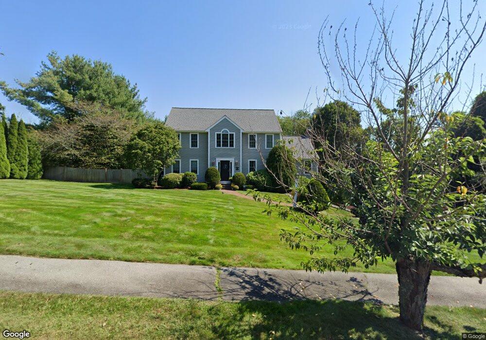
1 Andrews Way Southborough, MA 01772
Estimated Value: $1,248,000 - $1,419,000
4
Beds
4
Baths
2,552
Sq Ft
$520/Sq Ft
Est. Value
About This Home
This home is located at 1 Andrews Way, Southborough, MA 01772 and is currently estimated at $1,327,618, approximately $520 per square foot. 1 Andrews Way is a home located in Worcester County with nearby schools including Mary E Finn School, Albert S. Woodward Memorial School, and Margaret A. Neary School.
Ownership History
Date
Name
Owned For
Owner Type
Purchase Details
Closed on
Nov 3, 2000
Sold by
Dutko Brian W and Dutko Debra M
Bought by
Adams Bradford A and Adams Alyssa
Current Estimated Value
Create a Home Valuation Report for This Property
The Home Valuation Report is an in-depth analysis detailing your home's value as well as a comparison with similar homes in the area
Home Values in the Area
Average Home Value in this Area
Purchase History
| Date | Buyer | Sale Price | Title Company |
|---|---|---|---|
| Adams Bradford A | $594,000 | -- |
Source: Public Records
Mortgage History
| Date | Status | Borrower | Loan Amount |
|---|---|---|---|
| Open | Adams Bradford A | $417,000 | |
| Closed | Adams Bradford A | $528,000 |
Source: Public Records
Tax History Compared to Growth
Tax History
| Year | Tax Paid | Tax Assessment Tax Assessment Total Assessment is a certain percentage of the fair market value that is determined by local assessors to be the total taxable value of land and additions on the property. | Land | Improvement |
|---|---|---|---|---|
| 2025 | $15,111 | $1,094,200 | $350,700 | $743,500 |
| 2024 | $14,141 | $1,016,600 | $345,900 | $670,700 |
| 2023 | $13,353 | $904,700 | $327,600 | $577,100 |
| 2022 | $12,513 | $768,600 | $285,800 | $482,800 |
| 2021 | $6,181 | $760,000 | $290,200 | $469,800 |
| 2020 | $12,243 | $734,900 | $284,600 | $450,300 |
| 2019 | $2,040 | $702,800 | $268,500 | $434,300 |
| 2018 | $10,904 | $675,600 | $259,400 | $416,200 |
| 2017 | $1,974 | $668,500 | $259,400 | $409,100 |
| 2016 | $10,688 | $675,600 | $254,600 | $421,000 |
| 2015 | $10,495 | $655,100 | $239,800 | $415,300 |
Source: Public Records
Map
Nearby Homes
- 11 Whispering Brook Rd Unit 55
- lot 1 Sears Rd
- 39 Desimone Dr
- Lot 2 Quinn Rd
- 14 Lovers Ln
- 14 Wolfpen Ln
- 15 Lovers Ln
- 8 Rock Spring Ln
- 120 Airport Blvd
- 58 Walker St
- 6 Eastbrook Farm Ln
- 273 W Main St Unit B12
- 146 Framingham Rd
- 8 Saint Mary's Way Unit 8
- 30 Broad St Unit 104
- 30A Winter Ave
- 3 Madison St
- 76 Broad St
- 2 Adams St
- 102 Liberty St