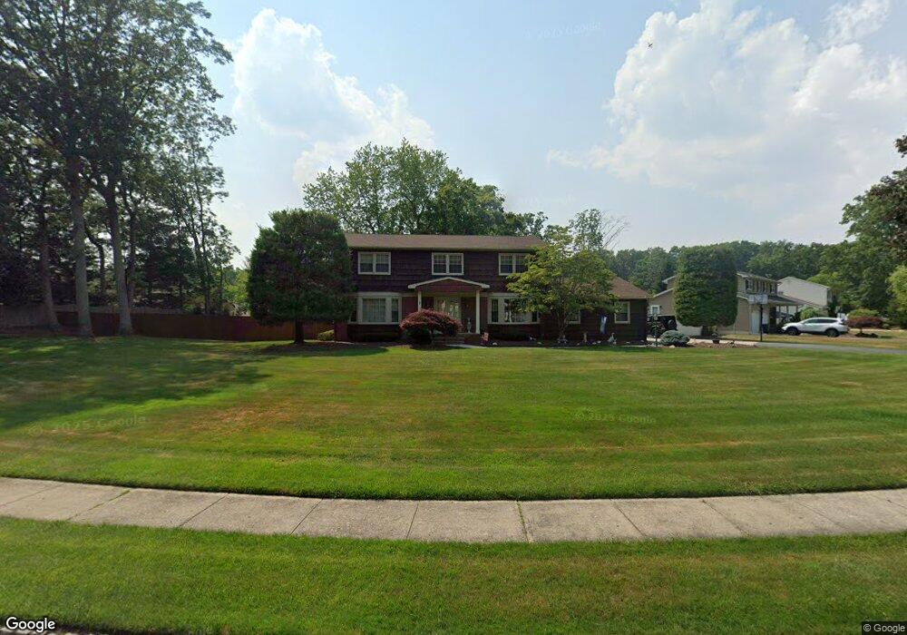
1 Apollo Rd Manalapan, NJ 07726
Estimated Value: $885,000 - $932,000
4
Beds
3
Baths
2,788
Sq Ft
$327/Sq Ft
Est. Value
About This Home
This home is located at 1 Apollo Rd, Manalapan, NJ 07726 and is currently estimated at $910,889, approximately $326 per square foot. 1 Apollo Rd is a home located in Monmouth County with nearby schools including Milford Brook Elementary School, Pine Brook Elementary School, and Manalapan-Englishtown Middle School.
Ownership History
Date
Name
Owned For
Owner Type
Purchase Details
Closed on
Apr 27, 2006
Sold by
Longo James
Bought by
Santino John S and Santino Mary M
Current Estimated Value
Home Financials for this Owner
Home Financials are based on the most recent Mortgage that was taken out on this home.
Original Mortgage
$400,000
Outstanding Balance
$230,867
Interest Rate
6.34%
Mortgage Type
New Conventional
Estimated Equity
$680,022
Create a Home Valuation Report for This Property
The Home Valuation Report is an in-depth analysis detailing your home's value as well as a comparison with similar homes in the area
Home Values in the Area
Average Home Value in this Area
Purchase History
| Date | Buyer | Sale Price | Title Company |
|---|---|---|---|
| Santino John S | $650,000 | -- |
Source: Public Records
Mortgage History
| Date | Status | Borrower | Loan Amount |
|---|---|---|---|
| Open | Santino John S | $400,000 |
Source: Public Records
Tax History Compared to Growth
Tax History
| Year | Tax Paid | Tax Assessment Tax Assessment Total Assessment is a certain percentage of the fair market value that is determined by local assessors to be the total taxable value of land and additions on the property. | Land | Improvement |
|---|---|---|---|---|
| 2025 | $12,203 | $796,200 | $303,800 | $492,400 |
| 2024 | $11,866 | $722,900 | $303,800 | $419,100 |
| 2023 | $11,866 | $713,100 | $303,800 | $409,300 |
| 2022 | $11,343 | $662,500 | $272,800 | $389,700 |
| 2021 | $11,343 | $546,400 | $199,800 | $346,600 |
| 2020 | $10,973 | $534,500 | $189,800 | $344,700 |
| 2019 | $10,838 | $527,400 | $189,800 | $337,600 |
| 2018 | $10,577 | $511,700 | $189,800 | $321,900 |
| 2017 | $10,396 | $503,200 | $189,800 | $313,400 |
| 2016 | $10,173 | $498,200 | $188,800 | $309,400 |
| 2015 | $10,599 | $513,500 | $212,100 | $301,400 |
| 2014 | $9,512 | $448,700 | $163,400 | $285,300 |
Source: Public Records
Map
Nearby Homes
- 70 Overlook Way Unit E
- 544 Union Hill Rd
- 5 Yeoman Way
- 84 Amberly Dr Unit J
- 1 Spruce Way
- 4 Spruce Way
- 86 Arrowood Rd Unit B
- 4 Vicksburg Dr
- 521 Union Hill Rd
- 519 Union Hill Rd
- 34 Appomattox Dr
- 1 Vicksburg Dr
- 18 Rowena Rd
- 224 Union Hill Rd
- 210 Pine Brook Rd
- 181 Arrowood Rd Unit D
- 167 Amberly Dr Unit H
- 162 Cross Slope Ct Unit K
- 2 Wendi Way
- 5 Crusade Ct