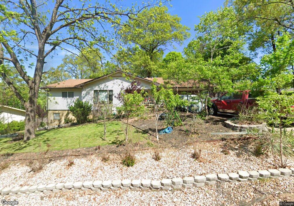
1 Ashfield Ln Bella Vista, AR 72715
Estimated Value: $283,000 - $392,000
4
Beds
3
Baths
2,309
Sq Ft
$150/Sq Ft
Est. Value
About This Home
This home is located at 1 Ashfield Ln, Bella Vista, AR 72715 and is currently estimated at $346,156, approximately $149 per square foot. 1 Ashfield Ln is a home located in Benton County with nearby schools including Thomas Jefferson Elementary School, Lincoln Junior High School, and Old High Middle School.
Ownership History
Date
Name
Owned For
Owner Type
Purchase Details
Closed on
Oct 1, 2025
Sold by
Commissioner Of State Lands
Bought by
Mark David and Selfridge Radonna
Current Estimated Value
Purchase Details
Closed on
Nov 19, 2010
Sold by
Holt Ethel B and Holt Revocable Trust
Bought by
Selfridge David Mark and Selfridge Radonna
Purchase Details
Closed on
Dec 16, 1996
Bought by
Holt Tr
Purchase Details
Closed on
Jun 30, 1988
Bought by
Holt
Purchase Details
Closed on
Sep 15, 1982
Bought by
Rees
Create a Home Valuation Report for This Property
The Home Valuation Report is an in-depth analysis detailing your home's value as well as a comparison with similar homes in the area
Home Values in the Area
Average Home Value in this Area
Purchase History
| Date | Buyer | Sale Price | Title Company |
|---|---|---|---|
| Mark David | $5,828 | None Listed On Document | |
| Selfridge David Mark | $73,000 | None Available | |
| Holt Tr | -- | -- | |
| N | -- | -- | |
| Holt | $60,000 | -- | |
| Rees | $85,000 | -- |
Source: Public Records
Tax History Compared to Growth
Tax History
| Year | Tax Paid | Tax Assessment Tax Assessment Total Assessment is a certain percentage of the fair market value that is determined by local assessors to be the total taxable value of land and additions on the property. | Land | Improvement |
|---|---|---|---|---|
| 2025 | $2,842 | $65,619 | $1,600 | $64,019 |
| 2024 | $2,579 | $65,619 | $1,600 | $64,019 |
| 2023 | $2,345 | $43,400 | $800 | $42,600 |
| 2022 | $2,234 | $43,400 | $800 | $42,600 |
| 2021 | $2,044 | $43,400 | $800 | $42,600 |
| 2020 | $1,875 | $29,430 | $600 | $28,830 |
| 2019 | $1,875 | $29,430 | $600 | $28,830 |
| 2018 | $1,875 | $29,430 | $600 | $28,830 |
| 2017 | $1,367 | $29,430 | $600 | $28,830 |
| 2016 | $1,367 | $29,430 | $600 | $28,830 |
| 2015 | $1,577 | $26,160 | $1,000 | $25,160 |
| 2014 | $1,227 | $26,160 | $1,000 | $25,160 |
Source: Public Records
Map
Nearby Homes
- 13 Kensington Dr
- Lot 26 Block 2 Kensington Dr
- 30 Kensington Dr
- TBD Dunsford Dr
- Lot 23 of Block 1 Dunsford Dr
- 22 Pembroke Ln
- 6 & 8 Gail Ln
- 14 Gretchen Ln
- 3 Lance Ln
- 4 Frensham Ln
- 7 Joanie Ln
- 55 Portsmouth Dr
- 9 Estes Dr
- 9 Connie Ln
- Lot 1 of Block 3 London Dr
- 5 Matlock Cir
- 6 Connie Ln
- 21 Estes Dr
- 2 Portland Ln
- 27 Basildon Dr
- 3 Ashfield Ln
- 5 Ashfield Ln
- -- Ashfield Ln
- 88 Ashfield Ln
- 7 Ashfield Ln
- 10 Kensington Dr
- 1 Martham Ln
- 6 Kensington Dr
- 210 Ashfield Ln
- 914 Ashfield Ln
- 9 Ashfield Ln
- 4 Kensington Dr
- 6 Ashfield Ln
- 1 Kensington Dr
- 3 Kensington Dr
- 18 Martham Ln
- 0 Martham Ln
- Lot 71 Martham Ln
- 5 Kensington Dr
- 12 Kensington Dr