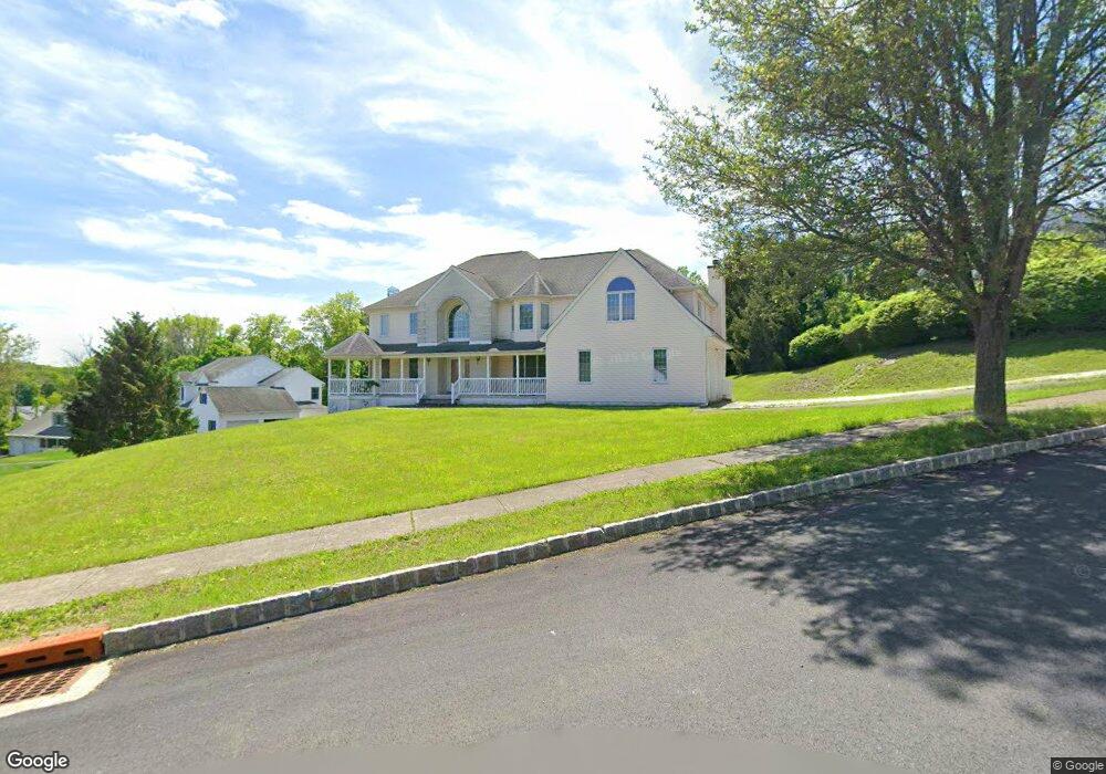
1 Babbitt Ct Newton, NJ 07860
Estimated Value: $584,000 - $896,000
--
Bed
--
Bath
3,559
Sq Ft
$213/Sq Ft
Est. Value
About This Home
This home is located at 1 Babbitt Ct, Newton, NJ 07860 and is currently estimated at $758,658, approximately $213 per square foot. 1 Babbitt Ct is a home located in Sussex County with nearby schools including Merriam Avenue School, Halsted Street Middle School, and Newton High School.
Ownership History
Date
Name
Owned For
Owner Type
Purchase Details
Closed on
Mar 21, 2024
Sold by
Cunningham Marie and Cunningham Brenda
Bought by
Cunningham Marie and Cunningham Brenda
Current Estimated Value
Purchase Details
Closed on
Sep 11, 2000
Sold by
Green Ridge Construction Inc
Bought by
Cunningham Marie and Cunningham Brenda
Home Financials for this Owner
Home Financials are based on the most recent Mortgage that was taken out on this home.
Original Mortgage
$243,000
Interest Rate
8.07%
Create a Home Valuation Report for This Property
The Home Valuation Report is an in-depth analysis detailing your home's value as well as a comparison with similar homes in the area
Home Values in the Area
Average Home Value in this Area
Purchase History
| Date | Buyer | Sale Price | Title Company |
|---|---|---|---|
| Cunningham Marie | -- | None Listed On Document | |
| Cunningham Marie | -- | None Listed On Document | |
| Cunningham Marie | $362,912 | -- |
Source: Public Records
Mortgage History
| Date | Status | Borrower | Loan Amount |
|---|---|---|---|
| Previous Owner | Cunningham Marie | $243,000 |
Source: Public Records
Tax History Compared to Growth
Tax History
| Year | Tax Paid | Tax Assessment Tax Assessment Total Assessment is a certain percentage of the fair market value that is determined by local assessors to be the total taxable value of land and additions on the property. | Land | Improvement |
|---|---|---|---|---|
| 2025 | $17,968 | $690,500 | $126,800 | $563,700 |
| 2024 | $17,495 | $658,900 | $106,500 | $552,400 |
| 2023 | $17,495 | $389,300 | $81,500 | $307,800 |
| 2022 | $17,565 | $389,300 | $81,500 | $307,800 |
| 2021 | $17,487 | $389,300 | $81,500 | $307,800 |
| 2020 | $17,219 | $389,300 | $81,500 | $307,800 |
| 2019 | $16,685 | $389,300 | $81,500 | $307,800 |
| 2018 | $16,596 | $389,300 | $81,500 | $307,800 |
| 2017 | $16,499 | $389,300 | $81,500 | $307,800 |
| 2016 | $16,234 | $389,300 | $81,500 | $307,800 |
| 2015 | $15,806 | $389,300 | $81,500 | $307,800 |
| 2014 | $15,479 | $389,300 | $81,500 | $307,800 |
Source: Public Records
Map
Nearby Homes
- 5 Babbitt Ct
- 21 Carriage Ln Unit 21
- 40 Carriage Ln Unit 40
- 76 Carriage Ln Unit 76
- 67 Ryerson Ave
- 219 Woodside Ave
- 36 Paterson Ave
- 103 Woodside Ave
- 0 W Nelson St
- 37 Foster St
- 9 Lawnwood Ave
- 13 Summit Ave
- 5 Clarkson St
- 66 Paterson Ave
- 63 Merriam Ave
- 14 Trenton Place
- 22 Woodside Ave
- 46 Orchard St Unit 2
- 46 Pine St
- 30 Linmor Ave