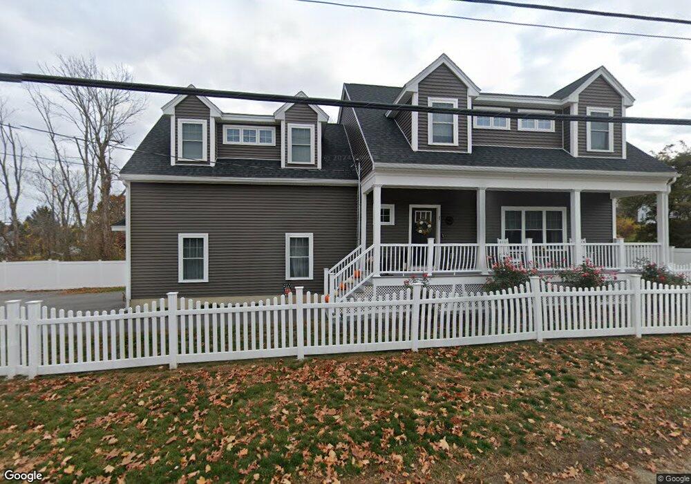
1 Birchmeadow Rd Merrimac, MA 01860
Estimated Value: $819,000 - $984,000
3
Beds
4
Baths
2,548
Sq Ft
$351/Sq Ft
Est. Value
About This Home
This home is located at 1 Birchmeadow Rd, Merrimac, MA 01860 and is currently estimated at $894,426, approximately $351 per square foot. 1 Birchmeadow Rd is a home located in Essex County with nearby schools including Pentucket Regional High School.
Ownership History
Date
Name
Owned For
Owner Type
Purchase Details
Closed on
Nov 16, 2022
Sold by
Wahlgren Linda
Bought by
Linda P Wahlgren Lt
Current Estimated Value
Purchase Details
Closed on
Aug 31, 2020
Sold by
Cook Christopher P
Bought by
Wahlgren Linda
Home Financials for this Owner
Home Financials are based on the most recent Mortgage that was taken out on this home.
Original Mortgage
$250,000
Interest Rate
3%
Mortgage Type
New Conventional
Purchase Details
Closed on
Nov 21, 2019
Sold by
Mary Cormier Inc
Bought by
Cook Christopher P
Home Financials for this Owner
Home Financials are based on the most recent Mortgage that was taken out on this home.
Original Mortgage
$335,000
Interest Rate
3.6%
Mortgage Type
New Conventional
Purchase Details
Closed on
Nov 13, 2018
Sold by
Es Reynolds Leighton A
Bought by
Mary Cormier Inc
Purchase Details
Closed on
Oct 31, 1969
Bought by
Reynolds Leighton A and Reynolds Jane M
Create a Home Valuation Report for This Property
The Home Valuation Report is an in-depth analysis detailing your home's value as well as a comparison with similar homes in the area
Home Values in the Area
Average Home Value in this Area
Purchase History
| Date | Buyer | Sale Price | Title Company |
|---|---|---|---|
| Linda P Wahlgren Lt | -- | None Available | |
| Wahlgren Linda | $605,000 | None Available | |
| Cook Christopher P | $530,000 | -- | |
| Mary Cormier Inc | $140,000 | -- | |
| Reynolds Leighton A | $3,000 | -- |
Source: Public Records
Mortgage History
| Date | Status | Borrower | Loan Amount |
|---|---|---|---|
| Previous Owner | Wahlgren Linda | $250,000 | |
| Previous Owner | Cook Christopher P | $335,000 |
Source: Public Records
Tax History Compared to Growth
Tax History
| Year | Tax Paid | Tax Assessment Tax Assessment Total Assessment is a certain percentage of the fair market value that is determined by local assessors to be the total taxable value of land and additions on the property. | Land | Improvement |
|---|---|---|---|---|
| 2025 | $10,319 | $778,800 | $283,600 | $495,200 |
| 2024 | $9,928 | $735,400 | $250,200 | $485,200 |
| 2023 | $9,286 | $628,700 | $223,500 | $405,200 |
| 2022 | $9,293 | $568,700 | $193,500 | $375,200 |
| 2021 | $8,228 | $504,800 | $160,100 | $344,700 |
| 2020 | $3,646 | $245,000 | $160,100 | $84,900 |
| 2019 | $3,404 | $215,300 | $133,500 | $81,800 |
| 2018 | $3,418 | $216,900 | $133,500 | $83,400 |
| 2017 | $3,216 | $196,800 | $113,400 | $83,400 |
| 2016 | $3,119 | $193,000 | $113,400 | $79,600 |
| 2015 | $2,997 | $184,400 | $110,100 | $74,300 |
| 2014 | $2,906 | $182,900 | $110,100 | $72,800 |
Source: Public Records
Map
Nearby Homes
- 1 Birch Meadow Rd
- 2 Birchmeadow Rd
- 2 Birchmeadow Rd
- 85 W Main St
- 87 W Main St
- 4 Birchmeadow Rd
- 83 W Main St
- 89 W Main St Unit 2
- 89 W Main St Unit 3
- 89 W Main St
- 6 Birchmeadow Rd
- 5 Birchmeadow Rd
- 81 W Main St
- 7 Birch Meadow Rd
- 7 Birchmeadow Rd
- 8 Birchmeadow Rd
- 3 Whittier Dr
- 1 Whittier Dr
- 79 W Main St
- 5 Whittier Dr