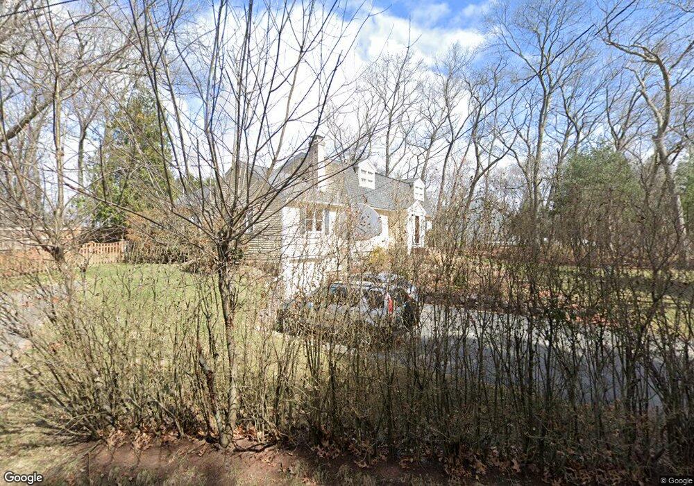
1 Blue Jay Dr Concord, MA 01742
Estimated Value: $1,245,000 - $1,303,000
3
Beds
2
Baths
2,190
Sq Ft
$580/Sq Ft
Est. Value
About This Home
This home is located at 1 Blue Jay Dr, Concord, MA 01742 and is currently estimated at $1,271,107, approximately $580 per square foot. 1 Blue Jay Dr is a home located in Middlesex County with nearby schools including Thoreau Elementary School, Concord Middle School, and Concord Carlisle High School.
Ownership History
Date
Name
Owned For
Owner Type
Purchase Details
Closed on
Oct 21, 2013
Sold by
Pereira-Duraes Candido and Opitz Anita L
Bought by
Naidu Vijay and Naidu Asha
Current Estimated Value
Home Financials for this Owner
Home Financials are based on the most recent Mortgage that was taken out on this home.
Original Mortgage
$417,000
Outstanding Balance
$314,314
Interest Rate
4.58%
Mortgage Type
New Conventional
Estimated Equity
$956,793
Purchase Details
Closed on
Jan 16, 2004
Sold by
Baldwin Robert H and Baldwin Debra M
Bought by
Opitz Anita L and Pereira-Duraes Candido
Home Financials for this Owner
Home Financials are based on the most recent Mortgage that was taken out on this home.
Original Mortgage
$531,000
Interest Rate
5.98%
Mortgage Type
Purchase Money Mortgage
Purchase Details
Closed on
Aug 1, 2002
Sold by
Corcoran William J and Corcoran Karen M
Bought by
Baldwin Robert H and Baldwin Debra M
Home Financials for this Owner
Home Financials are based on the most recent Mortgage that was taken out on this home.
Original Mortgage
$465,000
Interest Rate
6.64%
Mortgage Type
Purchase Money Mortgage
Purchase Details
Closed on
Jul 8, 1996
Sold by
Bates Suzanne W
Bought by
Corcoran William J and Corcoran Karen M
Home Financials for this Owner
Home Financials are based on the most recent Mortgage that was taken out on this home.
Original Mortgage
$291,920
Interest Rate
7.98%
Mortgage Type
Purchase Money Mortgage
Purchase Details
Closed on
Apr 30, 1993
Sold by
Household Fin Corp Ii
Bought by
Bates Suzanne W
Home Financials for this Owner
Home Financials are based on the most recent Mortgage that was taken out on this home.
Original Mortgage
$238,500
Interest Rate
7.51%
Mortgage Type
Purchase Money Mortgage
Purchase Details
Closed on
Apr 6, 1993
Sold by
Benoit Benjamin L and Household Fin Corp
Bought by
Household Fin Corp
Home Financials for this Owner
Home Financials are based on the most recent Mortgage that was taken out on this home.
Original Mortgage
$238,500
Interest Rate
7.51%
Mortgage Type
Purchase Money Mortgage
Create a Home Valuation Report for This Property
The Home Valuation Report is an in-depth analysis detailing your home's value as well as a comparison with similar homes in the area
Home Values in the Area
Average Home Value in this Area
Purchase History
| Date | Buyer | Sale Price | Title Company |
|---|---|---|---|
| Naidu Vijay | $630,000 | -- | |
| Naidu Vijay | $630,000 | -- | |
| Opitz Anita L | $590,000 | -- | |
| Baldwin Robert H | $595,000 | -- | |
| Corcoran William J | $364,900 | -- | |
| Bates Suzanne W | $265,000 | -- | |
| Household Fin Corp | $1,000 | -- |
Source: Public Records
Mortgage History
| Date | Status | Borrower | Loan Amount |
|---|---|---|---|
| Open | Naidu Vijay | $417,000 | |
| Closed | Naidu Vijay | $417,000 | |
| Previous Owner | Opitz Anita L | $531,000 | |
| Previous Owner | Baldwin Robert H | $465,000 | |
| Previous Owner | Household Fin Corp | $288,200 | |
| Previous Owner | Household Fin Corp | $291,920 | |
| Previous Owner | Household Fin Corp | $238,500 |
Source: Public Records
Tax History
| Year | Tax Paid | Tax Assessment Tax Assessment Total Assessment is a certain percentage of the fair market value that is determined by local assessors to be the total taxable value of land and additions on the property. | Land | Improvement |
|---|---|---|---|---|
| 2025 | $140 | $1,054,800 | $444,700 | $610,100 |
| 2024 | $13,850 | $1,054,800 | $444,700 | $610,100 |
| 2023 | $11,670 | $900,500 | $404,300 | $496,200 |
| 2022 | $11,029 | $747,200 | $323,400 | $423,800 |
| 2021 | $10,878 | $739,000 | $323,400 | $415,600 |
| 2020 | $10,423 | $732,500 | $323,400 | $409,100 |
| 2019 | $10,472 | $738,000 | $334,100 | $403,900 |
| 2018 | $9,636 | $674,300 | $306,700 | $367,600 |
| 2017 | $9,182 | $652,600 | $284,800 | $367,800 |
| 2016 | $8,824 | $633,900 | $284,800 | $349,100 |
| 2015 | $8,367 | $585,500 | $263,700 | $321,800 |
Source: Public Records
Map
Nearby Homes
- 65 Summit St
- 66 Old Stow Rd
- 37 Water St
- 27 Water St
- 20 Westvale Meadows Unit C
- 116 Conant St
- 245 Oak Hill Cir
- 95 Conant St Unit 320
- 42 Sunnyside Ln
- 1844 Main St Unit 1844
- 67 Conant St
- 22 Center Village Dr
- 59 Lexington Dr
- 100 Harrington Ave
- 54 Maple St
- 303 School St
- 102 Highland St
- 70 McCallar Ln
- 53 Prairie St
- 32 Highland St
- 389 Laws Brook Rd
- 401 Laws Brook Rd
- 401 Laws Brook Rd
- 113 Hillside Ave
- 143 Hillside Ave
- 377 Laws Brook Rd
- 21 Blue Jay Dr
- 97 Hillside Ave
- 97 Hillside Ave Unit 1
- 86 Hillside Ave
- 125 Hillside Ave
- 365 Laws Brook Rd
- 83 Hillside Ave
- 12 Sorrel Rd
- 382 Laws Brook Rd
- 135 Hillside Ave
- 368 Laws Brook Rd
- 32 Blue Jay Dr
- 20 Hill St
- 414 Laws Brook Rd
Your Personal Tour Guide
Ask me questions while you tour the home.