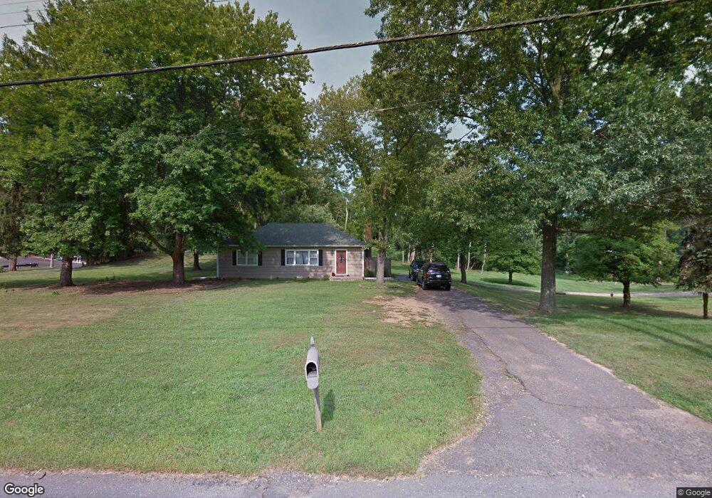
1 Boundary Rd Colts Neck, NJ 07722
Estimated Value: $684,000 - $870,390
3
Beds
2
Baths
2,350
Sq Ft
$324/Sq Ft
Est. Value
About This Home
This home is located at 1 Boundary Rd, Colts Neck, NJ 07722 and is currently estimated at $760,598, approximately $323 per square foot. 1 Boundary Rd is a home located in Monmouth County with nearby schools including Conover Road School, Cedar Drive Middle School, and Colts Neck High School.
Ownership History
Date
Name
Owned For
Owner Type
Purchase Details
Closed on
Feb 12, 2019
Sold by
Ellis Roger and Ellis Melissa
Bought by
Ellis Roger
Current Estimated Value
Purchase Details
Closed on
Apr 10, 2009
Sold by
Dlj Mortgage Capital Inc
Bought by
Ellis Roger and Ellis Melissa
Home Financials for this Owner
Home Financials are based on the most recent Mortgage that was taken out on this home.
Original Mortgage
$260,000
Interest Rate
4.87%
Mortgage Type
Stand Alone First
Purchase Details
Closed on
Dec 29, 2006
Sold by
Wiszowaty Stanley
Bought by
Holmes Andrew E
Home Financials for this Owner
Home Financials are based on the most recent Mortgage that was taken out on this home.
Original Mortgage
$80,000
Interest Rate
6.14%
Mortgage Type
New Conventional
Create a Home Valuation Report for This Property
The Home Valuation Report is an in-depth analysis detailing your home's value as well as a comparison with similar homes in the area
Home Values in the Area
Average Home Value in this Area
Purchase History
| Date | Buyer | Sale Price | Title Company |
|---|---|---|---|
| Ellis Roger | -- | None Available | |
| Ellis Roger | $259,900 | None Available | |
| Holmes Andrew E | $400,000 | -- |
Source: Public Records
Mortgage History
| Date | Status | Borrower | Loan Amount |
|---|---|---|---|
| Previous Owner | Ellis Roger | $260,000 | |
| Previous Owner | Holmes Andrew E | $80,000 |
Source: Public Records
Tax History Compared to Growth
Tax History
| Year | Tax Paid | Tax Assessment Tax Assessment Total Assessment is a certain percentage of the fair market value that is determined by local assessors to be the total taxable value of land and additions on the property. | Land | Improvement |
|---|---|---|---|---|
| 2025 | $9,748 | $808,500 | $414,000 | $394,500 |
| 2024 | $9,879 | $654,200 | $301,500 | $352,700 |
| 2023 | $9,879 | $634,900 | $301,500 | $333,400 |
| 2022 | $9,332 | $585,000 | $274,500 | $310,500 |
| 2021 | $9,332 | $534,500 | $274,500 | $260,000 |
| 2020 | $5,248 | $297,500 | $244,000 | $53,500 |
| 2019 | $5,088 | $288,900 | $236,000 | $52,900 |
| 2018 | $5,094 | $287,000 | $244,000 | $43,000 |
| 2017 | $4,997 | $282,500 | $240,000 | $42,500 |
| 2016 | $4,743 | $274,000 | $236,000 | $38,000 |
| 2015 | $4,806 | $277,000 | $240,000 | $37,000 |
| 2014 | $5,678 | $336,600 | $300,000 | $36,600 |
Source: Public Records
Map
Nearby Homes
- 88 Clover Hill Rd
- 12 Crest Dr
- 11 Applethorn Ct
- 20 Birch Ln
- 39 Mountainside Dr
- 18 Egret Ln
- 421 Georgetown Dr
- 680 - 21.04 County Road 520
- 680 - 21.1 County Road 520
- 680 - 21.21 County Road 520
- 680 County Road 520
- 680 - 21.15 County Road 520
- 680 - 21.19 County Road 520
- 680 - 21.11 County Road 520
- 680 - 21.12 County Road 520
- 680 - 21.09 County Road 520
- 680 - 21.05 County Road 520
- 680 - 21.13 County Road 520
- 680 - 21.06 County Road 520
- 680 - 21.16 County Road 520
- 2 Boundary Rd
- 4 Boundary Rd
- 600 Route 520
- 579 County Road 520
- 579 Highway 520
- 6 Boundary Rd
- 577 County Road 520
- 577 Newman Springs Rd
- 8 Boundary Rd
- 68 Glenwood Rd
- 64 Glenwood Rd
- 10 Boundary Rd
- 573 Route 520
- 72 Glenwood Rd
- 14 Boundary Rd
- 660 County 520
- 60 Glenwood Rd
- 53 Glenwood Rd
- 61 Glenwood Rd
- 57 Glenwood Rd