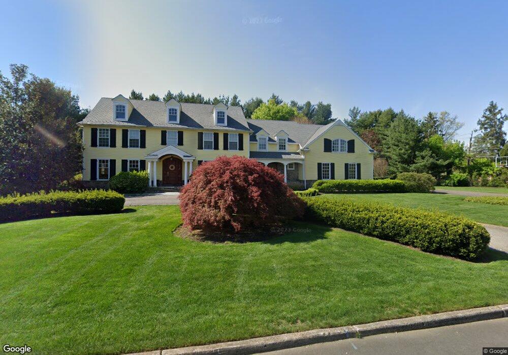
1 Broadacres Ct Moorestown, NJ 08057
Estimated Value: $1,783,501 - $1,907,000
5
Beds
4
Baths
6,246
Sq Ft
$296/Sq Ft
Est. Value
About This Home
This home is located at 1 Broadacres Ct, Moorestown, NJ 08057 and is currently estimated at $1,851,500, approximately $296 per square foot. 1 Broadacres Ct is a home located in Burlington County with nearby schools including George C. Baker Elementary School, Moorestown Upper Elementary School, and William Allen Middle School.
Ownership History
Date
Name
Owned For
Owner Type
Purchase Details
Closed on
Dec 3, 2019
Sold by
Dyer Daniel P and Dyer Bettina Gail
Bought by
Dyer Daniel P
Current Estimated Value
Purchase Details
Closed on
Oct 22, 2001
Sold by
Piersanti Thomas C and Piersanti Susan D
Bought by
Dyer Daniel P and Dyer Bettina Gail
Home Financials for this Owner
Home Financials are based on the most recent Mortgage that was taken out on this home.
Original Mortgage
$32,500
Interest Rate
6.39%
Mortgage Type
Unknown
Create a Home Valuation Report for This Property
The Home Valuation Report is an in-depth analysis detailing your home's value as well as a comparison with similar homes in the area
Home Values in the Area
Average Home Value in this Area
Purchase History
| Date | Buyer | Sale Price | Title Company |
|---|---|---|---|
| Dyer Daniel P | -- | None Available | |
| Dyer Daniel P | $650,000 | -- |
Source: Public Records
Mortgage History
| Date | Status | Borrower | Loan Amount |
|---|---|---|---|
| Closed | Dyer Daniel P | $32,500 | |
| Open | Dyer Daniel P | $520,000 |
Source: Public Records
Tax History Compared to Growth
Tax History
| Year | Tax Paid | Tax Assessment Tax Assessment Total Assessment is a certain percentage of the fair market value that is determined by local assessors to be the total taxable value of land and additions on the property. | Land | Improvement |
|---|---|---|---|---|
| 2025 | $29,789 | $1,050,000 | $439,400 | $610,600 |
| 2024 | $28,886 | $1,050,000 | $439,400 | $610,600 |
| 2023 | $28,886 | $1,050,000 | $439,400 | $610,600 |
| 2022 | $34,073 | $1,251,300 | $439,400 | $811,900 |
| 2021 | $33,622 | $1,251,300 | $439,400 | $811,900 |
| 2020 | $33,410 | $1,251,300 | $439,400 | $811,900 |
| 2019 | $32,822 | $1,251,300 | $439,400 | $811,900 |
| 2018 | $31,933 | $1,251,300 | $439,400 | $811,900 |
| 2017 | $32,208 | $1,251,300 | $439,400 | $811,900 |
| 2016 | $32,096 | $1,251,300 | $439,400 | $811,900 |
| 2015 | $31,708 | $1,251,300 | $439,400 | $811,900 |
| 2014 | $30,106 | $1,251,300 | $439,400 | $811,900 |
Source: Public Records
Map
Nearby Homes
- 863 Golf View Rd
- 744 Signal Light Rd
- 205 E Central Ave
- 133 Plum St Unit 6
- 308 Elm St
- 80 E 3rd St
- 82 E 3rd St
- 66 E 3rd St
- 50 E 3rd St
- 15 E 2nd St
- 543 Bethel Ave
- 7 Whitetail Ct
- 493 N Church St
- 343 Tom Brown Rd
- 628 Windsock Way
- 347 Tom Brown Rd
- 408 E 2nd St
- 308 Farmdale Rd
- 316 Farmdale Rd
- 129 S Church St
- 170 Bridgeboro Rd
- 2 Broadacres Ct
- 7 Broadacres Ct
- 150 Bridgeboro Rd
- 6 Broadacres Ct
- 202 Bridgeboro Rd
- 3 Broadacres Ct
- 5 Broadacres Ct
- 631 Chester Ave
- 201 Bridgeboro Rd
- 130 Bridgeboro Rd
- 4 Broadacres Ct
- 725 Riverton Rd
- 633 Chester Ave
- 205 Bridgeboro Rd
- 706 Chester Ave
- 207 Bridgeboro Rd
- 712 Riverton Rd
- 704 Chester Ave
- 729 Riverton Rd