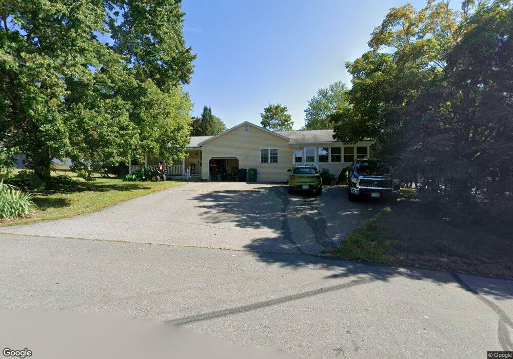
1 Brookfield Dr Nashua, NH 03063
Northwest Nashua NeighborhoodEstimated Value: $640,000 - $771,000
About This Home
This home is located at 1 Brookfield Dr, Nashua, NH 03063 and is currently estimated at $707,802, approximately $275 per square foot. 1 Brookfield Dr is a home located in Hillsborough County with nearby schools including Birch Hill Elementary School, Pennichuck Middle School, and Elm Street Middle School.
Ownership History
We collect this data history from publicly available records. To have your information removed, we recommend requesting removal directly through your county’s website.
Purchase Details
Purchase Details
Home Values in the Area
Average Home Value in this Area
Purchase History
We collect this data history from publicly available records. To have your information removed, we recommend requesting removal directly through your county’s website.
| Date | Buyer | Sale Price | Title Company |
|---|---|---|---|
| -- | -- | ||
| $65,000 | -- |
Mortgage History
We collect this data history from publicly available records. To have your information removed, we recommend requesting removal directly through your county’s website.
| Date | Status | Borrower | Loan Amount |
|---|---|---|---|
| Open | $269,369 | ||
| Previous Owner | $203,500 | ||
| Previous Owner | $85,000 | ||
| Closed | $215,000 |
Tax History
We collect this data history from publicly available records. To have your information removed, we recommend requesting removal directly through your county’s website.
| Year | Tax Paid | Tax Assessment Tax Assessment Total Assessment is a certain percentage of the fair market value that is determined by local assessors to be the total taxable value of land and additions on the property. | Land | Improvement |
|---|---|---|---|---|
| 2025 | $10,128 | $601,800 | $172,100 | $429,700 |
| 2024 | $9,569 | $601,800 | $172,100 | $429,700 |
| 2023 | $9,314 | $510,900 | $137,700 | $373,200 |
| 2022 | $9,232 | $510,900 | $137,700 | $373,200 |
| 2021 | $8,132 | $350,200 | $91,800 | $258,400 |
| 2020 | $7,746 | $342,600 | $91,800 | $250,800 |
| 2019 | $7,455 | $342,600 | $91,800 | $250,800 |
| 2018 | $7,267 | $342,600 | $91,800 | $250,800 |
| 2017 | $7,809 | $302,800 | $76,200 | $226,600 |
| 2016 | $7,591 | $302,800 | $76,200 | $226,600 |
| 2015 | $7,428 | $302,800 | $76,200 | $226,600 |
| 2014 | $7,282 | $302,800 | $76,200 | $226,600 |
Map
- 8 Bartemus Trail Unit U216
- 208 Bartemus Trail Unit U45
- 204 Bartemus Trail Unit U47
- 51 Bartemus Trail Unit U455
- 11B Joe's Way
- 17 Xenia St
- 165 Shore Dr
- 300 Candlewood Park Unit 314
- 500 Candlewood Park Unit 35
- 500 Candlewood Park Unit 13
- 500 Candlewood Park Unit 38
- 11 Gary St
- 11 Hammar Rd
- 40 Coburn Ave
- 18 Cobble Hill Rd
- 7 Hopi Dr
- 33 Larkspur Ct Unit U123
- 377 Broad St
- 14 Upstone Dr
- 9 Mahogany Dr Unit U106
- 9 Brookfield Dr
- 3 Brookfield Dr
- 3 Brookfield Dr
- 604 Broad St
- 2 Ducas Ave
- 606 Broad St
- 602 Broad St
- 356 Broad St
- 6 Ducas Ave Unit 123
- 5 Brookfield Dr
- 599 Broad St
- 14 Ducas Ave Unit 994
- 6-6A Brookfield Dr
- 11 Bartemus Trail Unit 108
- 5 Ducas Ave
- 600 Broad St
- 597 Broad St
- 11 Ducas Ave
- 2 Abbe Ln
- 13 Ducas Ave
Ask me questions while you tour the home.