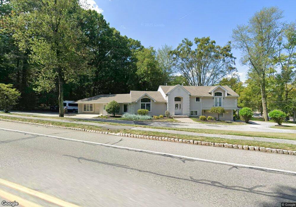
1 Bryant Dr Livingston, NJ 07039
Estimated Value: $1,139,000 - $2,023,000
--
Bed
--
Bath
2,836
Sq Ft
$535/Sq Ft
Est. Value
About This Home
This home is located at 1 Bryant Dr, Livingston, NJ 07039 and is currently estimated at $1,518,118, approximately $535 per square foot. 1 Bryant Dr is a home with nearby schools including Livingston Sr High School and Aquinas Academy.
Ownership History
Date
Name
Owned For
Owner Type
Purchase Details
Closed on
Oct 26, 2005
Sold by
Cocuzza Angelo
Bought by
1 Bryant Drive Llc
Current Estimated Value
Home Financials for this Owner
Home Financials are based on the most recent Mortgage that was taken out on this home.
Original Mortgage
$5,240
Outstanding Balance
$2,827
Interest Rate
5.79%
Mortgage Type
Purchase Money Mortgage
Estimated Equity
$1,515,291
Purchase Details
Closed on
Aug 5, 2001
Sold by
Mccarthy Brian
Bought by
Cocuzza Angelo
Create a Home Valuation Report for This Property
The Home Valuation Report is an in-depth analysis detailing your home's value as well as a comparison with similar homes in the area
Home Values in the Area
Average Home Value in this Area
Purchase History
| Date | Buyer | Sale Price | Title Company |
|---|---|---|---|
| 1 Bryant Drive Llc | $650,000 | -- | |
| Cocuzza Angelo | $280,000 | -- |
Source: Public Records
Mortgage History
| Date | Status | Borrower | Loan Amount |
|---|---|---|---|
| Open | 1 Bryant Drive Llc | $5,240 |
Source: Public Records
Tax History Compared to Growth
Tax History
| Year | Tax Paid | Tax Assessment Tax Assessment Total Assessment is a certain percentage of the fair market value that is determined by local assessors to be the total taxable value of land and additions on the property. | Land | Improvement |
|---|---|---|---|---|
| 2025 | $20,418 | $860,800 | $315,900 | $544,900 |
| 2024 | $20,418 | $860,800 | $315,900 | $544,900 |
| 2022 | $20,082 | $860,800 | $315,900 | $544,900 |
| 2021 | $19,919 | $860,800 | $315,900 | $544,900 |
| 2020 | $19,549 | $860,800 | $315,900 | $544,900 |
| 2019 | $20,240 | $773,700 | $315,900 | $457,800 |
| 2018 | $19,969 | $773,700 | $315,900 | $457,800 |
| 2017 | $19,706 | $773,700 | $315,900 | $457,800 |
| 2016 | $19,343 | $773,700 | $315,900 | $457,800 |
| 2015 | $19,056 | $773,700 | $315,900 | $457,800 |
| 2014 | $18,437 | $773,700 | $315,900 | $457,800 |
Source: Public Records
Map
Nearby Homes
- 10 Elmwood Ct
- 141 Madison Ct
- 27 Filmore Ave
- 52 Congressional Pkwy
- 41 W Mcclellan Ave
- 36 Crestview Hill Rd
- 37 Filmore Ave
- 6 Elkin Dr
- 6 Mayhew Dr
- 44 Lincoln Ave
- 45 Brandon Ave
- 21 Maplewood Dr
- 61 Hazel Ave
- 63 N Livingston Ave
- 91 Keyes Rd
- 7 Franklin Ave
- 22 Tuxedo Dr
- 24 Cliffside Dr
- 43 Franklin Ave
- 53 Rockledge Dr
- 3 Bryant Dr
- 5 Bryant Dr
- 180 N Livingston Ave
- 178 N Livingston Ave
- 182 N Livingston Ave
- 176 N Livingston Ave
- 174 N Livingston Ave
- 7 Bryant Dr
- 2 Bryant Dr
- 4 Bryant Dr
- 172 N Livingston Ave
- 6 Bryant Dr
- 8 Ashwood Dr
- 9 Bryant Dr
- 188 N Livingston Ave
- 193 N Livingston Ave
- 8 Bryant Dr
- 190 N Livingston Ave
- 10 Ashwood Dr
- 11 Bryant Dr