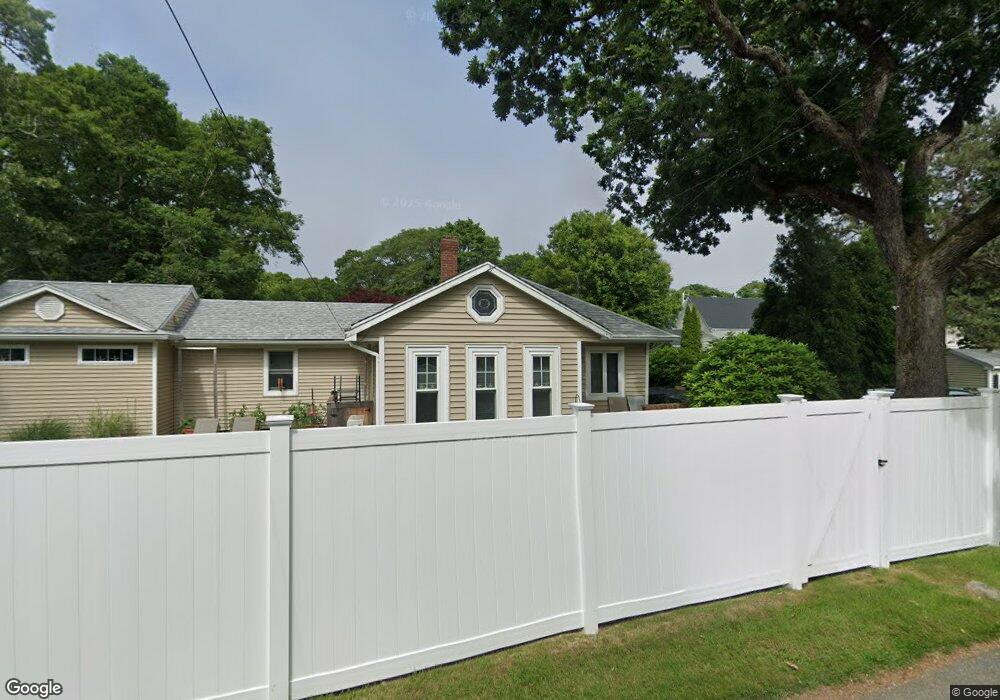
1 Cahoon Rd Buzzards Bay, MA 02532
Estimated Value: $356,000 - $483,000
2
Beds
2
Baths
1,248
Sq Ft
$349/Sq Ft
Est. Value
About This Home
This home is located at 1 Cahoon Rd, Buzzards Bay, MA 02532 and is currently estimated at $435,769, approximately $349 per square foot. 1 Cahoon Rd is a home with nearby schools including St Margaret Regional School.
Ownership History
Date
Name
Owned For
Owner Type
Purchase Details
Closed on
Feb 28, 2024
Sold by
Mello Patricia D
Bought by
One Cahoon Rd Rt and Mello
Current Estimated Value
Purchase Details
Closed on
May 30, 1996
Sold by
Empire Mortgage Lp 4 and Empire Mtg 4 Inc
Bought by
Mello Patricia D
Create a Home Valuation Report for This Property
The Home Valuation Report is an in-depth analysis detailing your home's value as well as a comparison with similar homes in the area
Purchase History
| Date | Buyer | Sale Price | Title Company |
|---|---|---|---|
| One Cahoon Rd Rt | -- | None Available | |
| One Cahoon Rd Rt | -- | None Available | |
| Mello Patricia D | $67,450 | -- | |
| Mello Patricia D | $67,450 | -- |
Source: Public Records
Mortgage History
| Date | Status | Borrower | Loan Amount |
|---|---|---|---|
| Previous Owner | Mello Patricia D | $84,000 | |
| Previous Owner | Mello Patricia D | $84,000 | |
| Previous Owner | Mello Patricia D | $90,300 |
Source: Public Records
Tax History
| Year | Tax Paid | Tax Assessment Tax Assessment Total Assessment is a certain percentage of the fair market value that is determined by local assessors to be the total taxable value of land and additions on the property. | Land | Improvement |
|---|---|---|---|---|
| 2025 | $4,158 | $378,700 | $116,200 | $262,500 |
| 2024 | $4,268 | $365,400 | $91,200 | $274,200 |
| 2023 | $3,604 | $324,600 | $82,800 | $241,800 |
| 2022 | $3,604 | $264,600 | $82,800 | $181,800 |
| 2021 | $3,356 | $239,700 | $82,800 | $156,900 |
| 2020 | $2,898 | $211,400 | $82,800 | $128,600 |
| 2019 | $2,701 | $199,200 | $81,300 | $117,900 |
| 2018 | $2,586 | $184,200 | $81,300 | $102,900 |
| 2017 | $2,424 | $173,400 | $81,300 | $92,100 |
| 2016 | $2,250 | $159,700 | $80,400 | $79,300 |
| 2015 | $2,188 | $159,700 | $80,400 | $79,300 |
| 2014 | $2,269 | $170,700 | $73,100 | $97,600 |
Source: Public Records
Map
Nearby Homes
- 3 Fairway Dr Unit F
- 13 Bay Pointe Drive Extension
- 13 Bay Pointe Drive Extension Unit 13
- 3132 Cranberry Hwy Unit 59
- 92 Choctaw Dr
- 60 Martin St
- 23 Starboard Dr Unit Lot 50
- 36B Starboard Dr Unit 36E
- 36B Starboard Dr Unit 36G
- 36B Starboard Dr Unit 36C
- 36B Starboard Dr Unit 36A
- 36B Starboard Dr Unit 36D
- 36B Starboard Dr Unit 36B
- 36B Starboard Dr Unit 36F
- 36B Starboard Dr Unit 36H
- 67 Algonquin St
- 22 Long Neck Rd
- 4 Van Bummel Rd
- 29 Wenonah Rd
- 29 Wenonah Rd
Your Personal Tour Guide
Ask me questions while you tour the home.