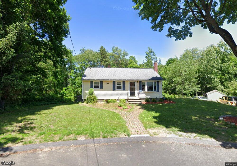
1 Capt Peter Simpson Rd Millbury, MA 01527
Armory Village NeighborhoodEstimated Value: $405,000 - $463,000
3
Beds
2
Baths
910
Sq Ft
$473/Sq Ft
Est. Value
About This Home
This home is located at 1 Capt Peter Simpson Rd, Millbury, MA 01527 and is currently estimated at $430,085, approximately $472 per square foot. 1 Capt Peter Simpson Rd is a home located in Worcester County with nearby schools including Elmwood Street Elementary School, Raymond E. Shaw Elementary School, and Millbury Junior/Senior High School.
Ownership History
Date
Name
Owned For
Owner Type
Purchase Details
Closed on
Sep 3, 2010
Sold by
Townsend Toni and Citimortgage Inc
Bought by
Souto Yvonne M
Current Estimated Value
Home Financials for this Owner
Home Financials are based on the most recent Mortgage that was taken out on this home.
Original Mortgage
$158,663
Outstanding Balance
$109,462
Interest Rate
5.5%
Mortgage Type
FHA
Estimated Equity
$320,623
Purchase Details
Closed on
Feb 1, 2007
Sold by
Lemay Michel J and Lemay Phyllis M
Bought by
Townsend Toni
Home Financials for this Owner
Home Financials are based on the most recent Mortgage that was taken out on this home.
Original Mortgage
$176,250
Interest Rate
6.16%
Mortgage Type
Purchase Money Mortgage
Create a Home Valuation Report for This Property
The Home Valuation Report is an in-depth analysis detailing your home's value as well as a comparison with similar homes in the area
Home Values in the Area
Average Home Value in this Area
Purchase History
| Date | Buyer | Sale Price | Title Company |
|---|---|---|---|
| Souto Yvonne M | $161,000 | -- | |
| Souto Yvonne M | $161,000 | -- | |
| Townsend Toni | $235,000 | -- | |
| Townsend Toni | $235,000 | -- |
Source: Public Records
Mortgage History
| Date | Status | Borrower | Loan Amount |
|---|---|---|---|
| Open | Souto Yvonne M | $158,663 | |
| Closed | Townsend Toni | $158,663 | |
| Previous Owner | Townsend Toni | $176,250 | |
| Previous Owner | Townsend Toni | $65,000 |
Source: Public Records
Tax History
| Year | Tax Paid | Tax Assessment Tax Assessment Total Assessment is a certain percentage of the fair market value that is determined by local assessors to be the total taxable value of land and additions on the property. | Land | Improvement |
|---|---|---|---|---|
| 2025 | $5,096 | $380,600 | $115,800 | $264,800 |
| 2024 | $4,678 | $353,600 | $107,300 | $246,300 |
| 2023 | $4,282 | $296,300 | $75,200 | $221,100 |
| 2022 | $4,104 | $273,600 | $75,200 | $198,400 |
| 2021 | $4,023 | $260,700 | $75,200 | $185,500 |
| 2020 | $3,923 | $255,900 | $75,200 | $180,700 |
| 2019 | $3,764 | $237,500 | $68,300 | $169,200 |
| 2018 | $3,539 | $216,600 | $68,300 | $148,300 |
| 2017 | $3,339 | $203,200 | $68,300 | $134,900 |
| 2016 | $3,121 | $189,600 | $68,300 | $121,300 |
| 2015 | $3,144 | $191,000 | $72,700 | $118,300 |
| 2014 | $2,984 | $174,500 | $72,700 | $101,800 |
Source: Public Records
Map
Nearby Homes
- 2 Jessica j Dr
- 4 Jessica j Dr
- 5 Mogren Dr
- 8 Sycamore Cir
- 128 Worcester Providence Turnpike
- 124 Worcester Providence Turnpike
- 7 Canal St
- Lot 1 Cooper Rd
- 8 Autumn Gate Cir
- 37-39 Main St
- 8 Lincoln Ave
- 17 Lincoln Ave
- 38 W Main St
- 20 Woodridge Rd
- 168 Burbank Rd
- 46 Lexington Rd
- 2 Riverlin Pkwy
- 66 Buttonwood Ave
- 152 W Main St Unit A
- 0 Worcester Providence Turnpike
- 2 Capt Peter Simpson Rd
- 3 Capt Peter Simpson Rd
- 4 Capt Peter Simpson Rd
- 5 Capt Peter Simpson Rd
- 5 Capt Peter Simpson Rd Unit B
- 3 Aldrich Ave
- 13 Thomas Hill Rd
- 7 Capt Peter Simpson Rd
- 7 Captain Peter Simpson Rd
- 1 Aldrich Ave
- 11 Thomas Hill Rd
- 4 Aldrich Ave
- 2 Aldrich Ave
- 11 Capt Peter Simpson Rd
- 14 Thomas Hill Rd
- 20 Rice Rd
- 5 Thomas Hill Rd
- 12 Thomas Hill Rd
- 3 Thomas Hill Rd
- 13 Capt Peter Simpson Rd
Your Personal Tour Guide
Ask me questions while you tour the home.