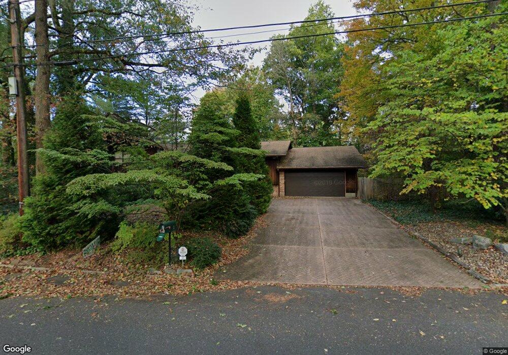
1 Cardinal Dr Moorestown, NJ 08057
Estimated Value: $737,202 - $1,000,000
Studio
--
Bath
2,962
Sq Ft
$293/Sq Ft
Est. Value
About This Home
This home is located at 1 Cardinal Dr, Moorestown, NJ 08057 and is currently estimated at $868,551, approximately $293 per square foot. 1 Cardinal Dr is a home located in Burlington County with nearby schools including George C. Baker Elementary School, Moorestown Upper Elementary School, and William Allen Middle School.
Ownership History
Date
Name
Owned For
Owner Type
Purchase Details
Closed on
Jul 16, 2022
Sold by
Marilyn A Mcgeorge Family Trust
Bought by
Mcgeorge Kathryn
Current Estimated Value
Purchase Details
Closed on
Jul 15, 2022
Sold by
Demmerly Jr Frank R
Bought by
Marilyn A Mcgeorge Family Trust
Purchase Details
Closed on
Nov 6, 2007
Sold by
Armstrong Sarah J
Bought by
Mcgeorge Kathryn and Mcgeorge Marilyn
Create a Home Valuation Report for This Property
The Home Valuation Report is an in-depth analysis detailing your home's value as well as a comparison with similar homes in the area
Home Values in the Area
Average Home Value in this Area
Purchase History
| Date | Buyer | Sale Price | Title Company |
|---|---|---|---|
| Mcgeorge Kathryn | -- | Boenning Henry O | |
| Mcgeorge Kathryn | -- | None Listed On Document | |
| Marilyn A Mcgeorge Family Trust | -- | Boenning Henry O | |
| Marilyn A Mcgeorge Family Trust | -- | None Listed On Document | |
| Mcgeorge Kathryn | $525,000 | Weichert Title Agency |
Source: Public Records
Tax History
| Year | Tax Paid | Tax Assessment Tax Assessment Total Assessment is a certain percentage of the fair market value that is determined by local assessors to be the total taxable value of land and additions on the property. | Land | Improvement |
|---|---|---|---|---|
| 2025 | $10,037 | $353,800 | $121,900 | $231,900 |
| 2024 | $9,733 | $353,800 | $121,900 | $231,900 |
| 2023 | $9,733 | $353,800 | $121,900 | $231,900 |
| 2022 | $9,634 | $353,800 | $121,900 | $231,900 |
| 2021 | $8,861 | $353,800 | $121,900 | $231,900 |
| 2020 | $9,446 | $353,800 | $121,900 | $231,900 |
| 2019 | $9,280 | $353,800 | $121,900 | $231,900 |
| 2018 | $9,029 | $353,800 | $121,900 | $231,900 |
| 2017 | $9,107 | $353,800 | $121,900 | $231,900 |
| 2016 | $9,075 | $353,800 | $121,900 | $231,900 |
| 2015 | $8,965 | $353,800 | $121,900 | $231,900 |
| 2014 | $8,512 | $353,800 | $121,900 | $231,900 |
Source: Public Records
Map
Nearby Homes
- 2801 Riverton Rd
- 1025 Riverton Rd
- 17 Cardinal Dr
- 904 Heritage Rd
- 2 Oriole Way
- 2801 Riverton Rd
- 8 Saratoga Springs Dr
- 4 Saratoga Springs Dr
- 611 New Albany Rd
- 323 Parry Rd
- 236 Carriage Hill Dr
- 707 Parry Blvd
- 62 Sussex Dr
- 343 Tom Brown Rd
- 190 Westover Dr
- 347 Tom Brown Rd
- 715 Willow Dr
- 705 Iron Post Rd
- 502 Pomona Rd
- 700 Lippincott Ave
- 1008 Riverton Rd
- 6 Cardinal Dr
- 5 Cardinal Dr
- 2 Cardinal Dr
- 10 Cardinal Dr
- 1021 Riverton Rd
- 1004 Riverton Rd
- 1017 Riverton Rd
- 928 Fernwood Rd
- 924 Fernwood Rd
- 1029 Riverton Rd
- 14 Cardinal Dr
- 920 Fernwood Rd
- 9 Cardinal Dr
- 1013 Riverton Rd
- 932 Fernwood Rd
- 1000 Riverton Rd
- 916 Fernwood Rd
- 1033 Riverton Rd
- 2 Robin Rd
Your Personal Tour Guide
Ask me questions while you tour the home.