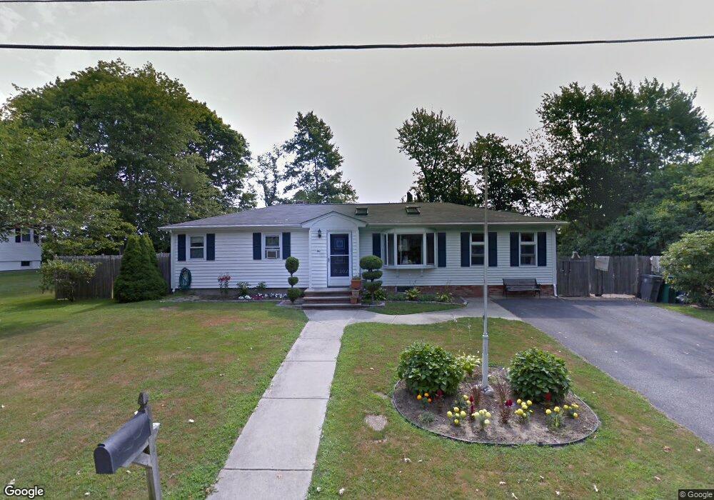
1 Cedar Ave Middletown, RI 02842
Estimated Value: $567,000 - $622,000
3
Beds
2
Baths
1,320
Sq Ft
$452/Sq Ft
Est. Value
About This Home
This home is located at 1 Cedar Ave, Middletown, RI 02842 and is currently estimated at $596,334, approximately $451 per square foot. 1 Cedar Ave is a home located in Newport County with nearby schools including Middletown High School, St Michael's Country Day School, and All Saints STEAM Academy.
Ownership History
Date
Name
Owned For
Owner Type
Purchase Details
Closed on
Jun 28, 2019
Sold by
Mcdevitt-Boliver Laurie and Boliver Matthew P
Bought by
Perkins Owen T and Perkins Margaret D
Current Estimated Value
Purchase Details
Closed on
Jan 21, 1999
Sold by
Lehane Robert T and Lehane Jean P
Bought by
Ferreira Arthur S and Ferreira Margaret
Home Financials for this Owner
Home Financials are based on the most recent Mortgage that was taken out on this home.
Original Mortgage
$106,000
Interest Rate
6.7%
Purchase Details
Closed on
Jul 2, 1992
Sold by
Commercial Credit Corp
Bought by
Lehane Robert
Create a Home Valuation Report for This Property
The Home Valuation Report is an in-depth analysis detailing your home's value as well as a comparison with similar homes in the area
Home Values in the Area
Average Home Value in this Area
Purchase History
| Date | Buyer | Sale Price | Title Company |
|---|---|---|---|
| Perkins Owen T | $350,385 | -- | |
| Ferreira Arthur S | $132,500 | -- | |
| Lehane Robert | $90,000 | -- |
Source: Public Records
Mortgage History
| Date | Status | Borrower | Loan Amount |
|---|---|---|---|
| Previous Owner | Lehane Robert | $91,300 | |
| Previous Owner | Lehane Robert | $10,000 | |
| Previous Owner | Lehane Robert | $137,000 | |
| Previous Owner | Lehane Robert | $106,000 |
Source: Public Records
Tax History
| Year | Tax Paid | Tax Assessment Tax Assessment Total Assessment is a certain percentage of the fair market value that is determined by local assessors to be the total taxable value of land and additions on the property. | Land | Improvement |
|---|---|---|---|---|
| 2025 | $5,706 | $484,000 | $313,500 | $170,500 |
| 2024 | $5,450 | $484,000 | $313,500 | $170,500 |
| 2023 | $4,170 | $331,200 | $211,900 | $119,300 |
| 2022 | $3,981 | $331,200 | $211,900 | $119,300 |
| 2021 | $3,981 | $331,200 | $211,900 | $119,300 |
| 2020 | $4,033 | $293,100 | $159,100 | $134,000 |
| 2018 | $4,030 | $293,100 | $159,100 | $134,000 |
| 2016 | $4,273 | $277,100 | $159,000 | $118,100 |
| 2015 | $4,168 | $277,100 | $159,000 | $118,100 |
| 2014 | $4,278 | $266,200 | $144,500 | $121,700 |
| 2013 | $4,182 | $266,200 | $144,500 | $121,700 |
Source: Public Records
Map
Nearby Homes
- 23 Indian Hill Cir
- 81 Beagle Dr
- 310 Corey Ln
- 223 Corey Ln
- 141 Gray Craig Rd
- 16 Ward Ave
- 476 Green End Ave
- 265 Prospect Ave
- 515 Indian Ave
- 10 Oceanview Dr
- 206 Reservoir Rd
- 118 Wolcott Ave
- 225 Old Mill Ln
- 181 Center Ave
- 318 Mitchell's Ln
- 55 John Clarke Rd Unit 8
- 55 John Clarke Rd Unit 3
- 10 Smithfield Dr
- 74 Valley Rd
- 0 Allston Ave
- 3 Cedar Ave
- 1108 Green End Ave
- 2 Cedar Ave
- 1132 Green End Ave
- 1098 Green End Ave
- 5 Cedar Ave
- 3 Spruce Ave
- 1119 Green End Ave
- 6 Cedar Ave
- 1101 Green End Ave
- 7 Cedar Ave
- 1084 Green End Ave
- 2 Spruce Ave
- 1140 Green End Ave
- 5 Spruce Ave
- 4 Spruce Ave
- 1091 Green End Ave
- 1137 Green End Ave
- 8 Cedar Ave
- 6 Spruce Ave
Your Personal Tour Guide
Ask me questions while you tour the home.