
Seller's Agent in 2025
Kerrin O'Brien
O'Brien Realty, LLC
(732) 320-6999
27 in this area
198 Total Sales
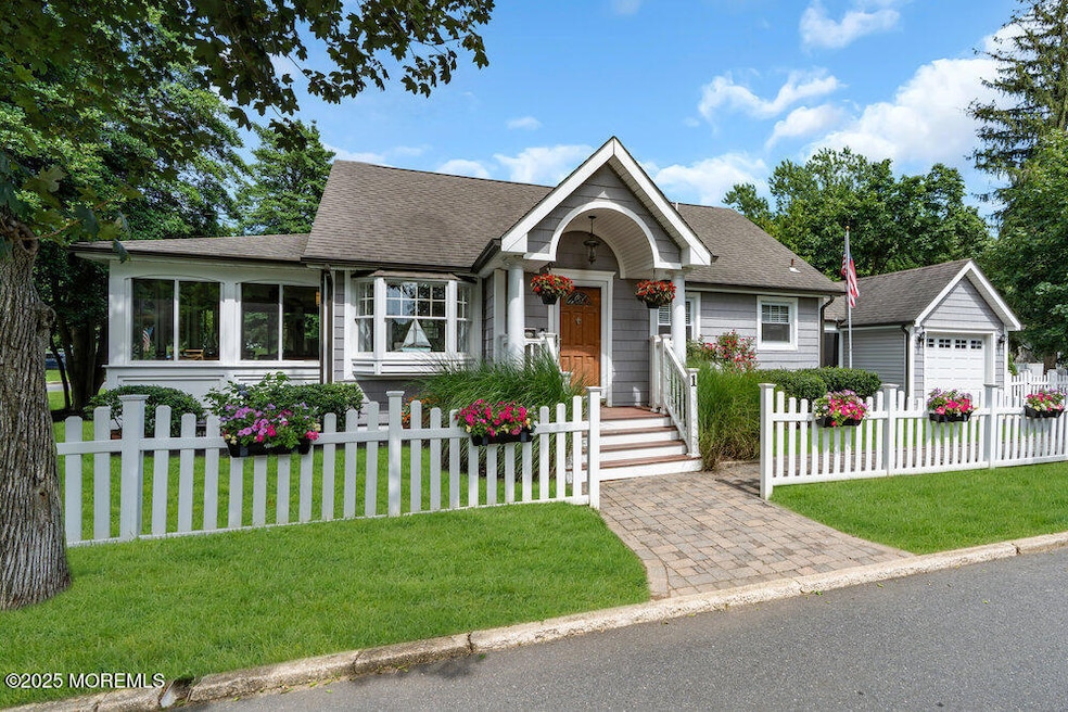
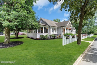
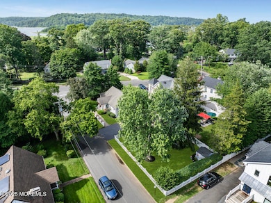
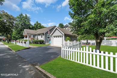
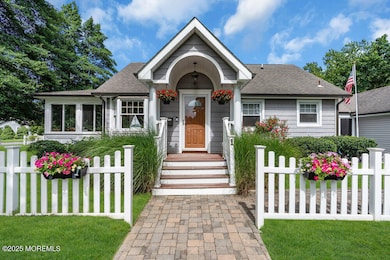
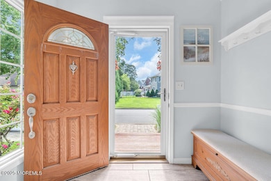
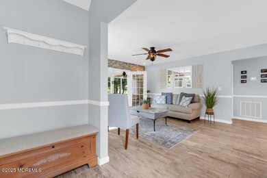
Gorgeous coastal Cape featuring 2 beds and 1.5 baths, set on a prime corner lot, approx. 180' wide, in the heart of Rumson. This charming home pairs tasteful interior upgrades—granite countertops, stainless steel appliances, & new flooring—w/ a serene outdoor retreat, including a lush tree-lined yard and three-season mahogany porch. The finished basement adds bonus living space & storage, while the breezeway-connected garage & double-wide driveway offer convenient parking. Recent improvements include a high-pressure waterline, new HVAC & newer water heater, windows, flooring, sprinkler system, and a white PVC fence surrounding the landscaped yard. Approved plans for a second-story addition offer exciting future potential.
Last Agent to Sell the Property
O'Brien Realty, LLC License #1007851 Listed on: 07/18/2025
| Date | Type | Sale Price | Title Company |
|---|---|---|---|
| Deed | $1,200,000 | Title Protection | |
| Deed | $340,000 | -- |
| Date | Status | Loan Amount | Loan Type |
|---|---|---|---|
| Open | $800,000 | New Conventional | |
| Previous Owner | $250,000 | No Value Available |
| Date | Event | Price | List to Sale | Price per Sq Ft |
|---|---|---|---|---|
| 10/15/2025 10/15/25 | Sold | $1,200,000 | -4.0% | $1,299 / Sq Ft |
| 08/19/2025 08/19/25 | Pending | -- | -- | -- |
| 07/18/2025 07/18/25 | For Sale | $1,250,000 | -- | $1,353 / Sq Ft |
| Year | Tax Paid | Tax Assessment Tax Assessment Total Assessment is a certain percentage of the fair market value that is determined by local assessors to be the total taxable value of land and additions on the property. | Land | Improvement |
|---|---|---|---|---|
| 2025 | $9,577 | $934,200 | $856,400 | $77,800 |
| 2024 | $9,735 | $870,600 | $799,800 | $70,800 |
| 2023 | $9,735 | $832,800 | $768,600 | $64,200 |
| 2022 | $9,136 | $740,700 | $680,400 | $60,300 |
| 2021 | $9,136 | $642,000 | $587,600 | $54,400 |
| 2020 | $8,794 | $613,700 | $541,000 | $72,700 |
| 2019 | $7,371 | $501,800 | $359,600 | $142,200 |
| 2018 | $7,339 | $495,200 | $359,600 | $135,600 |
| 2017 | $6,703 | $456,300 | $324,800 | $131,500 |
| 2016 | $6,491 | $453,000 | $324,800 | $128,200 |
| 2015 | $6,498 | $447,200 | $324,800 | $122,400 |
| 2014 | $6,383 | $438,100 | $319,000 | $119,100 |
Seller's Agent in 2025
Kerrin O'Brien
O'Brien Realty, LLC
(732) 320-6999
27 in this area
198 Total Sales
J
Buyer's Agent in 2025
Judy Eggert
Petillo Eggert Realty, LLC
(732) 996-6845
1 in this area
37 Total Sales
Source: MOREMLS (Monmouth Ocean Regional REALTORS®)
MLS Number: 22520821
APN: 41-00070-0000-00035
Disclaimer: Certain information contained herein is derived from information provided by parties other than Homes.com. All information provided is deemed reliable, but is not guaranteed to be accurate and should be independently verified.
![]() IDX information is provided exclusively for personal, non-commercial use, and may not be used for any purpose other than to identify prospective properties consumers may be interested in purchasing.
IDX information is provided exclusively for personal, non-commercial use, and may not be used for any purpose other than to identify prospective properties consumers may be interested in purchasing.
Information is deemed reliable but not guaranteed.
Ask me questions while you tour the home.