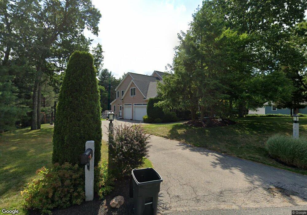
1 Chieftain Ln Natick, MA 01760
Estimated Value: $1,860,361 - $2,405,000
5
Beds
5
Baths
4,017
Sq Ft
$515/Sq Ft
Est. Value
About This Home
This home is located at 1 Chieftain Ln, Natick, MA 01760 and is currently estimated at $2,068,090, approximately $514 per square foot. 1 Chieftain Ln is a home located in Middlesex County with nearby schools including Natick High School, Memorial Elementary School, and J F Kennedy Middle School.
Ownership History
Date
Name
Owned For
Owner Type
Purchase Details
Closed on
Aug 6, 2002
Sold by
The Migroup Inc
Bought by
Norchi Terrence W and Norchi Heidi P
Current Estimated Value
Home Financials for this Owner
Home Financials are based on the most recent Mortgage that was taken out on this home.
Original Mortgage
$440,000
Interest Rate
6.64%
Mortgage Type
Purchase Money Mortgage
Purchase Details
Closed on
Feb 25, 2000
Sold by
Sanctuary Dev Corp
Bought by
Jehlik Gregory and Jehlik Kim A
Home Financials for this Owner
Home Financials are based on the most recent Mortgage that was taken out on this home.
Original Mortgage
$250,000
Interest Rate
8.15%
Mortgage Type
Purchase Money Mortgage
Create a Home Valuation Report for This Property
The Home Valuation Report is an in-depth analysis detailing your home's value as well as a comparison with similar homes in the area
Home Values in the Area
Average Home Value in this Area
Purchase History
| Date | Buyer | Sale Price | Title Company |
|---|---|---|---|
| Norchi Terrence W | $1,175,000 | -- | |
| The Migroup Inc | $1,175,000 | -- | |
| Jehlik Gregory | $791,400 | -- |
Source: Public Records
Mortgage History
| Date | Status | Borrower | Loan Amount |
|---|---|---|---|
| Open | Jehlik Gregory | $362,000 | |
| Closed | The Migroup Inc | $440,000 | |
| Closed | Norchi Terrence W | $500,000 | |
| Previous Owner | Jehlik Gregory | $250,000 | |
| Previous Owner | Jehlik Gregory | $250,000 | |
| Closed | Jehlik Gregory | $200,000 |
Source: Public Records
Tax History
| Year | Tax Paid | Tax Assessment Tax Assessment Total Assessment is a certain percentage of the fair market value that is determined by local assessors to be the total taxable value of land and additions on the property. | Land | Improvement |
|---|---|---|---|---|
| 2025 | $19,107 | $1,597,600 | $546,400 | $1,051,200 |
| 2024 | $18,413 | $1,501,900 | $517,500 | $984,400 |
| 2023 | $16,531 | $1,307,800 | $454,000 | $853,800 |
| 2022 | $16,358 | $1,226,200 | $408,800 | $817,400 |
| 2021 | $15,598 | $1,146,100 | $386,400 | $759,700 |
| 2020 | $15,370 | $1,129,300 | $369,600 | $759,700 |
| 2019 | $14,353 | $1,129,300 | $369,600 | $759,700 |
| 2018 | $14,308 | $1,096,400 | $352,800 | $743,600 |
| 2017 | $14,465 | $1,072,300 | $342,000 | $730,300 |
| 2016 | $14,456 | $1,065,300 | $342,000 | $723,300 |
| 2015 | $14,324 | $1,036,500 | $342,000 | $694,500 |
Source: Public Records
Map
Nearby Homes
- 81 Woodland St
- 2 Arrow Path
- 165 Woodland St
- 11 Avon St
- 104 Eliot St
- 67 E Central St & 5 Union St
- 14 Pinewood Ave
- 5 Wilson St Unit 5A
- 48 Algonquian Dr
- 6A Lincoln St Unit 6A
- 3A Wilson St Unit 3A
- 4B Lincoln St Unit 4B
- 189 Eliot St
- 3 Wilson St Unit 3B
- 8 Floral Ave Unit 8
- 83 Eliot St
- 12 Floral Ave
- 8 Floral Avenue Extension
- 6 Floral Avenue Extension
- 3 Vale St Unit A
- Lot 2 Chieftain Way
- Lot 3 Chieftain Way
- 8 Chieftain Ln
- 5 Chieftain Ln
- 11 Moccasin Path
- 2 Chieftain Ln
- 19 Clearview Dr
- 15 Moccasin Path
- 15 Moccasin Path Unit A
- 12 Moccasin Path
- 17 Clearview Dr
- 16 Clearview Dr
- 9 Moccasin Path
- 10 Moccasin Path
- 6 Moccasin Path
- 8 Moccasin Path
- 22 Chieftain Ln
- 14 Moccasin Path
- 7 Chieftain Ln
- 15 Clearview Dr
Your Personal Tour Guide
Ask me questions while you tour the home.