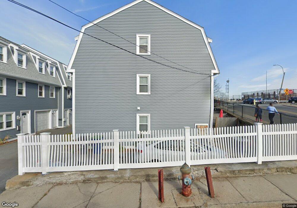
1 Clark St Unit 6 Somerville, MA 02143
Prospect Hill NeighborhoodEstimated Value: $731,000 - $819,000
2
Beds
2
Baths
985
Sq Ft
$800/Sq Ft
Est. Value
About This Home
This home is located at 1 Clark St Unit 6, Somerville, MA 02143 and is currently estimated at $788,111, approximately $800 per square foot. 1 Clark St Unit 6 is a home located in Middlesex County with nearby schools including Somerville High School and Prospect Hill Academy Charter School.
Ownership History
Date
Name
Owned For
Owner Type
Purchase Details
Closed on
Jul 3, 2000
Sold by
Silva Michael A and Silva Lynda Y
Bought by
Doherty Jennifer J
Current Estimated Value
Home Financials for this Owner
Home Financials are based on the most recent Mortgage that was taken out on this home.
Original Mortgage
$46,000
Outstanding Balance
$16,880
Interest Rate
8.59%
Mortgage Type
Purchase Money Mortgage
Estimated Equity
$771,231
Purchase Details
Closed on
Jul 9, 1991
Sold by
Morelli Gerald F
Bought by
Somrock Corp
Create a Home Valuation Report for This Property
The Home Valuation Report is an in-depth analysis detailing your home's value as well as a comparison with similar homes in the area
Home Values in the Area
Average Home Value in this Area
Purchase History
| Date | Buyer | Sale Price | Title Company |
|---|---|---|---|
| Doherty Jennifer J | $186,000 | -- | |
| Somrock Corp | $112,000 | -- |
Source: Public Records
Mortgage History
| Date | Status | Borrower | Loan Amount |
|---|---|---|---|
| Open | Somrock Corp | $46,000 | |
| Previous Owner | Somrock Corp | $13,600 |
Source: Public Records
Tax History
| Year | Tax Paid | Tax Assessment Tax Assessment Total Assessment is a certain percentage of the fair market value that is determined by local assessors to be the total taxable value of land and additions on the property. | Land | Improvement |
|---|---|---|---|---|
| 2025 | $8,210 | $752,500 | $0 | $752,500 |
| 2024 | $7,721 | $733,900 | $0 | $733,900 |
| 2023 | $7,589 | $733,900 | $0 | $733,900 |
| 2022 | $7,079 | $695,400 | $0 | $695,400 |
| 2021 | $7,086 | $695,400 | $0 | $695,400 |
| 2020 | $6,878 | $681,700 | $0 | $681,700 |
| 2019 | $5,435 | $505,100 | $0 | $505,100 |
| 2018 | $6,120 | $541,100 | $0 | $541,100 |
| 2017 | $5,610 | $480,700 | $0 | $480,700 |
| 2016 | $4,773 | $380,900 | $0 | $380,900 |
| 2015 | $4,593 | $364,200 | $0 | $364,200 |
Source: Public Records
Map
Nearby Homes
- 83 Newton St
- 8 Everett St
- 84 Prospect St Unit 302
- 84 Prospect St Unit 205
- 26 Adrian St
- 10 Oak St
- 300 Somerville Ave
- 39 Oak St Unit 39B
- 42 Oak St
- 42 Oak St Unit 42
- 3 Linden St
- 31 Houghton St Unit A
- 10 Sanborn Ave
- 16 Columbus Ave
- 432 Norfolk St Unit 4G
- 71 Oak St
- 42 Bow St Unit 5
- 25 Perry St Unit 1
- 367 Somerville Ave Unit G
- 305 Webster Ave Unit 104
- 1 Clark St Unit 8
- 1 Clark St Unit 7
- 1 Clark St Unit 5
- 1 Clark St Unit 1
- 1 Clark St
- 1 Clark St Unit B
- 3 Clark St Unit 3
- 3 Clark St Unit 4
- 3 Clark St
- 3 Clark St Unit 2
- 3 Clark St Unit 1
- 3 Clark St
- 3 Clark St Unit C
- 3 Clark St Unit B
- 3A Clark St
- 3A Clark St Unit 3A
- 3A Clark St Unit 1
- 11 Clark St
- 57 Newton St
- 59 Newton St Unit 2
Your Personal Tour Guide
Ask me questions while you tour the home.