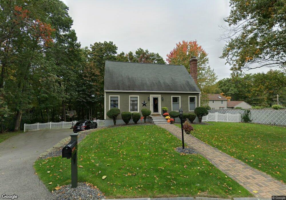
1 Clementi Ln Methuen, MA 01844
The East End NeighborhoodEstimated Value: $617,000 - $676,000
3
Beds
2
Baths
2,106
Sq Ft
$307/Sq Ft
Est. Value
About This Home
This home is located at 1 Clementi Ln, Methuen, MA 01844 and is currently estimated at $646,823, approximately $307 per square foot. 1 Clementi Ln is a home located in Essex County with nearby schools including Methuen High School and Community Day Charter Public School - Gateway.
Ownership History
Date
Name
Owned For
Owner Type
Purchase Details
Closed on
Aug 28, 1998
Sold by
Obrien Kevin M
Bought by
Zarzour Gregory A
Current Estimated Value
Purchase Details
Closed on
Feb 25, 1994
Sold by
Rebhan Mark R
Bought by
Obrien Kevin M
Purchase Details
Closed on
Jul 8, 1992
Sold by
Duma Joseph R
Bought by
Rebhan Mark R
Create a Home Valuation Report for This Property
The Home Valuation Report is an in-depth analysis detailing your home's value as well as a comparison with similar homes in the area
Home Values in the Area
Average Home Value in this Area
Purchase History
| Date | Buyer | Sale Price | Title Company |
|---|---|---|---|
| Zarzour Gregory A | $160,000 | -- | |
| Zarzour Gregory A | $160,000 | -- | |
| Obrien Kevin M | $149,000 | -- | |
| Obrien Kevin M | $149,000 | -- | |
| Rebhan Mark R | $149,000 | -- | |
| Rebhan Mark R | $149,000 | -- |
Source: Public Records
Mortgage History
| Date | Status | Borrower | Loan Amount |
|---|---|---|---|
| Open | Rebhan Mark R | $186,000 | |
| Closed | Rebhan Mark R | $20,000 |
Source: Public Records
Tax History
| Year | Tax Paid | Tax Assessment Tax Assessment Total Assessment is a certain percentage of the fair market value that is determined by local assessors to be the total taxable value of land and additions on the property. | Land | Improvement |
|---|---|---|---|---|
| 2025 | $5,788 | $547,100 | $224,600 | $322,500 |
| 2024 | $5,757 | $530,100 | $197,300 | $332,800 |
| 2023 | $5,355 | $457,700 | $174,500 | $283,200 |
| 2022 | $5,155 | $395,000 | $151,800 | $243,200 |
| 2021 | $4,899 | $371,400 | $144,200 | $227,200 |
| 2020 | $4,906 | $365,000 | $144,200 | $220,800 |
| 2019 | $4,860 | $342,500 | $136,600 | $205,900 |
| 2018 | $4,641 | $325,200 | $129,000 | $196,200 |
| 2017 | $4,474 | $305,400 | $129,000 | $176,400 |
| 2016 | $4,279 | $288,900 | $129,000 | $159,900 |
| 2015 | $3,986 | $273,000 | $121,400 | $151,600 |
Source: Public Records
Map
Nearby Homes
- 16 Christopher Dr Unit 38
- 45 Christopher Dr Unit 106
- 17 Ferry Rd
- 6 Ferry Rd
- 51 Ford St Unit A
- 10 Fenwick Cir
- 5 Pilgrim Cir Unit C
- 27 Russell Farm Dr
- 29 Bradstreet Ave
- 30 Anderson Dr
- 183 Farrwood Dr
- 414 Farrwood Dr Unit 414
- 128 Pleasant Valley St
- 524 Merrimack St
- 396 Oak St
- 201 Aberdeen Rd
- 68 Ashford St
- 1 Riverview Blvd Unit 8-203
- 1 Riverview Blvd Unit 1:209
- 1 Riverview Blvd Unit 4-203
Your Personal Tour Guide
Ask me questions while you tour the home.