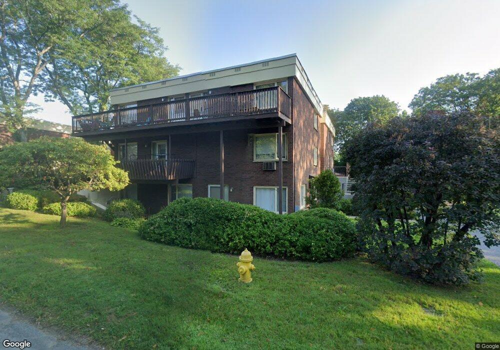
1 Colt Rd Unit 6 Pittsfield, MA 01201
Estimated Value: $193,000 - $245,000
2
Beds
1
Bath
1,042
Sq Ft
$207/Sq Ft
Est. Value
About This Home
This home is located at 1 Colt Rd Unit 6, Pittsfield, MA 01201 and is currently estimated at $216,206, approximately $207 per square foot. 1 Colt Rd Unit 6 is a home located in Berkshire County with nearby schools including Egremont Elementary School, Theodore Herberg Middle School, and Pittsfield High School.
Ownership History
Date
Name
Owned For
Owner Type
Purchase Details
Closed on
Dec 27, 2021
Sold by
Levine Jonathan Est
Bought by
Berkowitz Evan J
Current Estimated Value
Home Financials for this Owner
Home Financials are based on the most recent Mortgage that was taken out on this home.
Original Mortgage
$121,550
Outstanding Balance
$111,832
Interest Rate
2.98%
Mortgage Type
Purchase Money Mortgage
Estimated Equity
$104,374
Purchase Details
Closed on
Mar 4, 2019
Sold by
Jeffery Thomas A and Jeffery Mary E
Bought by
Levine Jonathan M
Purchase Details
Closed on
Dec 30, 1996
Sold by
Spencer Louise W
Bought by
Jeffery Thomas A and Jeffery Mary E
Purchase Details
Closed on
Dec 4, 1992
Sold by
Kar Maril and Kar Slowick T
Bought by
Spencer Louise W
Create a Home Valuation Report for This Property
The Home Valuation Report is an in-depth analysis detailing your home's value as well as a comparison with similar homes in the area
Home Values in the Area
Average Home Value in this Area
Purchase History
| Date | Buyer | Sale Price | Title Company |
|---|---|---|---|
| Berkowitz Evan J | $143,000 | None Available | |
| Levine Jonathan M | $131,000 | -- | |
| Jeffery Thomas A | $85,000 | -- | |
| Spencer Louise W | $65,000 | -- |
Source: Public Records
Mortgage History
| Date | Status | Borrower | Loan Amount |
|---|---|---|---|
| Open | Berkowitz Evan J | $121,550 |
Source: Public Records
Tax History Compared to Growth
Tax History
| Year | Tax Paid | Tax Assessment Tax Assessment Total Assessment is a certain percentage of the fair market value that is determined by local assessors to be the total taxable value of land and additions on the property. | Land | Improvement |
|---|---|---|---|---|
| 2025 | $3,315 | $184,800 | $0 | $184,800 |
| 2024 | $3,681 | $199,500 | $0 | $199,500 |
| 2023 | $3,012 | $164,400 | $0 | $164,400 |
| 2022 | $2,582 | $139,100 | $0 | $139,100 |
| 2021 | $2,545 | $132,200 | $0 | $132,200 |
| 2020 | $2,602 | $132,000 | $0 | $132,000 |
| 2019 | $2,579 | $132,800 | $0 | $132,800 |
| 2018 | $2,509 | $129,600 | $0 | $129,600 |
| 2017 | $2,499 | $127,300 | $0 | $127,300 |
| 2016 | $2,459 | $131,100 | $0 | $131,100 |
| 2015 | $2,368 | $131,100 | $0 | $131,100 |
Source: Public Records
Map
Nearby Homes
- 247 South St
- 68 Colt Rd
- 31 Henry Ave
- 89 Crofut St
- 121 Wendell Ave
- 133 Pomeroy Ave
- 20, 26, 30 E Housatonic St
- 96 Boylston St
- 261 Pomeroy Ave
- 50 W Housatonic St
- 92 W Housatonic St
- 79 Center St
- 61 Pomeroy Ave
- 55 Pomeroy Ave Unit 6
- 200 W Housatonic St Unit 16
- 71 S Church St Unit S102
- 48 Copley Terrace
- 18 Velma Ave
- 32 Velma Ave
- 36 Chickering St
- 1 Colt Rd
- 1 Colt Rd Unit 5
- 1 Colt Rd Unit 10
- 1 Colt Rd Unit 3
- 1 Colt Rd Unit 2
- 1 Colt Rd Unit 7
- 1 Colt Rd Unit 8
- 1 Colt Rd Unit 15
- 1 Colt Rd Unit 9
- 1 Colt Rd Unit 14
- 1 Colt Rd Unit 4
- 1 Colt Rd Unit 11
- 1 Colt Rd Unit 6
- 1 Colt Rd Unit 12
- 1 Colt Rd
- 1 Colt Rd Unit 1
- 1 Colt Rd Unit 9
- 1 Colt Rd Unit 3
- 15 Colt Rd Unit 15
- 267 South St