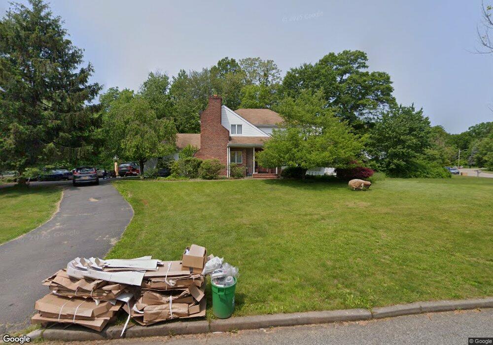
1 Conway Ct New City, NY 10956
Estimated Value: $780,000 - $1,003,000
3
Beds
3
Baths
2,790
Sq Ft
$314/Sq Ft
Est. Value
About This Home
This home is located at 1 Conway Ct, New City, NY 10956 and is currently estimated at $877,312, approximately $314 per square foot. 1 Conway Ct is a home located in Rockland County with nearby schools including Summit Park Elementary School, Pomona Middle School, and Ramapo High School.
Ownership History
Date
Name
Owned For
Owner Type
Purchase Details
Closed on
Feb 23, 2004
Sold by
Kennedy Donald
Bought by
Michel Claire
Current Estimated Value
Home Financials for this Owner
Home Financials are based on the most recent Mortgage that was taken out on this home.
Original Mortgage
$240,000
Outstanding Balance
$111,150
Interest Rate
5.65%
Mortgage Type
Purchase Money Mortgage
Estimated Equity
$766,162
Purchase Details
Closed on
Mar 3, 2000
Sold by
Gentile John and Gentile Antoinette
Bought by
Kennedy Donald
Home Financials for this Owner
Home Financials are based on the most recent Mortgage that was taken out on this home.
Original Mortgage
$176,000
Interest Rate
8.21%
Purchase Details
Closed on
Sep 18, 1996
Sold by
Mount Crest Development Corp
Bought by
Gentile John and Gentile Antoinette
Create a Home Valuation Report for This Property
The Home Valuation Report is an in-depth analysis detailing your home's value as well as a comparison with similar homes in the area
Home Values in the Area
Average Home Value in this Area
Purchase History
| Date | Buyer | Sale Price | Title Company |
|---|---|---|---|
| Michel Claire | $390,000 | Stewart Title | |
| Kennedy Donald | $220,000 | National Granite Title Insur | |
| Gentile John | $125,000 | Commonwealth Land Title Ins |
Source: Public Records
Mortgage History
| Date | Status | Borrower | Loan Amount |
|---|---|---|---|
| Open | Michel Claire | $240,000 | |
| Previous Owner | Kennedy Donald | $176,000 |
Source: Public Records
Tax History Compared to Growth
Tax History
| Year | Tax Paid | Tax Assessment Tax Assessment Total Assessment is a certain percentage of the fair market value that is determined by local assessors to be the total taxable value of land and additions on the property. | Land | Improvement |
|---|---|---|---|---|
| 2024 | $14,476 | $60,000 | $22,000 | $38,000 |
| 2023 | $14,476 | $60,000 | $22,000 | $38,000 |
| 2022 | $13,945 | $60,000 | $22,000 | $38,000 |
| 2021 | $13,945 | $60,000 | $22,000 | $38,000 |
| 2020 | $13,658 | $60,000 | $22,000 | $38,000 |
| 2019 | $13,861 | $60,000 | $22,000 | $38,000 |
| 2018 | $13,861 | $60,000 | $22,000 | $38,000 |
| 2017 | $13,567 | $60,000 | $22,000 | $38,000 |
| 2016 | $13,442 | $60,000 | $22,000 | $38,000 |
| 2015 | -- | $60,000 | $22,000 | $38,000 |
| 2014 | -- | $60,000 | $22,000 | $38,000 |
Source: Public Records
Map
Nearby Homes
- 398 New Hempstead Rd
- 8 Stark Ct
- 7 Elizabeth Ct
- 8 Aron Ct
- 2 Pulver Place
- 61 Buena Vista Rd
- 9 Aron Ct
- 15 Greenridge Way
- 15 Wagon Wheel Dr
- 16 Wagon Wheel Dr
- 20 Badger St
- 32 Badger St
- 16 Dessau Cir
- 15 Sunny Ridge Rd
- 97 Westview Rd
- 415 Phillips Hill Rd
- 6 Adele Blvd
- 20 Nob Hill Rd
- 19 Grand St
- 28 Nob Hill Rd
- 3 Conway Ct
- 2 Conway Ct
- 6 Conway Ct
- 5 Conway Ct
- 455 New Hempstead Rd
- 8 Round Pond Ct
- 8 Ilana Ln
- 10 Round Pond Ct
- 474 New Hempstead Rd
- 7 Conway Ct
- 453 New Hempstead Rd
- 441 New Hempstead Rd
- 6 Ilana Ln
- 9 Round Pond Ct
- 5 Round Pond Ct
- 7 Round Pond Ct
- 451 New Hempstead Rd
- 3 Round Pond Ct
- 484 New Hempstead Rd
- 487 New Hempstead Rd