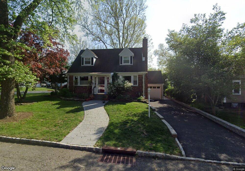
1 Cooper Ave Roseland, NJ 07068
Estimated Value: $638,295 - $669,000
--
Bed
--
Bath
1,296
Sq Ft
$503/Sq Ft
Est. Value
About This Home
This home is located at 1 Cooper Ave, Roseland, NJ 07068 and is currently estimated at $651,574, approximately $502 per square foot. 1 Cooper Ave is a home located in Essex County with nearby schools including Lester C. Noecker Elementary School, West Essex Middle School, and West Essex High School.
Ownership History
Date
Name
Owned For
Owner Type
Purchase Details
Closed on
Nov 18, 2005
Sold by
Mccabe Connie
Bought by
Fosdick Pamela
Current Estimated Value
Purchase Details
Closed on
Jan 20, 2003
Sold by
Mccabe Kevin
Bought by
Mccabe Connie
Purchase Details
Closed on
Mar 3, 1998
Sold by
Bonanno Frank R
Bought by
Mccabe Kevin and Mccabe Connie
Purchase Details
Closed on
Dec 26, 1990
Sold by
Bonanno Rose
Bought by
Bonanno Frank R and Bonanno Keller,Frances S
Create a Home Valuation Report for This Property
The Home Valuation Report is an in-depth analysis detailing your home's value as well as a comparison with similar homes in the area
Home Values in the Area
Average Home Value in this Area
Purchase History
| Date | Buyer | Sale Price | Title Company |
|---|---|---|---|
| Fosdick Pamela | $435,000 | -- | |
| Mccabe Connie | -- | -- | |
| Mccabe Kevin | $189,000 | -- | |
| Bonanno Frank R | -- | -- |
Source: Public Records
Tax History Compared to Growth
Tax History
| Year | Tax Paid | Tax Assessment Tax Assessment Total Assessment is a certain percentage of the fair market value that is determined by local assessors to be the total taxable value of land and additions on the property. | Land | Improvement |
|---|---|---|---|---|
| 2025 | $7,579 | $529,900 | $271,300 | $258,600 |
| 2024 | $7,579 | $529,900 | $271,300 | $258,600 |
| 2022 | $7,645 | $327,400 | $182,000 | $145,400 |
| 2021 | $7,540 | $327,400 | $182,000 | $145,400 |
| 2020 | $7,514 | $327,400 | $182,000 | $145,400 |
| 2019 | $7,445 | $327,400 | $182,000 | $145,400 |
| 2018 | $7,380 | $327,400 | $182,000 | $145,400 |
| 2017 | $7,376 | $327,400 | $182,000 | $145,400 |
| 2016 | $7,262 | $327,400 | $182,000 | $145,400 |
| 2015 | $7,278 | $327,400 | $182,000 | $145,400 |
| 2014 | $7,075 | $327,400 | $182,000 | $145,400 |
Source: Public Records
Map
Nearby Homes
- 26 Passaic Ave
- 38 Passaic Ave
- 20 Lenape Dr
- 518 Eagle Rock Ave
- 6 Mulford Ct Unit Address 6
- 6 Mulford Ct Unit C0013
- 88 Kent Dr Unit C0176
- 144 Passaic Ave
- 178 Passaic Ave
- 192 Eagle Rock Ave
- 30 Schweinberg Dr
- 187 Passaic Ave
- 39 Schweinberg Dr Unit 2039
- 39 Schweinberg Dr
- 281 N Livingston Ave
- 41 W Mcclellan Ave
- 11 Homestead Terrace
- 8 Riker Hill Rd
- 9 Cliffside Dr