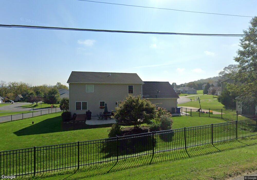
1 Creekside Dr Selinsgrove, PA 17870
Estimated Value: $411,000 - $508,000
--
Bed
--
Bath
--
Sq Ft
0.42
Acres
About This Home
This home is located at 1 Creekside Dr, Selinsgrove, PA 17870 and is currently estimated at $459,219. 1 Creekside Dr is a home located in Snyder County with nearby schools including Selinsgrove Area Elementary School, Selinsgrove Intermediate School, and Selinsgrove Area Middle School.
Ownership History
Date
Name
Owned For
Owner Type
Purchase Details
Closed on
Jun 18, 2020
Sold by
Tesfayohannes Beraki Mengsteab and Tesfazghi Bahta Tselat
Bought by
Dalius William D and Dalius Lindsay M
Current Estimated Value
Home Financials for this Owner
Home Financials are based on the most recent Mortgage that was taken out on this home.
Original Mortgage
$294,500
Outstanding Balance
$261,052
Interest Rate
3.2%
Mortgage Type
New Conventional
Estimated Equity
$198,167
Purchase Details
Closed on
Jan 25, 2010
Sold by
Westbranch Real Estates Development
Bought by
Tesfayohannes Beraki Mensteab and Resfazghi Tselat Bahta
Create a Home Valuation Report for This Property
The Home Valuation Report is an in-depth analysis detailing your home's value as well as a comparison with similar homes in the area
Home Values in the Area
Average Home Value in this Area
Purchase History
| Date | Buyer | Sale Price | Title Company |
|---|---|---|---|
| Dalius William D | $310,000 | Madison Settlement Svcs Llc | |
| Tesfayohannes Beraki Mensteab | $39,900 | -- |
Source: Public Records
Mortgage History
| Date | Status | Borrower | Loan Amount |
|---|---|---|---|
| Open | Dalius William D | $294,500 | |
| Closed | Tesfayohannes Beraki Mensteab | $0 |
Source: Public Records
Tax History Compared to Growth
Tax History
| Year | Tax Paid | Tax Assessment Tax Assessment Total Assessment is a certain percentage of the fair market value that is determined by local assessors to be the total taxable value of land and additions on the property. | Land | Improvement |
|---|---|---|---|---|
| 2025 | $4,496 | $47,260 | $10,000 | $37,260 |
| 2024 | $4,288 | $46,450 | $10,000 | $36,450 |
| 2023 | $1,083 | $46,450 | $10,000 | $36,450 |
| 2022 | $4,078 | $46,450 | $10,000 | $36,450 |
| 2021 | $4,078 | $46,450 | $10,000 | $36,450 |
| 2020 | $4,078 | $46,450 | $10,000 | $36,450 |
| 2019 | $4,078 | $46,450 | $10,000 | $36,450 |
| 2018 | $4,078 | $46,450 | $10,000 | $36,450 |
| 2017 | $1,013 | $46,450 | $10,000 | $36,450 |
| 2016 | $1,013 | $46,450 | $10,000 | $36,450 |
| 2015 | $92,029 | $46,450 | $10,000 | $36,450 |
| 2014 | $92,029 | $46,450 | $10,000 | $36,450 |
Source: Public Records
Map
Nearby Homes
- 85 Old Colony Rd
- 20 Quarry Rd
- 1667&1679 Route 204
- 456 State School Rd
- Lot 1 522 Route S
- 732 Salem Rd
- 21 Calvett Place
- 107 Saint Andrews Way
- 321 Pleasant Dr
- 81 Saint Andrews Way
- 79 Saint Andrews Way
- 34 Oakmont Ct
- 610 N 10th St
- 90 Limerick Ln
- 88 Limerick Ln
- 86 Limerick Ln
- 84 Limerick Ln
- 722 N 8th St
- 0 Mill Rd
- 501 N 9th St