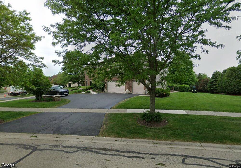
1 Crenshaw Ct Bolingbrook, IL 60490
Augusta Village NeighborhoodEstimated Value: $672,000 - $1,042,691
--
Bed
--
Bath
4,199
Sq Ft
$217/Sq Ft
Est. Value
About This Home
This home is located at 1 Crenshaw Ct, Bolingbrook, IL 60490 and is currently estimated at $910,897, approximately $216 per square foot. 1 Crenshaw Ct is a home located in Will County with nearby schools including Wayne Builta Elementary School, Clifford Crone Middle School, and Neuqua Valley High School.
Ownership History
Date
Name
Owned For
Owner Type
Purchase Details
Closed on
Sep 23, 2005
Sold by
Overstreet Builders Inc
Bought by
Robertson Pollis and Robertson Angela V
Current Estimated Value
Home Financials for this Owner
Home Financials are based on the most recent Mortgage that was taken out on this home.
Original Mortgage
$622,513
Outstanding Balance
$377,451
Interest Rate
8.05%
Mortgage Type
Fannie Mae Freddie Mac
Estimated Equity
$533,446
Create a Home Valuation Report for This Property
The Home Valuation Report is an in-depth analysis detailing your home's value as well as a comparison with similar homes in the area
Home Values in the Area
Average Home Value in this Area
Purchase History
| Date | Buyer | Sale Price | Title Company |
|---|---|---|---|
| Robertson Pollis | $767,500 | -- |
Source: Public Records
Mortgage History
| Date | Status | Borrower | Loan Amount |
|---|---|---|---|
| Open | Robertson Pollis | $622,513 |
Source: Public Records
Tax History Compared to Growth
Tax History
| Year | Tax Paid | Tax Assessment Tax Assessment Total Assessment is a certain percentage of the fair market value that is determined by local assessors to be the total taxable value of land and additions on the property. | Land | Improvement |
|---|---|---|---|---|
| 2024 | $22,751 | $326,581 | $43,968 | $282,613 |
| 2023 | $22,751 | $288,499 | $38,841 | $249,658 |
| 2022 | $18,739 | $244,696 | $36,742 | $207,954 |
| 2021 | $17,852 | $233,043 | $34,992 | $198,051 |
| 2020 | $17,483 | $229,351 | $34,438 | $194,913 |
| 2019 | $17,361 | $222,887 | $33,467 | $189,420 |
| 2018 | $17,015 | $214,969 | $32,731 | $182,238 |
| 2017 | $16,900 | $209,419 | $31,886 | $177,533 |
| 2016 | $17,062 | $204,911 | $31,200 | $173,711 |
| 2015 | $15,305 | $197,030 | $30,000 | $167,030 |
| 2014 | $15,305 | $186,090 | $30,000 | $156,090 |
| 2013 | $15,305 | $186,090 | $30,000 | $156,090 |
Source: Public Records
Map
Nearby Homes
- 1873 Baldwin Way
- 147 Willow Bend
- 5 Player Ct
- 1948 Bent Grass Way
- 484 Golden Star Dr
- 536 Sonoma Dr
- Woodside Plan at Sawgrass - Estates
- Mercer Plan at Sawgrass - Meadows
- Continental Plan at Sawgrass - Meadows
- Newberry Plan at Sawgrass - Meadows
- Westchester Plan at Sawgrass - Estates
- Riverton Plan at Sawgrass - Estates
- Castleton Plan at Sawgrass - Estates
- Willwood Plan at Sawgrass - Estates
- Waverly Plan at Sawgrass - Meadows
- 1995 Bent Grass Way
- 7 Snead Ct
- 1881 Bent Grass Way
- 1995 Norwich Ln
- 1963 Norwich Ln
- 1875 Pampas Cir
- 3 Crenshaw Ct
- 1871 Pampas Cir
- 1870 Pampas Cir
- 1866 Pampas Cir
- 7 Crenshaw Ct
- 1874 Pampas Cir
- 1867 Pampas Cir
- 1862 Pampas Cir
- 4 Crenshaw Ct
- 1879 Pampas Cir
- 5 Crenshaw Ct
- 1878 Pampas Cir
- 6 Crenshaw Ct
- 1863 Pampas Cir
- 1858 Pampas Cir
- 6 Trevino Ct
- 7 Trevino Ct
- 1883 Pampas Cir
- 1882 Pampas Cir
