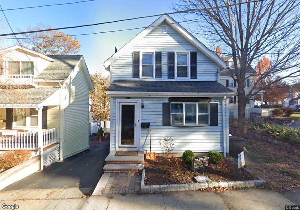
1 Dale Ct Unit 1 Stoneham, MA 02180
Colonial Park NeighborhoodEstimated Value: $600,000 - $647,000
3
Beds
2
Baths
1,067
Sq Ft
$581/Sq Ft
Est. Value
About This Home
This home is located at 1 Dale Ct Unit 1, Stoneham, MA 02180 and is currently estimated at $620,251, approximately $581 per square foot. 1 Dale Ct Unit 1 is a home located in Middlesex County with nearby schools including Stoneham High School, St. Patrick Elementary School, and Greater Boston Academy.
Ownership History
Date
Name
Owned For
Owner Type
Purchase Details
Closed on
Dec 15, 2016
Sold by
Lazzara Annette
Bought by
Kessler Jonathan and Kessler Dennis
Current Estimated Value
Home Financials for this Owner
Home Financials are based on the most recent Mortgage that was taken out on this home.
Original Mortgage
$186,000
Outstanding Balance
$151,997
Interest Rate
3.54%
Mortgage Type
New Conventional
Estimated Equity
$468,254
Purchase Details
Closed on
Sep 30, 2013
Sold by
Dinan Scott and Dinan Carole A
Bought by
Lazzara Annette
Home Financials for this Owner
Home Financials are based on the most recent Mortgage that was taken out on this home.
Original Mortgage
$238,400
Interest Rate
4.42%
Mortgage Type
New Conventional
Purchase Details
Closed on
Dec 31, 2003
Sold by
Bean-Cassino Maryann
Bought by
Dinan Carole Anne and Dinan Scott
Home Financials for this Owner
Home Financials are based on the most recent Mortgage that was taken out on this home.
Original Mortgage
$275,000
Interest Rate
5.86%
Mortgage Type
Purchase Money Mortgage
Purchase Details
Closed on
Jul 28, 1999
Sold by
Lopez Oscar and Lopez Deirdre
Bought by
Bean Maryann
Purchase Details
Closed on
Jun 30, 1995
Sold by
Mckinnon Phyllis
Bought by
Lopez Deidre and Lopez Oscar
Create a Home Valuation Report for This Property
The Home Valuation Report is an in-depth analysis detailing your home's value as well as a comparison with similar homes in the area
Home Values in the Area
Average Home Value in this Area
Purchase History
| Date | Buyer | Sale Price | Title Company |
|---|---|---|---|
| Kessler Jonathan | $346,800 | -- | |
| Lazzara Annette | $298,000 | -- | |
| Lazzara Annette | $298,000 | -- | |
| Dinan Carole Anne | $275,000 | -- | |
| Bean Maryann | $170,000 | -- | |
| Lopez Deidre | $106,500 | -- | |
| Lopez Deidre | $106,500 | -- |
Source: Public Records
Mortgage History
| Date | Status | Borrower | Loan Amount |
|---|---|---|---|
| Open | Kessler Jonathan | $186,000 | |
| Previous Owner | Lazzara Annette | $238,400 | |
| Previous Owner | Dinan Carole Anne | $275,000 | |
| Previous Owner | Lopez Deidre | $159,850 |
Source: Public Records
Tax History Compared to Growth
Tax History
| Year | Tax Paid | Tax Assessment Tax Assessment Total Assessment is a certain percentage of the fair market value that is determined by local assessors to be the total taxable value of land and additions on the property. | Land | Improvement |
|---|---|---|---|---|
| 2025 | $5,604 | $547,800 | $301,600 | $246,200 |
| 2024 | $5,357 | $505,900 | $277,800 | $228,100 |
| 2023 | $5,209 | $469,300 | $254,000 | $215,300 |
| 2022 | $4,505 | $432,800 | $230,200 | $202,600 |
| 2021 | $0 | $413,700 | $214,300 | $199,400 |
| 2020 | $4,250 | $393,900 | $195,600 | $198,300 |
| 2019 | $4,287 | $382,100 | $200,400 | $181,700 |
| 2018 | $6,855 | $336,800 | $165,500 | $171,300 |
| 2017 | $3,899 | $314,700 | $140,700 | $174,000 |
| 2016 | $3,827 | $301,300 | $140,700 | $160,600 |
| 2015 | $3,620 | $279,300 | $127,300 | $152,000 |
| 2014 | $2,854 | $211,600 | $107,200 | $104,400 |
Source: Public Records
Map
Nearby Homes
- 17 Emerson St Unit A
- 17A 17 B Emerson
- 8 Walnut St
- 34 Warren St Unit 3
- 137 Franklin St Unit 102
- 137 Franklin St Unit 404
- 10 Pomeworth St Unit H
- 43 Pomeworth St Unit 44
- 17 Franklin St
- 13 Washington Ave
- 20 Myrtle St
- 159 Franklin St Unit C2
- 12 Cottage St
- 25 Murdoch Rd
- 21 Tremont St Unit A
- 4 Gavin Cir
- 6 Gavin Cir
- 1 Tremont St
- 39 Tamarock Terrace
- 588 Main St Unit 3C
- 1 Dale Ct
- 3 Dale Ct
- 90 Franklin St
- 86 Franklin St Unit 88
- 86 Franklin St Unit 2
- 86-88 Franklin St
- 5 Dale Ct
- 89 Franklin St
- 91 Franklin St
- 84 Franklin St
- 84 Franklin St Unit 2
- 84 Franklin St Unit 3
- 83 Franklin St
- 94 Franklin St
- 7 Gerry Ct
- 87 Franklin St
- 96 Franklin St
- 3 Pond St
- 3 Pond St Unit 1
- 95 Franklin St