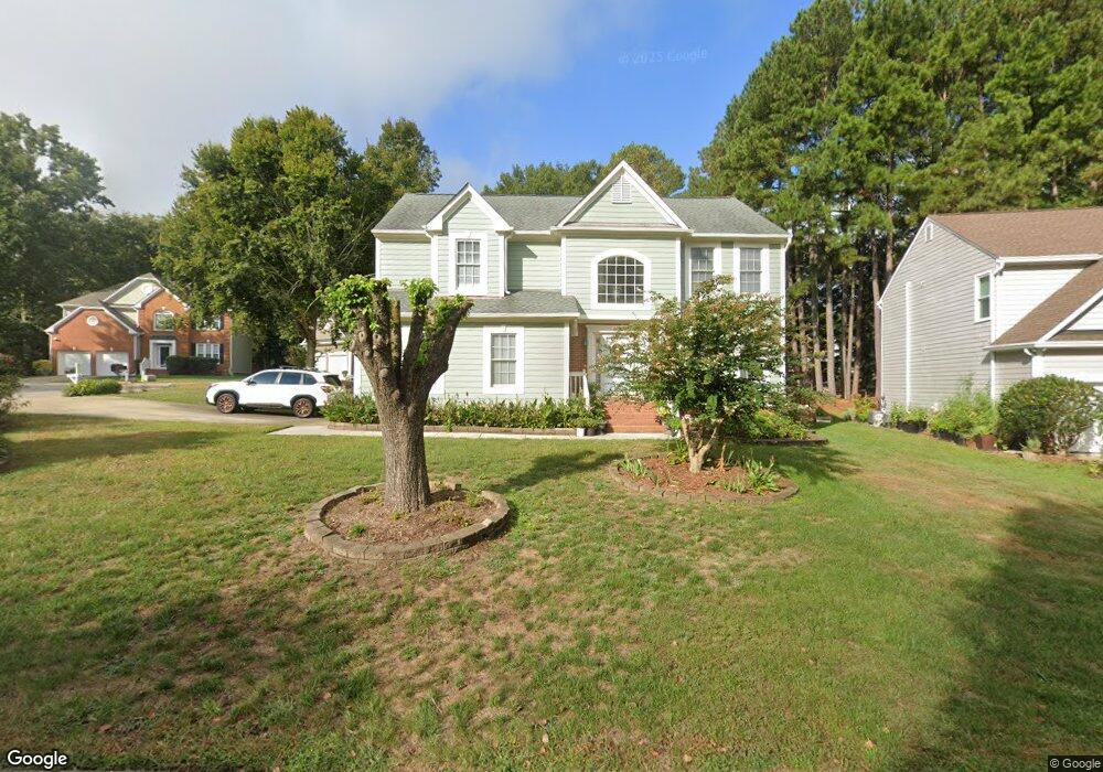
1 Dalidary Ct Durham, NC 27703
Eastern Durham NeighborhoodEstimated Value: $434,013 - $465,000
4
Beds
3
Baths
2,378
Sq Ft
$191/Sq Ft
Est. Value
About This Home
This home is located at 1 Dalidary Ct, Durham, NC 27703 and is currently estimated at $453,253, approximately $190 per square foot. 1 Dalidary Ct is a home located in Durham County with nearby schools including Oak Grove Elementary, John W Neal Middle School, and Southern School of Energy & Sustainability.
Create a Home Valuation Report for This Property
The Home Valuation Report is an in-depth analysis detailing your home's value as well as a comparison with similar homes in the area
Home Values in the Area
Average Home Value in this Area
Tax History Compared to Growth
Tax History
| Year | Tax Paid | Tax Assessment Tax Assessment Total Assessment is a certain percentage of the fair market value that is determined by local assessors to be the total taxable value of land and additions on the property. | Land | Improvement |
|---|---|---|---|---|
| 2025 | $4,281 | $431,854 | $64,297 | $367,557 |
| 2024 | $3,431 | $245,934 | $46,725 | $199,209 |
| 2023 | $3,221 | $245,934 | $46,725 | $199,209 |
| 2022 | $3,148 | $245,934 | $46,725 | $199,209 |
| 2021 | $3,133 | $245,934 | $46,725 | $199,209 |
| 2020 | $3,059 | $245,934 | $46,725 | $199,209 |
| 2019 | $3,059 | $245,934 | $46,725 | $199,209 |
| 2018 | $2,818 | $207,733 | $34,265 | $173,468 |
| 2017 | $2,797 | $207,733 | $34,265 | $173,468 |
| 2016 | $2,703 | $207,733 | $34,265 | $173,468 |
| 2015 | $2,861 | $206,696 | $38,492 | $168,204 |
| 2014 | $2,861 | $206,696 | $38,492 | $168,204 |
Source: Public Records
Map
Nearby Homes
- 16 Vestrial Ln
- 604 Bellmeade Bay Dr
- 516 Guy Walker Way
- 1315 Pennock Rd
- 907 Danbury Dr
- 932 Danbury Dr
- 610 Sherron Rd
- 622 Sherron Rd
- 517 Keith St
- 301 Sylvias Ct
- 2117 Fletchers Ridge Dr
- 208 Lick Creek Ln
- 1107 High Fox Dr
- 1013 Blackthorn Ln
- 17 Plumleaf Ln
- 807 Outlaw Ave
- 1114 Blackthorn Ln
- 807 Outlaw Ave Unit 19
- The Poplar Plan at Sherron Road Townes
- 528 Plumleaf Ln
- 1111 Gunston Ln
- 4 Dalidary Ct
- 1113 Gunston Ln
- 1108 Gunston Ln
- 1108 Gunstone Ln
- 5 Dalidary Ct
- 1112 Gunston Ln
- 1103 Gunston Ln
- 1104 Gunston Ln
- 3 Dalidary Ct
- 1115 Gunston Ln
- 1116 Gunston Ln
- 1100 Gunston Ln
- 1101 Nichols Farm Dr
- 5 Cameroons Place
- 1101 Gunston Ln
- 1103 Nichols Farm Dr
- 7 Cameroons Place
- 3 Cameroons Place
- 1105 Nichols Farm Dr