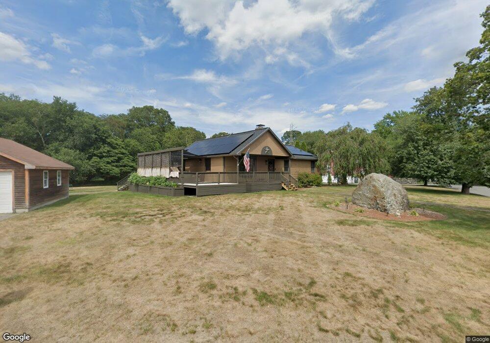
1 Damascus Rd Rehoboth, MA 02769
Estimated Value: $598,061 - $708,000
3
Beds
2
Baths
1,600
Sq Ft
$402/Sq Ft
Est. Value
About This Home
This home is located at 1 Damascus Rd, Rehoboth, MA 02769 and is currently estimated at $643,765, approximately $402 per square foot. 1 Damascus Rd is a home located in Bristol County with nearby schools including Dighton-Rehoboth Regional High School and Cedar Brook School.
Ownership History
Date
Name
Owned For
Owner Type
Purchase Details
Closed on
Aug 27, 2020
Sold by
Capello Peter F
Bought by
Lingard Nicholas and Lingard Jill
Current Estimated Value
Home Financials for this Owner
Home Financials are based on the most recent Mortgage that was taken out on this home.
Original Mortgage
$410,000
Outstanding Balance
$363,699
Interest Rate
3%
Mortgage Type
New Conventional
Estimated Equity
$280,066
Purchase Details
Closed on
Aug 26, 2010
Sold by
Capello Peter and Capello Karen D
Bought by
Capello Peter F
Purchase Details
Closed on
Apr 21, 1992
Sold by
Pavao David
Bought by
Capello Peter
Home Financials for this Owner
Home Financials are based on the most recent Mortgage that was taken out on this home.
Original Mortgage
$100,000
Interest Rate
8.75%
Mortgage Type
Purchase Money Mortgage
Create a Home Valuation Report for This Property
The Home Valuation Report is an in-depth analysis detailing your home's value as well as a comparison with similar homes in the area
Home Values in the Area
Average Home Value in this Area
Purchase History
| Date | Buyer | Sale Price | Title Company |
|---|---|---|---|
| Lingard Nicholas | $450,000 | None Available | |
| Capello Peter F | -- | -- | |
| Capello Peter | $61,000 | -- |
Source: Public Records
Mortgage History
| Date | Status | Borrower | Loan Amount |
|---|---|---|---|
| Open | Lingard Nicholas | $410,000 | |
| Previous Owner | Capello Peter | $100,000 | |
| Previous Owner | Capello Peter | $100,000 | |
| Previous Owner | Capello Peter | $115,000 | |
| Previous Owner | Capello Peter | $100,000 |
Source: Public Records
Tax History
| Year | Tax Paid | Tax Assessment Tax Assessment Total Assessment is a certain percentage of the fair market value that is determined by local assessors to be the total taxable value of land and additions on the property. | Land | Improvement |
|---|---|---|---|---|
| 2025 | $5,736 | $514,400 | $199,000 | $315,400 |
| 2024 | $5,540 | $487,700 | $207,700 | $280,000 |
| 2023 | $5,188 | $467,000 | $203,300 | $263,700 |
| 2022 | $5,188 | $409,500 | $186,400 | $223,100 |
| 2021 | $5,022 | $379,300 | $169,800 | $209,500 |
| 2020 | $4,887 | $372,500 | $177,800 | $194,700 |
| 2018 | $4,307 | $359,800 | $169,300 | $190,500 |
| 2017 | $4,043 | $321,900 | $169,300 | $152,600 |
| 2016 | $4,054 | $333,700 | $176,900 | $156,800 |
| 2015 | $3,838 | $311,800 | $168,700 | $143,100 |
| 2014 | $3,776 | $303,500 | $160,400 | $143,100 |
Source: Public Records
Map
Nearby Homes
Your Personal Tour Guide
Ask me questions while you tour the home.