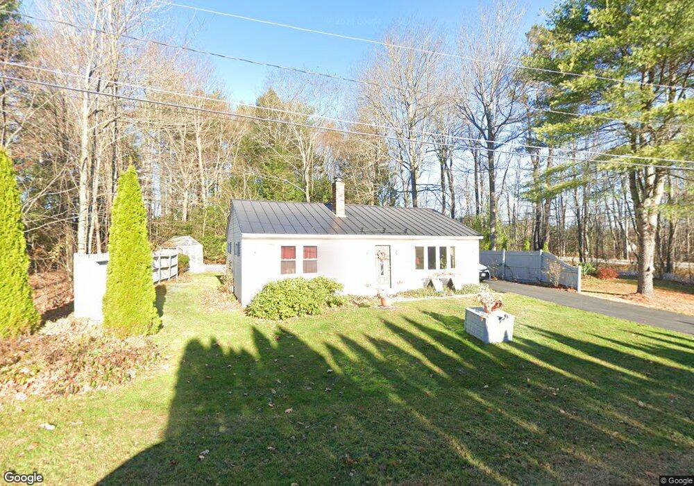
1 Daniel St Gorham, ME 04038
Estimated Value: $334,000 - $415,000
2
Beds
1
Bath
864
Sq Ft
$435/Sq Ft
Est. Value
About This Home
This home is located at 1 Daniel St, Gorham, ME 04038 and is currently estimated at $376,094, approximately $435 per square foot. 1 Daniel St is a home located in Cumberland County with nearby schools including Village Elementary School, Gorham Middle School, and Gorham High School.
Create a Home Valuation Report for This Property
The Home Valuation Report is an in-depth analysis detailing your home's value as well as a comparison with similar homes in the area
Home Values in the Area
Average Home Value in this Area
Tax History
| Year | Tax Paid | Tax Assessment Tax Assessment Total Assessment is a certain percentage of the fair market value that is determined by local assessors to be the total taxable value of land and additions on the property. | Land | Improvement |
|---|---|---|---|---|
| 2025 | $3,531 | $238,600 | $69,500 | $169,100 |
| 2024 | $3,507 | $238,600 | $69,500 | $169,100 |
| 2023 | $3,281 | $238,600 | $69,500 | $169,100 |
| 2022 | $3,066 | $238,600 | $69,500 | $169,100 |
| 2021 | $2,392 | $123,300 | $50,300 | $73,000 |
| 2020 | $2,343 | $123,300 | $50,300 | $73,000 |
| 2019 | $2,337 | $123,300 | $50,300 | $73,000 |
| 2018 | $2,244 | $123,300 | $50,300 | $73,000 |
| 2017 | $2,108 | $123,300 | $50,300 | $73,000 |
| 2016 | $2,096 | $123,300 | $50,300 | $73,000 |
| 2015 | $2,010 | $123,300 | $50,300 | $73,000 |
| 2014 | $2,008 | $115,400 | $58,800 | $56,600 |
| 2013 | $1,996 | $115,400 | $58,800 | $56,600 |
Source: Public Records
Map
Nearby Homes
- 4 Musket Dr
- 16 Daniel St
- 35 Rust Rd
- 866 Parker Farm Rd Unit A
- 866 Parker Farm Rd Unit B
- 866 Parker Farm Lot B Rd
- 866 Parker Farm Lot A Rd
- 116 Dingley Spring Rd
- 16 Norway Rd
- 555 Fort Hill Rd
- 42 Brandons Way
- 8 Martin Dr
- 696 Fort Hill Rd
- 697 Fort Hill Rd
- 127 Falcon Crest Dr Unit 4
- 4 Blueberry Ln Unit 4
- 182 Falcon Crest Dr Unit 56
- 30 Joan Dixon Way
- 187 Falcon Crest Dr Unit 30
- 188 Falcon Crest Dr Unit 58
Your Personal Tour Guide
Ask me questions while you tour the home.