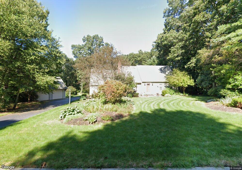
1 Daniels Rd Mendon, MA 01756
Estimated Value: $685,779 - $826,000
3
Beds
3
Baths
1,862
Sq Ft
$398/Sq Ft
Est. Value
About This Home
This home is located at 1 Daniels Rd, Mendon, MA 01756 and is currently estimated at $740,195, approximately $397 per square foot. 1 Daniels Rd is a home located in Worcester County with nearby schools including Nipmuc Regional High School, Bethany Christian Academy, and Mendon Mennonite School.
Ownership History
Date
Name
Owned For
Owner Type
Purchase Details
Closed on
Jun 21, 2024
Sold by
Vallan Barry
Bought by
Vallan Rachel
Current Estimated Value
Purchase Details
Closed on
Dec 15, 2009
Sold by
Schmitt Richard F and Schmitt Judith Ann
Bought by
Vallan Barry
Home Financials for this Owner
Home Financials are based on the most recent Mortgage that was taken out on this home.
Original Mortgage
$297,000
Interest Rate
5.02%
Mortgage Type
Purchase Money Mortgage
Create a Home Valuation Report for This Property
The Home Valuation Report is an in-depth analysis detailing your home's value as well as a comparison with similar homes in the area
Home Values in the Area
Average Home Value in this Area
Purchase History
| Date | Buyer | Sale Price | Title Company |
|---|---|---|---|
| Vallan Rachel | -- | None Available | |
| Vallan Rachel | -- | None Available | |
| Vallan Barry | $397,000 | -- | |
| Vallan Barry | $397,000 | -- |
Source: Public Records
Mortgage History
| Date | Status | Borrower | Loan Amount |
|---|---|---|---|
| Previous Owner | Vallan Barry | $297,000 | |
| Previous Owner | Vallan Barry | $170,681 | |
| Previous Owner | Vallan Barry | $83,000 |
Source: Public Records
Tax History Compared to Growth
Tax History
| Year | Tax Paid | Tax Assessment Tax Assessment Total Assessment is a certain percentage of the fair market value that is determined by local assessors to be the total taxable value of land and additions on the property. | Land | Improvement |
|---|---|---|---|---|
| 2025 | $8,698 | $649,600 | $180,300 | $469,300 |
| 2024 | $8,729 | $636,700 | $173,400 | $463,300 |
| 2023 | $8,500 | $582,200 | $154,700 | $427,500 |
| 2022 | $8,098 | $525,500 | $154,500 | $371,000 |
| 2021 | $7,970 | $474,700 | $149,900 | $324,800 |
| 2020 | $7,489 | $447,100 | $143,900 | $303,200 |
| 2019 | $6,981 | $417,000 | $133,800 | $283,200 |
| 2018 | $6,709 | $395,600 | $133,800 | $261,800 |
| 2017 | $6,864 | $386,700 | $133,800 | $252,900 |
| 2016 | $6,640 | $384,900 | $135,600 | $249,300 |
| 2015 | $5,893 | $368,100 | $135,600 | $232,500 |
| 2014 | $5,729 | $357,600 | $137,400 | $220,200 |
Source: Public Records
Map
Nearby Homes
- 25 Bens Way
- 2 Crestview Dr
- 23 Bens Way
- 13 Blackstone St
- 8 Puffer Dr
- 108 Laurelwood Dr Unit 108
- 164 Greene St
- 50 Hartford Ave E
- 93 Providence St Unit B
- 10 Wesley Dr
- 16 North Ave
- 26 Brookview Ln Unit 26
- 11 Heron Ln
- 14 Kelley Rd
- 13 Kelley Rd
- 111 Providence St
- 22 Washington St
- 6 Mellen St
- 29 Harmony Trail
- The Brooklyn Plan at Harmony - Subdivision
- 11 Neck Hill Rd
- 15 Neck Hill Rd
- 2 Daniels Rd
- 0 Daniels Rd Unit 72092482
- 0 Daniels Rd Unit 72469271
- 7 Neck Hill Rd
- 3 Daniels Rd
- 10 Neck Hill Rd
- 16 Neck Hill Rd
- 4 Daniels Rd
- 18 Neck Hill Rd
- 18 Neck Hill Rd Unit B
- 18 Neck Hill Rd Unit A
- 5 Daniels Rd
- 6 Neck Hill Rd
- 6 Daniels Rd
- 21 Neck Hill Rd
- 37 George St
- 31 George St
- 20 Neck Hill Rd