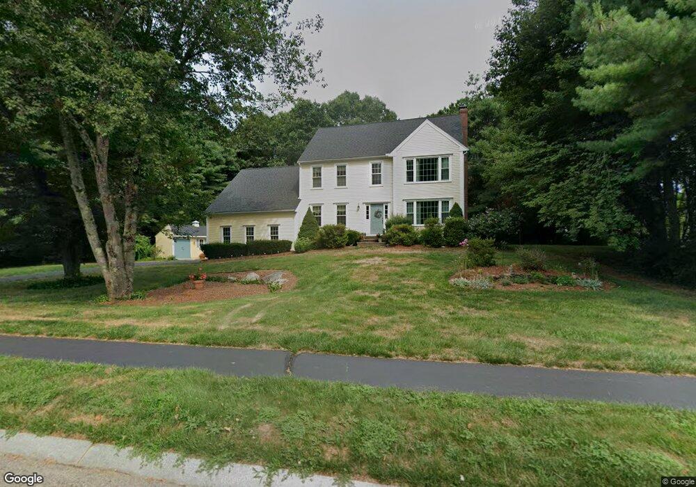
1 Downing Dr Norton, MA 02766
Estimated Value: $766,598 - $1,101,000
4
Beds
3
Baths
2,404
Sq Ft
$376/Sq Ft
Est. Value
About This Home
This home is located at 1 Downing Dr, Norton, MA 02766 and is currently estimated at $904,400, approximately $376 per square foot. 1 Downing Dr is a home located in Bristol County with nearby schools including L.G. Nourse Elementary School, Henri A. Yelle Elementary School, and Norton Middle School.
Create a Home Valuation Report for This Property
The Home Valuation Report is an in-depth analysis detailing your home's value as well as a comparison with similar homes in the area
Home Values in the Area
Average Home Value in this Area
Tax History
| Year | Tax Paid | Tax Assessment Tax Assessment Total Assessment is a certain percentage of the fair market value that is determined by local assessors to be the total taxable value of land and additions on the property. | Land | Improvement |
|---|---|---|---|---|
| 2025 | $85 | $658,300 | $211,600 | $446,700 |
| 2024 | $8,192 | $632,600 | $201,500 | $431,100 |
| 2023 | $7,759 | $597,300 | $190,100 | $407,200 |
| 2022 | $7,709 | $540,600 | $188,500 | $352,100 |
| 2021 | $7,368 | $493,500 | $179,600 | $313,900 |
| 2020 | $7,094 | $479,300 | $174,300 | $305,000 |
| 2019 | $6,929 | $465,000 | $167,700 | $297,300 |
| 2018 | $6,884 | $454,100 | $167,700 | $286,400 |
| 2017 | $6,901 | $449,000 | $167,700 | $281,300 |
| 2016 | $6,672 | $427,400 | $167,700 | $259,700 |
| 2015 | $6,688 | $434,600 | $178,100 | $256,500 |
| 2014 | $6,412 | $417,200 | $169,600 | $247,600 |
Source: Public Records
Map
Nearby Homes
- 35 Owen Rd
- O Leonard St
- 9 Winnecunnet Dr Unit 9
- 1 Wilbur Terrace Unit 6
- 104 Newcomb St Unit E
- 195 E Main St
- 0 S Washington St Unit 73437419
- 0 Kensington Rd
- 103 King Philip Rd
- 17 Lloyd Cir Unit 36
- 24 Lloyd Cir Unit 34
- 157 Highland St
- 30 Samoset St
- 0 Cobb St
- 0 Brook Pkwy
- 39 Cutter Dr
- 64 South St
- 32 Olde Farm Rd
- 3 Coach Rd
- 24 Coach Rd
Your Personal Tour Guide
Ask me questions while you tour the home.