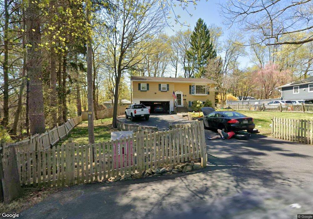
1 Dunning Rd Warwick, NY 10990
Estimated Value: $593,000 - $680,000
4
Beds
2
Baths
2,260
Sq Ft
$278/Sq Ft
Est. Value
About This Home
This home is located at 1 Dunning Rd, Warwick, NY 10990 and is currently estimated at $628,271, approximately $277 per square foot. 1 Dunning Rd is a home located in Orange County with nearby schools including Warwick Valley Middle School and Warwick Valley High School.
Ownership History
Date
Name
Owned For
Owner Type
Purchase Details
Closed on
Sep 7, 2012
Sold by
Jockle James
Bought by
Franklin Edward
Current Estimated Value
Home Financials for this Owner
Home Financials are based on the most recent Mortgage that was taken out on this home.
Original Mortgage
$216,600
Interest Rate
3.38%
Purchase Details
Closed on
Mar 9, 2007
Sold by
Rich Robert
Bought by
Jockle James
Create a Home Valuation Report for This Property
The Home Valuation Report is an in-depth analysis detailing your home's value as well as a comparison with similar homes in the area
Home Values in the Area
Average Home Value in this Area
Purchase History
| Date | Buyer | Sale Price | Title Company |
|---|---|---|---|
| Franklin Edward | $228,000 | John Burke | |
| Jockle James | $384,000 | Douglas Jones |
Source: Public Records
Mortgage History
| Date | Status | Borrower | Loan Amount |
|---|---|---|---|
| Previous Owner | Franklin Edward | $216,600 |
Source: Public Records
Tax History
| Year | Tax Paid | Tax Assessment Tax Assessment Total Assessment is a certain percentage of the fair market value that is determined by local assessors to be the total taxable value of land and additions on the property. | Land | Improvement |
|---|---|---|---|---|
| 2024 | $11,074 | $40,000 | $11,700 | $28,300 |
| 2023 | $11,074 | $40,000 | $11,700 | $28,300 |
| 2022 | $10,819 | $40,000 | $11,700 | $28,300 |
| 2021 | $10,912 | $40,000 | $11,700 | $28,300 |
| 2020 | $10,070 | $40,000 | $11,700 | $28,300 |
| 2019 | $9,410 | $40,000 | $11,700 | $28,300 |
| 2018 | $9,410 | $40,000 | $11,700 | $28,300 |
| 2017 | $9,168 | $40,000 | $11,700 | $28,300 |
| 2016 | $9,005 | $40,000 | $11,700 | $28,300 |
| 2015 | -- | $40,000 | $11,700 | $28,300 |
| 2014 | -- | $40,000 | $11,700 | $28,300 |
Source: Public Records
Map
Nearby Homes
- 49 Maple Ave
- 63 Colonial Ave
- 26 High St
- 77 Pine Island Turnpike
- 15 Cropsey St Unit 15-3A
- 2 Sly St
- 10 Howe St
- 81 Pine Island Turnpike
- 28 Brady Rd
- 0 State Route 94 S Unit KEY829812
- 0 Ackerman Rd
- 15 Cowdrey St
- 96 Galloway Rd
- 23 Candlestick Ct
- 180 West St
- 32 Highland Ave
- 49 Olde Wagon Rd
- 0 Brady Rd Unit KEY898171
- 0 Ball Rd
- 56 Ball Rd