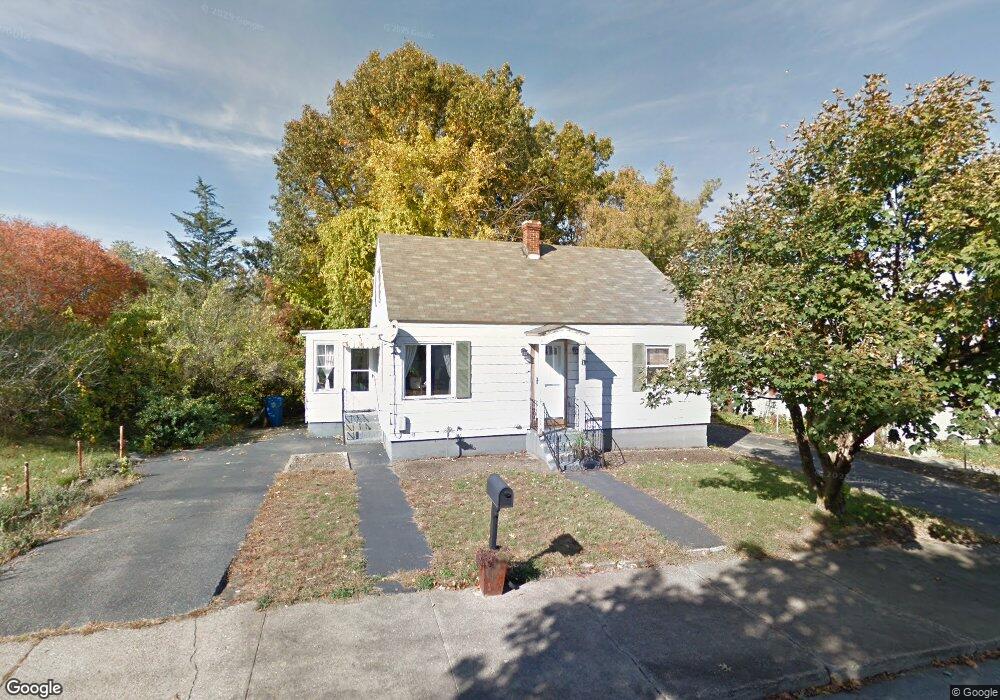
1 E Sylvester St Lawrence, MA 01843
Mount Vernon NeighborhoodEstimated Value: $436,000 - $500,000
2
Beds
1
Bath
1,152
Sq Ft
$418/Sq Ft
Est. Value
About This Home
This home is located at 1 E Sylvester St, Lawrence, MA 01843 and is currently estimated at $481,416, approximately $417 per square foot. 1 E Sylvester St is a home located in Essex County with nearby schools including John Breen School, School For Exceptional Studies, and Robert Frost Middle School.
Ownership History
Date
Name
Owned For
Owner Type
Purchase Details
Closed on
Jul 30, 2003
Sold by
Sansoucie Debra L
Bought by
Lane Carrie L
Current Estimated Value
Home Financials for this Owner
Home Financials are based on the most recent Mortgage that was taken out on this home.
Original Mortgage
$186,200
Outstanding Balance
$79,962
Interest Rate
5.28%
Mortgage Type
Purchase Money Mortgage
Estimated Equity
$401,454
Purchase Details
Closed on
Oct 31, 1997
Sold by
Mcclory Scott
Bought by
Delgrosso Debra L
Purchase Details
Closed on
Aug 27, 1993
Sold by
Lavigne William A
Bought by
Mcclory Scott
Create a Home Valuation Report for This Property
The Home Valuation Report is an in-depth analysis detailing your home's value as well as a comparison with similar homes in the area
Home Values in the Area
Average Home Value in this Area
Purchase History
| Date | Buyer | Sale Price | Title Company |
|---|---|---|---|
| Lane Carrie L | $196,000 | -- | |
| Delgrosso Debra L | $75,500 | -- | |
| Mcclory Scott | $55,000 | -- |
Source: Public Records
Mortgage History
| Date | Status | Borrower | Loan Amount |
|---|---|---|---|
| Open | Mcclory Scott | $186,200 | |
| Previous Owner | Mcclory Scott | $110,000 | |
| Previous Owner | Mcclory Scott | $30,000 |
Source: Public Records
Tax History
| Year | Tax Paid | Tax Assessment Tax Assessment Total Assessment is a certain percentage of the fair market value that is determined by local assessors to be the total taxable value of land and additions on the property. | Land | Improvement |
|---|---|---|---|---|
| 2025 | $3,889 | $441,900 | $143,400 | $298,500 |
| 2024 | $3,544 | $383,100 | $115,500 | $267,600 |
| 2023 | $3,679 | $362,100 | $103,600 | $258,500 |
| 2022 | $3,518 | $307,500 | $95,600 | $211,900 |
| 2021 | $3,177 | $258,900 | $87,600 | $171,300 |
| 2020 | $3,001 | $241,400 | $76,500 | $164,900 |
| 2019 | $3,198 | $233,800 | $83,500 | $150,300 |
| 2018 | $3,073 | $214,600 | $83,500 | $131,100 |
| 2017 | $2,968 | $193,500 | $81,200 | $112,300 |
| 2016 | $2,500 | $161,200 | $69,000 | $92,200 |
| 2015 | $2,437 | $161,200 | $69,000 | $92,200 |
Source: Public Records
Map
Nearby Homes
- 12B Stevens St
- 102 Weare St
- 116 Weare St
- 43 Gorham St
- 341 S Broadway- Parcel II
- 24 Inman St Unit 4
- 87-87A Brookfield St
- 10 Dartmouth Rd
- 42 York St
- 11 W Hawley St
- 354 N Main St Unit 204
- 28 Stirling St
- 27-29 Dorchester St
- 34 Martingale Ln Unit 34
- 31 Garfield St
- 34 Beaconsfield St
- 11 Cambridge St
- 53 Martingale Ln
- 46-46A Dorchester St
- 356-360 S Union St
- 1A E Sylvester St
- 2 E Sylvester St
- 4 E Sylvester St
- 440 S Broadway
- 438 S Broadway
- 621 S Union St
- 31 South St
- 450 S Broadway
- 4 E Gilbert St
- 623 S Union St
- 29 South St
- 452 S Broadway
- 436 S Broadway
- 2 Sylvester St Unit 2A
- 625 S Union St
- 525 S Broadway
- 2 Sylvester St
- 434 S Broadway
- 537 S Broadway
- 46 Sylvester St
Your Personal Tour Guide
Ask me questions while you tour the home.