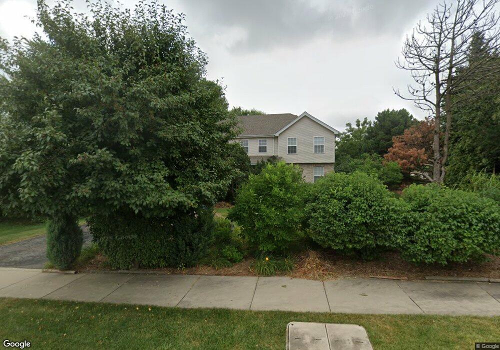
1 E Wise Rd Schaumburg, IL 60193
South Schaumburg NeighborhoodEstimated Value: $637,353 - $685,000
4
Beds
3
Baths
2,956
Sq Ft
$227/Sq Ft
Est. Value
About This Home
This home is located at 1 E Wise Rd, Schaumburg, IL 60193 and is currently estimated at $669,838, approximately $226 per square foot. 1 E Wise Rd is a home located in Cook County with nearby schools including Frederick Nerge Elementary School, Margaret Mead Junior High School, and J B Conant High School.
Ownership History
Date
Name
Owned For
Owner Type
Purchase Details
Closed on
Jul 10, 2002
Sold by
Mcnally John and Mcnally Lisa
Bought by
Bratkovich Sidney R and Bratkovich Jean
Current Estimated Value
Purchase Details
Closed on
Apr 18, 2000
Sold by
Old Castle Development Ltd
Bought by
Mcnally John and Mcnally Lisa
Home Financials for this Owner
Home Financials are based on the most recent Mortgage that was taken out on this home.
Original Mortgage
$160,000
Interest Rate
8.24%
Purchase Details
Closed on
Aug 9, 1999
Sold by
Battistone Eva
Bought by
Old Castle Development Ltd
Create a Home Valuation Report for This Property
The Home Valuation Report is an in-depth analysis detailing your home's value as well as a comparison with similar homes in the area
Home Values in the Area
Average Home Value in this Area
Purchase History
| Date | Buyer | Sale Price | Title Company |
|---|---|---|---|
| Bratkovich Sidney R | $394,000 | -- | |
| Mcnally John | $200,000 | -- | |
| Old Castle Development Ltd | $70,000 | -- |
Source: Public Records
Mortgage History
| Date | Status | Borrower | Loan Amount |
|---|---|---|---|
| Previous Owner | Mcnally John | $160,000 |
Source: Public Records
Tax History
| Year | Tax Paid | Tax Assessment Tax Assessment Total Assessment is a certain percentage of the fair market value that is determined by local assessors to be the total taxable value of land and additions on the property. | Land | Improvement |
|---|---|---|---|---|
| 2025 | $11,379 | $65,000 | $8,945 | $56,055 |
| 2024 | $11,379 | $48,065 | $7,951 | $40,114 |
| 2023 | $12,127 | $48,065 | $7,951 | $40,114 |
| 2022 | $12,127 | $48,065 | $7,951 | $40,114 |
| 2021 | $10,936 | $39,412 | $22,362 | $17,050 |
| 2020 | $10,816 | $39,412 | $22,362 | $17,050 |
| 2019 | $11,232 | $45,333 | $22,362 | $22,971 |
| 2018 | $10,899 | $39,753 | $18,884 | $20,869 |
| 2017 | $10,745 | $39,753 | $18,884 | $20,869 |
| 2016 | $11,306 | $43,427 | $18,884 | $24,543 |
| 2015 | $9,676 | $34,968 | $15,902 | $19,066 |
| 2014 | $10,488 | $38,013 | $15,902 | $22,111 |
| 2013 | $11,505 | $42,535 | $15,902 | $26,633 |
Source: Public Records
Map
Nearby Homes
- 20 Shore Dr
- 207 Mountain Interval Rd Unit 7230
- 240 Warren Ln Unit 11348
- 232 Warren Ln Unit 11546
- 134 Lunt Ave
- 1500 Illinois St
- 235 Quincy Ct
- 1326 Summit Dr
- 100 Pratt Blvd
- 1100 Boston Harbor Unit 7004
- 1630 Myrtle Park St
- 411 Drake Cir Unit 401B
- 733 Limerick Ln Unit 7333D
- 717 Killarney Ct Unit 2D
- 725 Limerick Ln Unit 2-B
- 829 Sienna Dr
- 1064 Hampton Harbor Unit 1064
- 518 E Niagara Ave
- 701 Limerick Ln Unit 3B
- 1055 Hampton Harbor Unit 1055
- 9 E Wise Rd
- 15 E Wise Rd
- 1217 S Roselle Rd
- 1208 Indian Hill Dr
- 1216 Indian Hill Dr
- 1223 S Roselle Rd
- 1222 Indian Hill Dr
- 8 W Niagara Ave
- 7 W Wise Rd
- 1228 Indian Hill Dr
- 31 E Wise Rd
- 13 W Wise Rd Unit 13
- 13 W Wise Rd
- 1233 S Roselle Rd
- 14 W Niagara Ave
- 1217 Indian Hill Dr
- 1232 Indian Hill Dr
- 5 W Niagara Ave
- 35 E Wise Rd
- 1223 Indian Hill Dr
Your Personal Tour Guide
Ask me questions while you tour the home.